The power of multispectral drone mapping
“We do a lot of test flights just to make sure that our customers are getting a perfect product,” explains Dejan Dragic, Team Lead Business Development & Training at Quantum-Systems.
Like Pix4D, the Quantum-Systems team is driven by data.
The team set out to answer the following questions:
- How does drone data compare to satellite data?
- Can vegetation be distinguished from the soil by using vegetation indices?
To find out, the team set out an experiment.
Project details
| Location | Penzinger Baggersee |
| Team | Quantum-Systems |
| Hardware | Drone: Quantum-SystemsTrinity F90+ Camera: MicaSense Altum |
| Software | Pix4Dmapper |
| Project duration (image acquisition and data processing) | 24 hours |
| Mean ground sampling distance (GSD) | 8.02 cm |
| Area | 45 hectares |
“Since we are drone manufacturers, we are often doing test flights,” explains Dejan. “We decided to perform a flight in the area nearby so we can analyze the data and see the correlation between vegetation indices and health conditions of the nearby forest and fields and also to check the power of the MicaSense Altum camera.”

The team also wanted to show the multispectral dimension of different colors of the water in various lakes and try to correlate that with the different soil and ground types.
Understanding the water content of the soil is essential for many industries such as construction, environmental monitoring, and digital agriculture.

Quantum-Systems chose the MicaSense Altum camera which has six sensors that are each sensitive to a specific band: red, green, blue, red edge, near-infrared (NIR), and thermal. When the MicaSense Altum camera is triggered, all six sensors capture an image simultaneously, making the data easier to align and use for analytics.
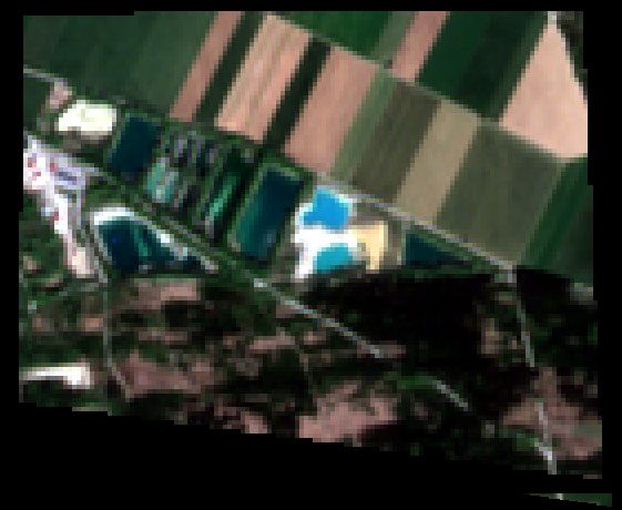
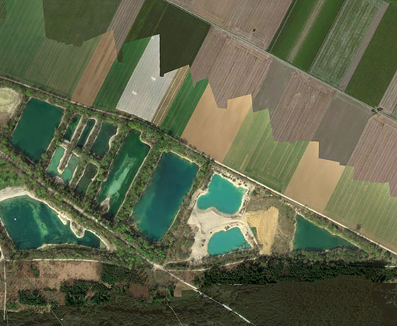
With images captured in six bands, the team can generate anything from digital surface models to vegetation indices to thermal maps. But how accurate is this data in comparison with satellite imagery?
Comparing drone and satellite imagery
For decades, satellite imagery has been the ‘gold standard’ of aerial imagery. But it has never been perfect. Satellite imagery is affected by cloud cover, while drones can fly lower than clouds or smoke. Additionally, satellite imagery is not as timely as drone data, a fact that can be important in time-sensitive situations.
The advantages of drone data become even more evident when paired with the right software. For this test, Quantum-Systems used Pix4Dmapper to process the acquired data from MicaSense Altum.
- Dejan Dragic, Team Lead Business Development & Training at Quantum-Systems

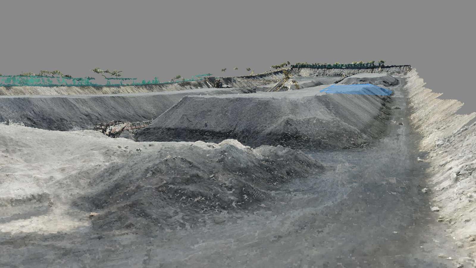
Capturing drone data
“The hardest part of the whole project was choosing the best place to take off and land!” says Dejan. “There are many lakes and we needed to choose the best spot from which you have always our drone in our line of sight.”
The Penzinger Baggersee is a series of swimming lakes in the German city of Penzinger, near Munich. The natural lakes have been deepened, and the artificial sandy beaches, grassy lawns, and amenities make the spot popular with locals and tourists alike.
The spot is an ideal test site, due to the variation in the landscape: from smooth lawns to wooded areas, and with plenty of ‘real world’ obstacles, such as buildings partially obscured by trees (and the occasional angry swan!).

What is VTOL technology?
Quantum-Systems products combine reach and efficiency with the ability to vertically take off and land (VTOL) without additional equipment. Through the founding team’s diversity, Quantum-Systems manages to combine extensive experience and expertise from all relevant areas of unmanned aerial systems.Great results
Based on the results, the Quantum-Systems team has determined that multispectral sensors can be used in a wide variety of applications. By generating specific vegetation indices, they could easily distinguish vegetation from the soil, track plant health and visualize the reflectance differences between lakes of different colors.
“Showing the real power of multispectral data is very important. The opportunity to compare drone data with Sentinel/Landsat is something revolutionary in the geospatial data field. Having a very high resolution RGB image with MicaSense Altum and visualised in Pix4Dmapper, close to the 4cm from 100m flying altitude, helps us in using only one sensor for multiple purposes. Together with Trinity F90+ we could map very large areas in just one flight,” concludes Dejan.