Why we built PIX4Dmatic as a complete geospatial platform
For years, PIX4D has been a trusted leader in professional mapping. Founded in 2011, our global impact has expanded from a core of surveyors to include engineers, construction teams, and experts in utilities, transportation, and collision reconstruction.
As our user base has grown, we are serving larger teams and corporations in rapidly growing markets, and the projects have grown accordingly larger and with scaled operations. This has meant navigating more complex needs. For example, a team would find themselves processing data in one tool, extracting deliverables in another, and finishing the job elsewhere. The feedback from these users was that fragmented workflows were slowing them down.
“Processing the data is only half the job. What we really need is a seamless path from capture to CAD- and GIS-ready deliverables.”
This set us on a path to rethink our desktop solutions, leading to PIX4Dmatic as a complete geospatial platform designed to unite processing and survey-grade deliverables in a single, continuous workflow.
A turning point in how we approached our desktop solutions
Professionals working on larger projects or scaled operations were no longer dealing with isolated datasets or single deliverables. They were managing larger areas and higher data volumes, often captured using a combination of aerial, terrestrial, and LiDAR technologies. In that context, accuracy remained essential — but efficiency and continuity across datasets became just as critical.
With more complex projects, each stage still delivered value on its own, but the overall workflow became fragmented, making it increasingly difficult to scale. What users were asking for was not another tool, but a way to move seamlessly from capture, regardless of the sensor, to CAD- and GIS-ready deliverables.
The challenge of unification
Bringing PIX4Dmatic and PIX4Dsurvey together was never meant to be a simple merge, as both products excel in their own domains, shaped by different user needs and optimized for different stages of the workflow.
One of the biggest challenges was preserving performance. Large-scale photogrammetric processing demands stability and the ability to handle heavy datasets without slowing operators down. Survey-grade extraction requires precision, control, and tools that invite careful interaction. Combining these two in a single workspace required careful architectural choices.
Equally important was maintaining clarity. Professionals rely on PIX4D tools in different ways; some focus on processing and modeling, while others focus on measurements, vectors, and deliverables. Unification does not mean forcing everyone into the same workflow. The platform had to remain flexible, allowing users to engage only with the tools they need, while still benefiting from a shared data context and a smooth handoff between stages. Many teams have built an established workflow around PIX4Dsurvey, and we did not want to disrupt this.
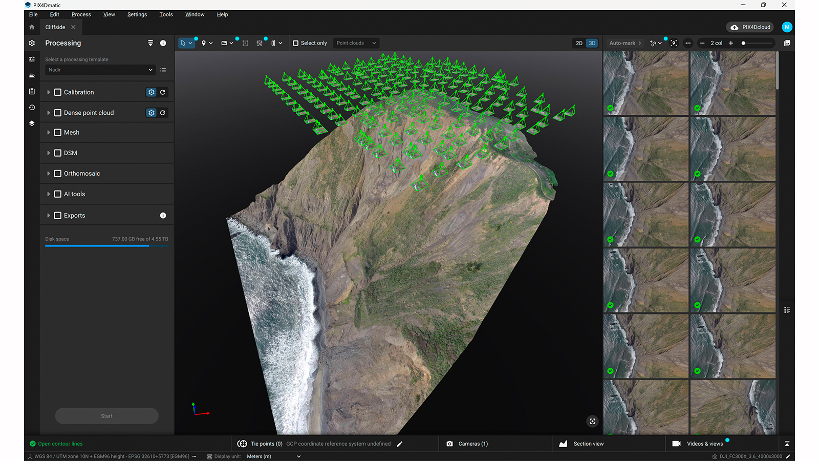
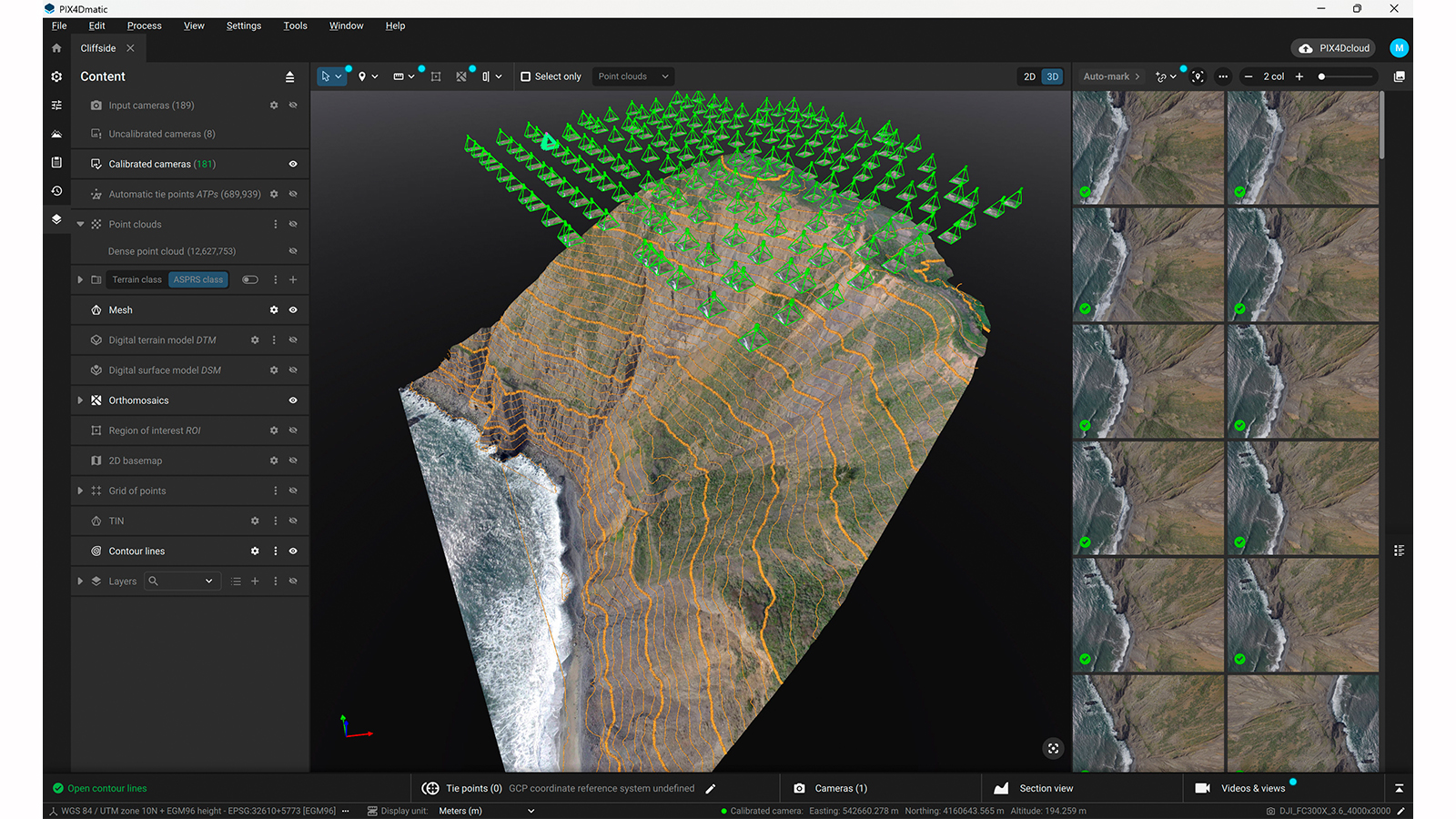
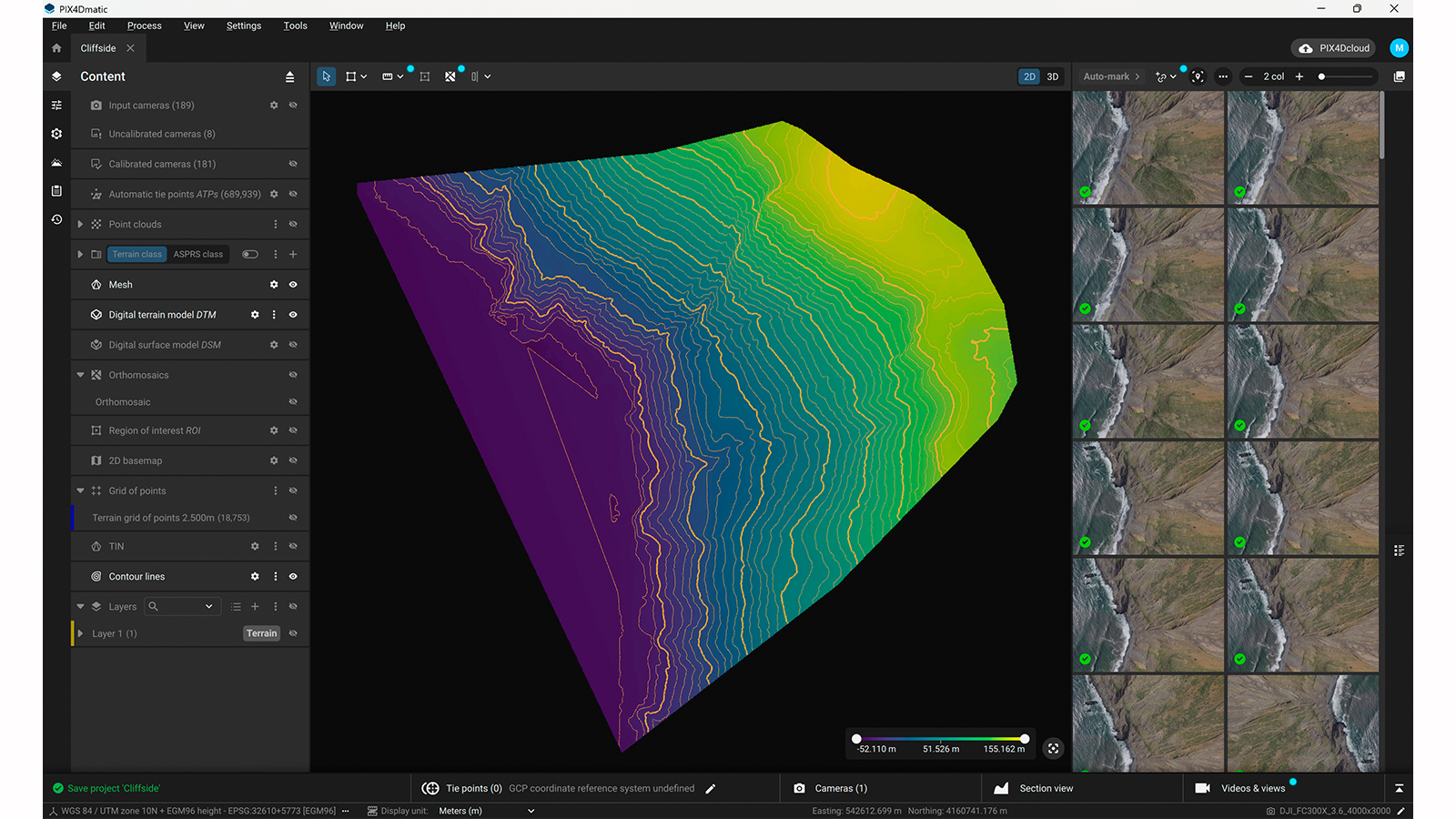
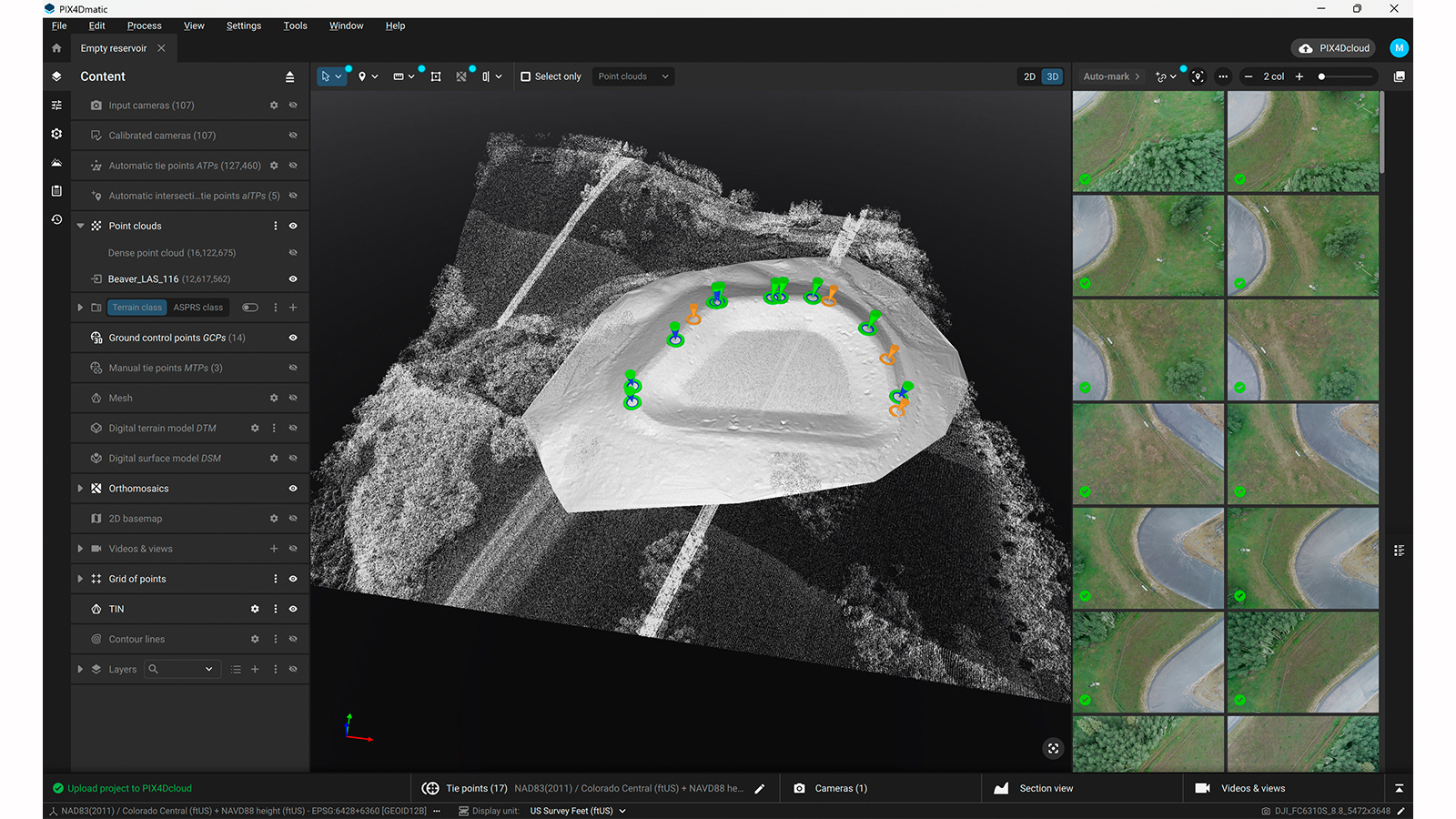
With this in mind, we have the new, unified PIX4Dmatic: a next-generation geospatial platform where large-scale processing and CAD- and GIS-ready extraction live side by side. A single environment with a smooth path from capture to deliverables, where dense point clouds, orthomosaics, terrain models, contours, and volumes are generated and refined in the same environment, directly on the processed data.
One workspace, from capture to deliverables
Measurements are performed where the data is created, and terrain classification and vector extraction no longer feel like a separate phase. In the unified workflow, outputs are already structured for CAD and GIS, without the need for extra formatting, cleanup, or rework, with no uncertainty about which version of the data is the right one.
Because PIX4Dmatic is built as part of the PIX4D ecosystem, this workflow extends beyond the desktop. Data captured in the field with PIX4Dcatch can be processed and refined in PIX4Dmatic, then shared through PIX4Dcloud for review, collaboration, and decision-making. From capture to delivery, the data remains connected — and so do the teams working with it.
Versatile solutions for every stage of your workflow
The modern geospatial landscape shouldn't force you into a one-size-fits-all solution. We recognize that not every team needs the same level of capability at the same moment. Our licensing allows you the freedom to choose a path that suits your specific operational focus.
Some professionals may prioritize high-accuracy 3D processing, georeferencing, and mesh generation for geospatial documentation. Others might focus exclusively on the final stages of the pipeline—performing terrain classification and extracting clean, CAD-ready deliverables like contour lines and DTMs from existing data. And many wish to operate within a fully integrated environment.
By offering these distinct levels of access, PIX4Dmatic ensures you only invest in the tools you need, whether you are building complex models from scratch or specializing in precision surveying and vector extraction