PIX4DBIM OUTPUTS
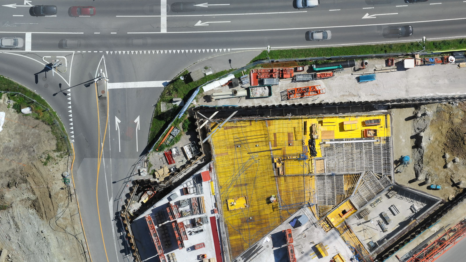
Get the data you need to track progress on your siteOrthomosaic
Georeferenced and scaled 2D orthophotos in high resolution, ideal for site visualization and measurements
Export formats: GeoTiff (.tif)
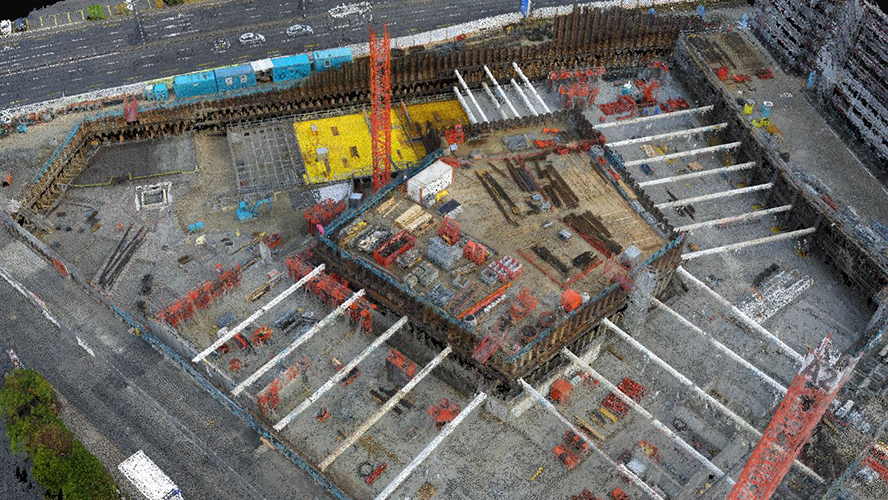
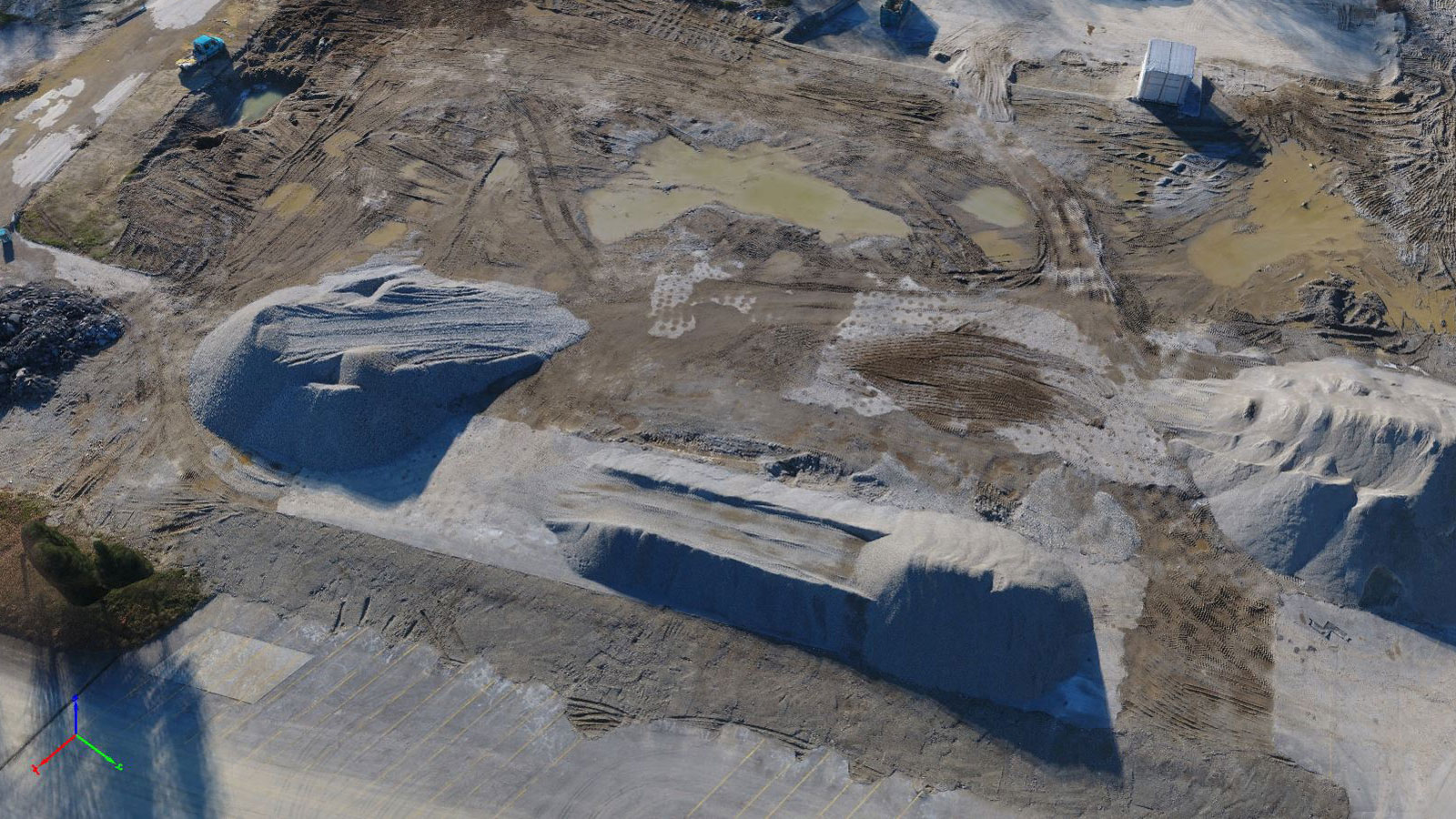
3D point cloud
Densified 3D point clouds to get the most accurate 3D representation of your site
Export formats: .las, .laz, .xyz, .ply
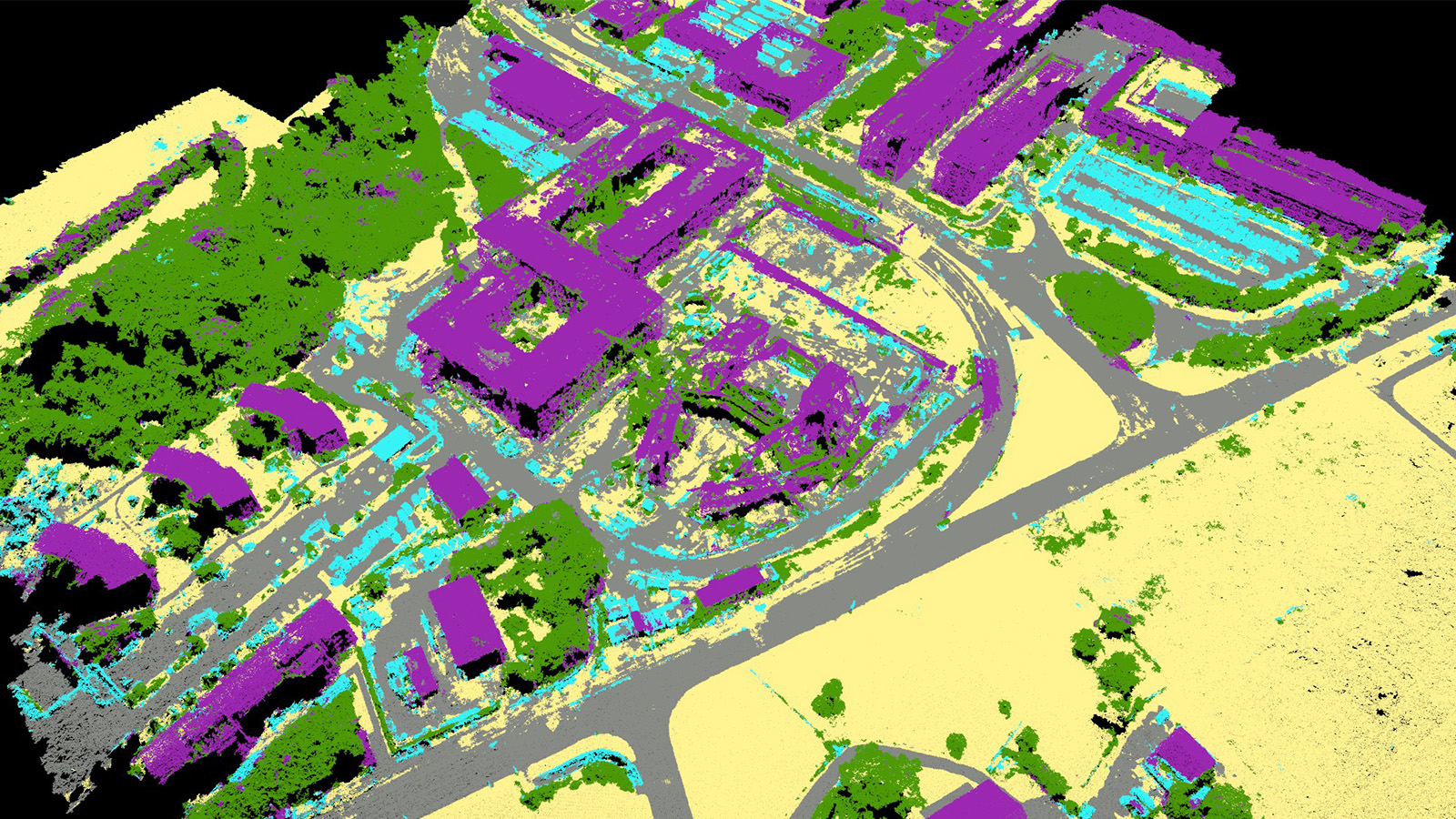
Classified point cloud
Automatic classification of the points into groups such as points road surface, building roofs, trees
Export formats: .las, .laz
3D textured mesh
Highly visual 3D textured mesh perfect for communication and client updates
Export formats: .obj, .ply, .dxf, .fbx, .pdf, .osgb, .slpk
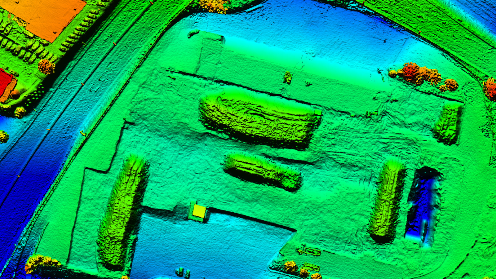
Digital surface model (DSM)
Visualization of the elevation and terrain in 2D to understand the shape of the land surface
Export formats: GeoTiff (.tif), .las, .laz, .xyz
Digital terrain model (DTM)
Filtering out all the objects like buildings, useful for terrain analysis
Export formats: GeoTiff (.tif)
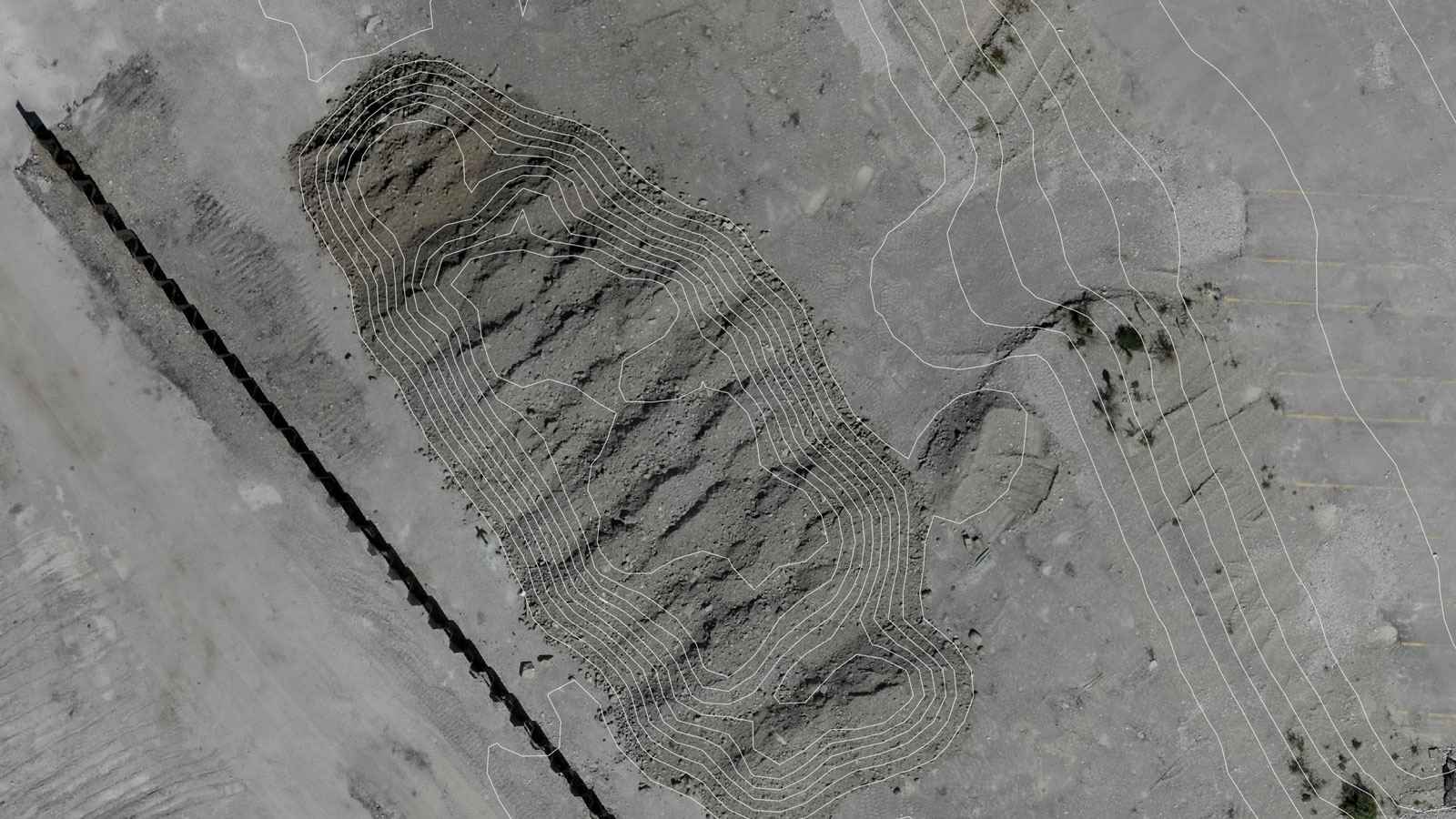
Contour map
Useful in design and earthwork phase to get simplified land surface representation
Export formats: .shp, .dxf, .pdf