Topografia florestal com PIX4Dmatic
Um levantamento topográfico convencional costuma focar no terreno e nos limites do lote. No entanto, neste projeto, o cliente queria preservar o maior número possível de árvores, projetando o edifício em harmonia com a paisagem existente.
Para isso, era imprescindível localizar e contabilizar com precisão cada árvore, permitindo o desenvolvimento de um projeto arquitetônico que priorizasse a integração com a natureza. Conversamos com Federico Bonet, topógrafo e proprietário da Aereal Pro Solutions SL — empresa especializada em drones, fotogrametria aérea e inspeções —, sobre os desafios técnicos de mapear uma floresta densa onde as ferramentas tradicionais deixam a desejar.
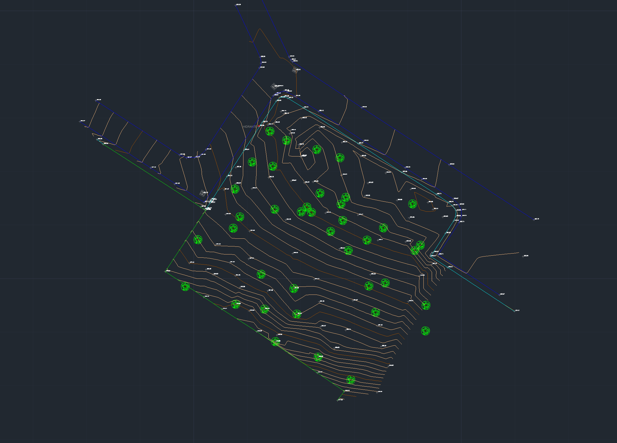
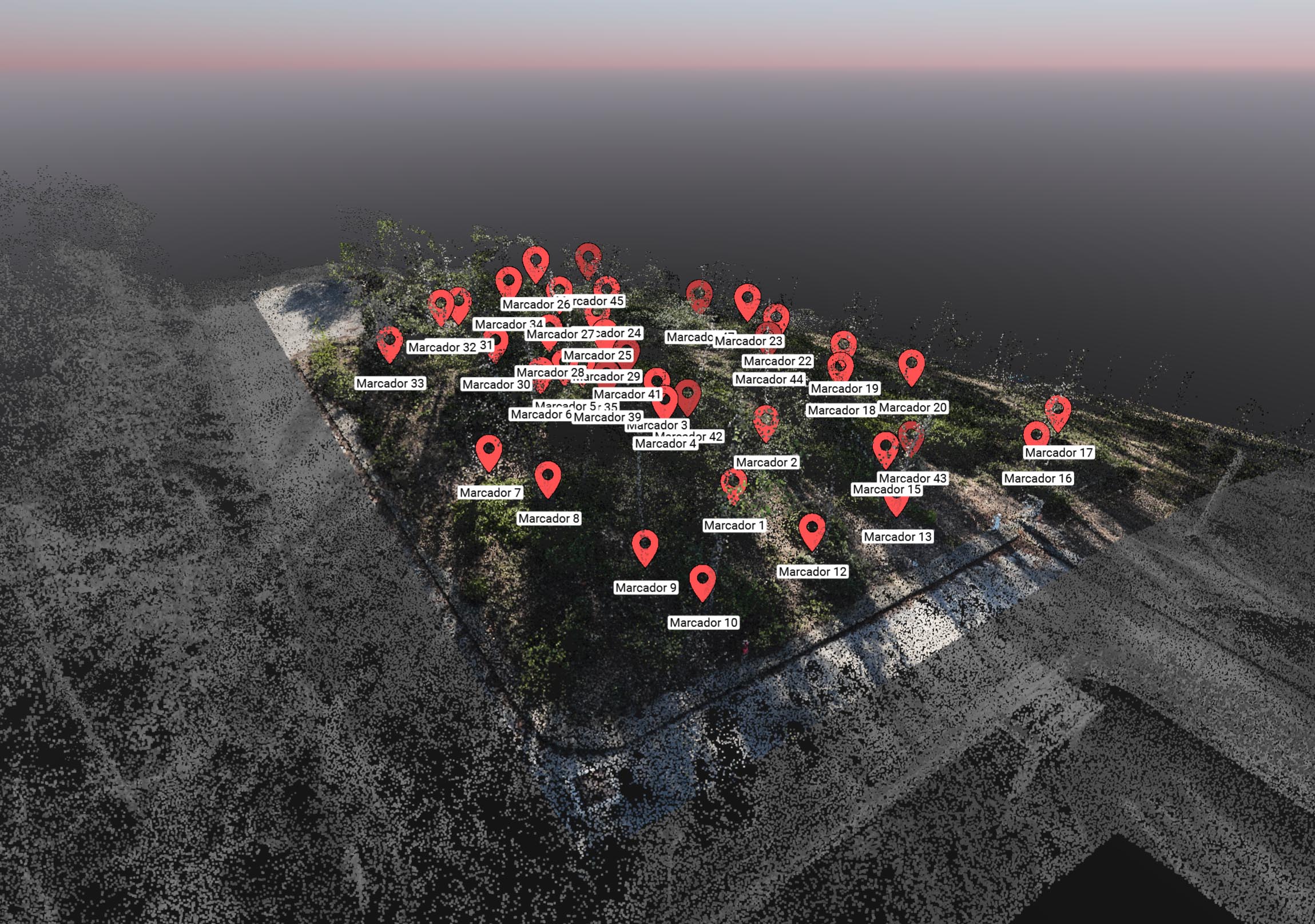
Para isso, foi necessário mapear com precisão a localização e a quantidade de cada uma das árvores do lote. Isso permitiu que os arquitetos projetassem o edifício respeitando a natureza existente, em vez de adaptar o terreno por meio do corte de árvores.
Eles se depararam com três desafios técnicos:
- A vegetação densa dificultava consideravelmente o trabalho
- As limitações dos equipamentos topográficos tradicionais, como as estações totais
- A dificuldade para identificar quais árvores já tinham sido medidas e quais ainda não
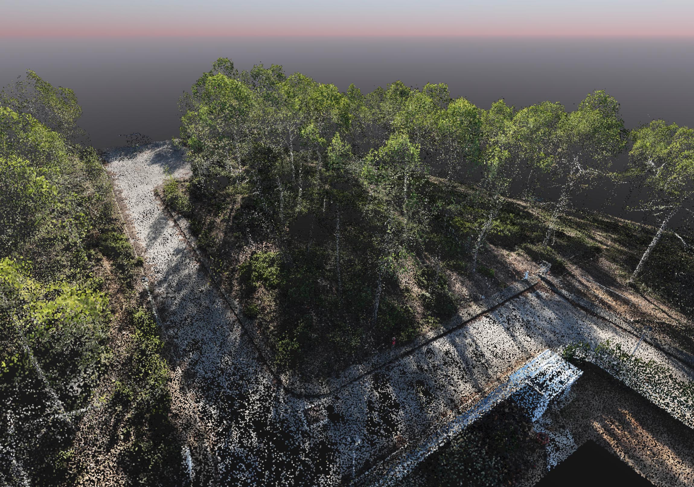
A copa densa das árvores complicou o trabalho de campo. O GPS tradicional mostrou-se pouco confiável, já que os galhos bloqueavam os sinais dos satélites, enquanto os equipamentos topográficos convencionais, como as estações totais, mal podiam ser utilizados devido à baixa visibilidade causada pela vegetação espessa.
Além disso, a falta de visibilidade dificultava muito o controle de quais árvores já tinham sido medidas e quais não. Para superar esses obstáculos, a equipe utilizou um drone para capturar o terreno do alto, combinando as imagens obtidas para gerar um mapa muito mais rápido e preciso do que o permitido pelos métodos tradicionais.
Para capturar árvores em 3D, é preciso mais do que uma simples vista aérea. Federico combinou um voo automatizado — que cobre rapidamente uma área ampla — com um voo manual que permitisse capturar imagens "por baixo" da copa das árvores. Essa abordagem "híbrida" permitiu que eles obtivessem dados suficientes para localizar com precisão a base de cada tronco, e não apenas as copas das árvores.
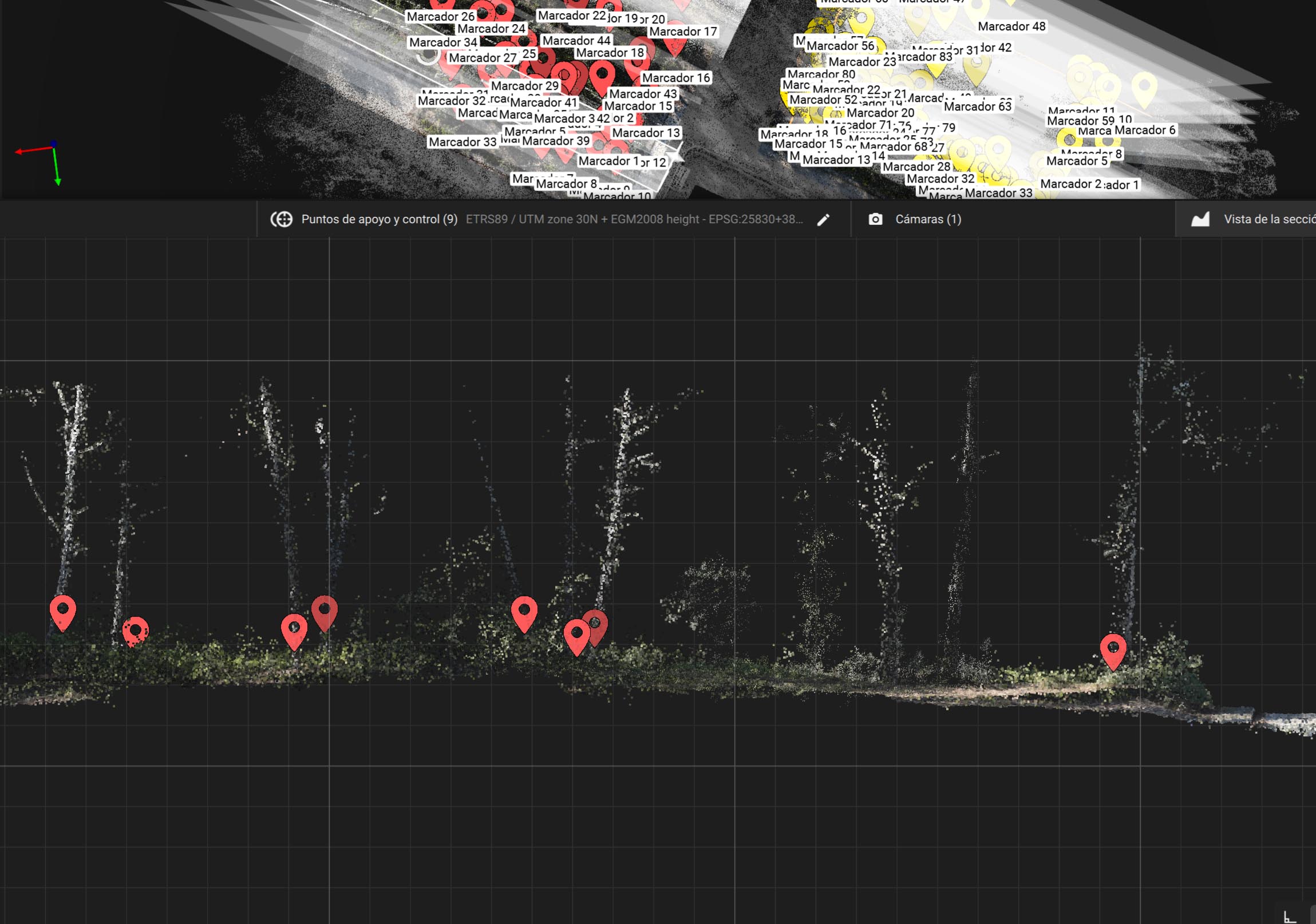
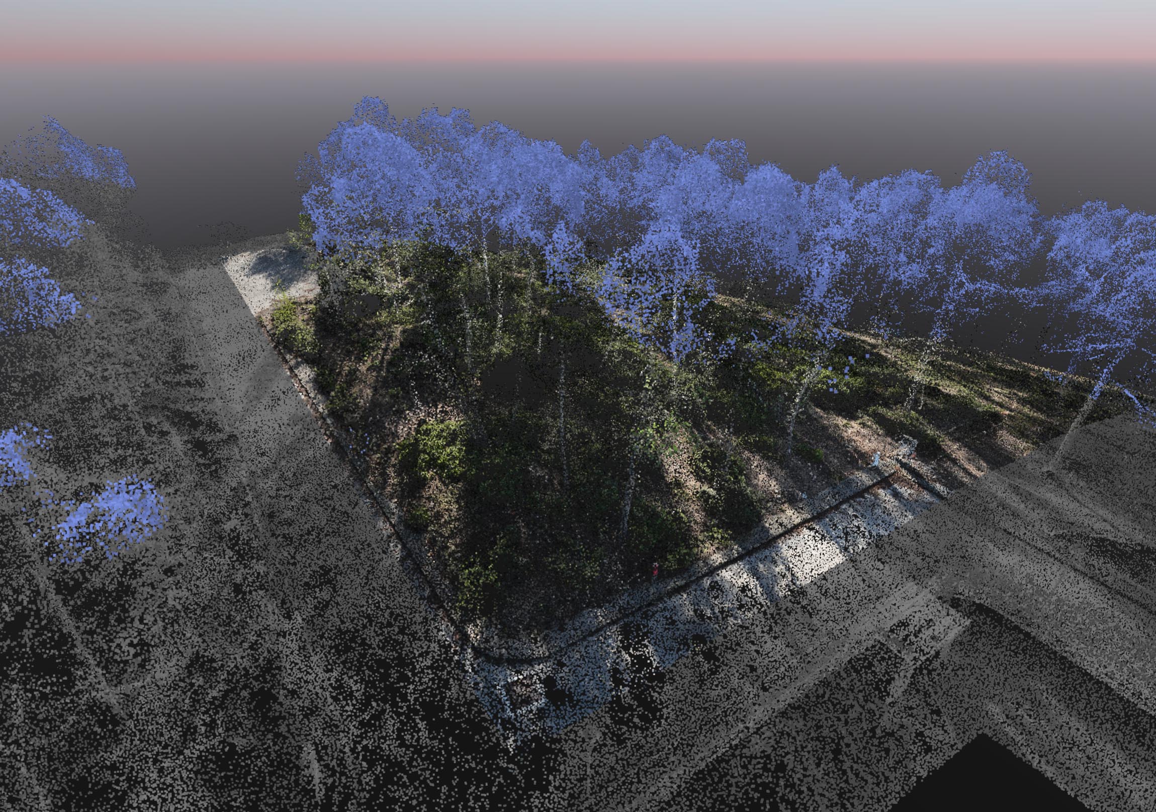
Ele voou com um DJI Mavic 3M com RTK, realizando voos nadir e oblíquos e capturando 649 imagens. O conjunto de dados foi processado no PIX4Dmatic com uma resolução GSD de 0,5 cm. Em seguida, as copas das árvores foram filtradas para manter apenas os troncos e, a partir desses perfis, foi possível localizar com precisão cada árvore do lote.
O resultado final foi um arquivo CAD que incluía os limites do terreno, as curvas de nível e a localização exata de cada árvore. Mais um exemplo de como o mapeamento com drones se integrou ao dia a dia da topografia moderna.
“O PIX4Dmatic nos ajudou a classificar a nuvem de pontos e a criar seções transversais para identificar melhor os troncos das árvores presentes no lote" - Federico Bonet, Surveyor, Aereal Pro Solutions SL