Wildlife damage assessment for crop insurance
Wild boars in cornfields cause significant yield losses for farmers and challenge insurance companies with damage assessments. Copterinspect, a northern Germany-based company founded in 2023 by farmer and drone expert Henry Kühl, used PIX4Dfields to efficiently and reliably quantify wild boar damage. Specializing in agricultural applications, Copterinspect also provides object surveying and building inspections, leveraging innovative drone technology to address diverse farming challenges across northern Germany.
Detecting wild boar damage in corn fields within a day
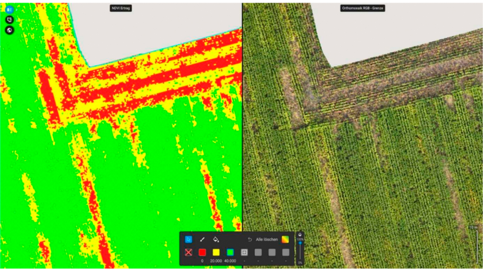
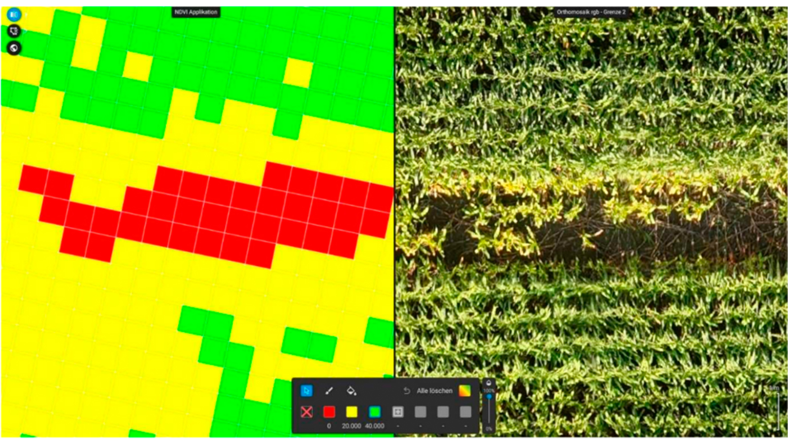
Before the corn harvest, Copterinspect was tasked with assessing wild boar damage in several fields. Manual estimation was slow and inaccurate, so he used a multispectral drone flight and NDVI analysis with PIX4Dfields. The project, including report generation and crop loss estimation, took 3 hours.
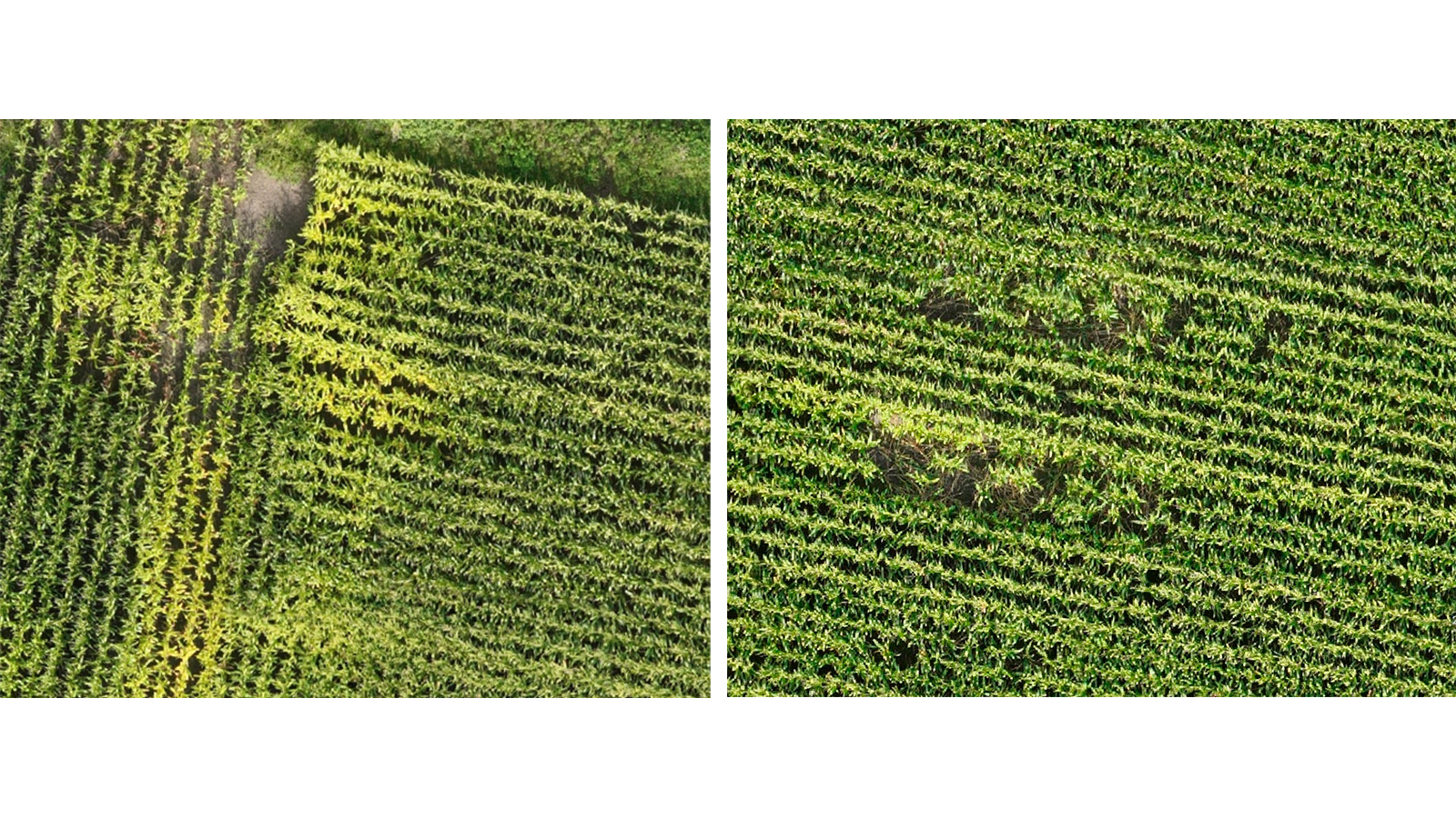
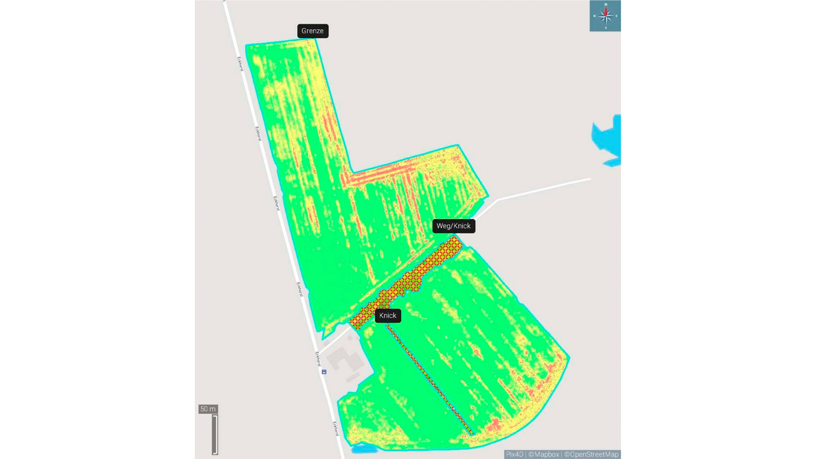
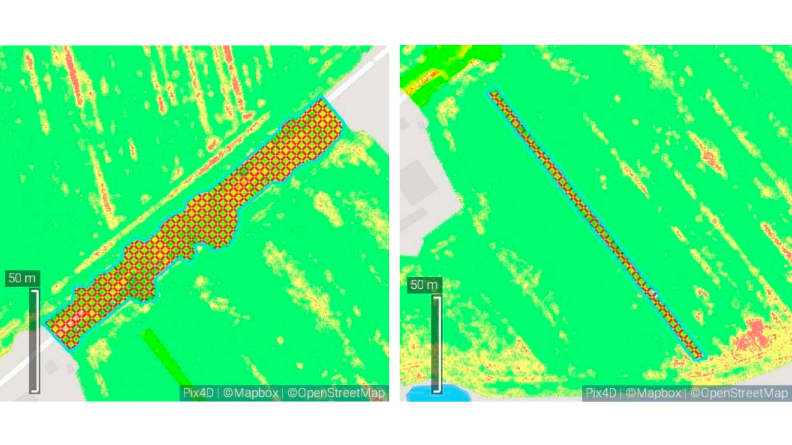
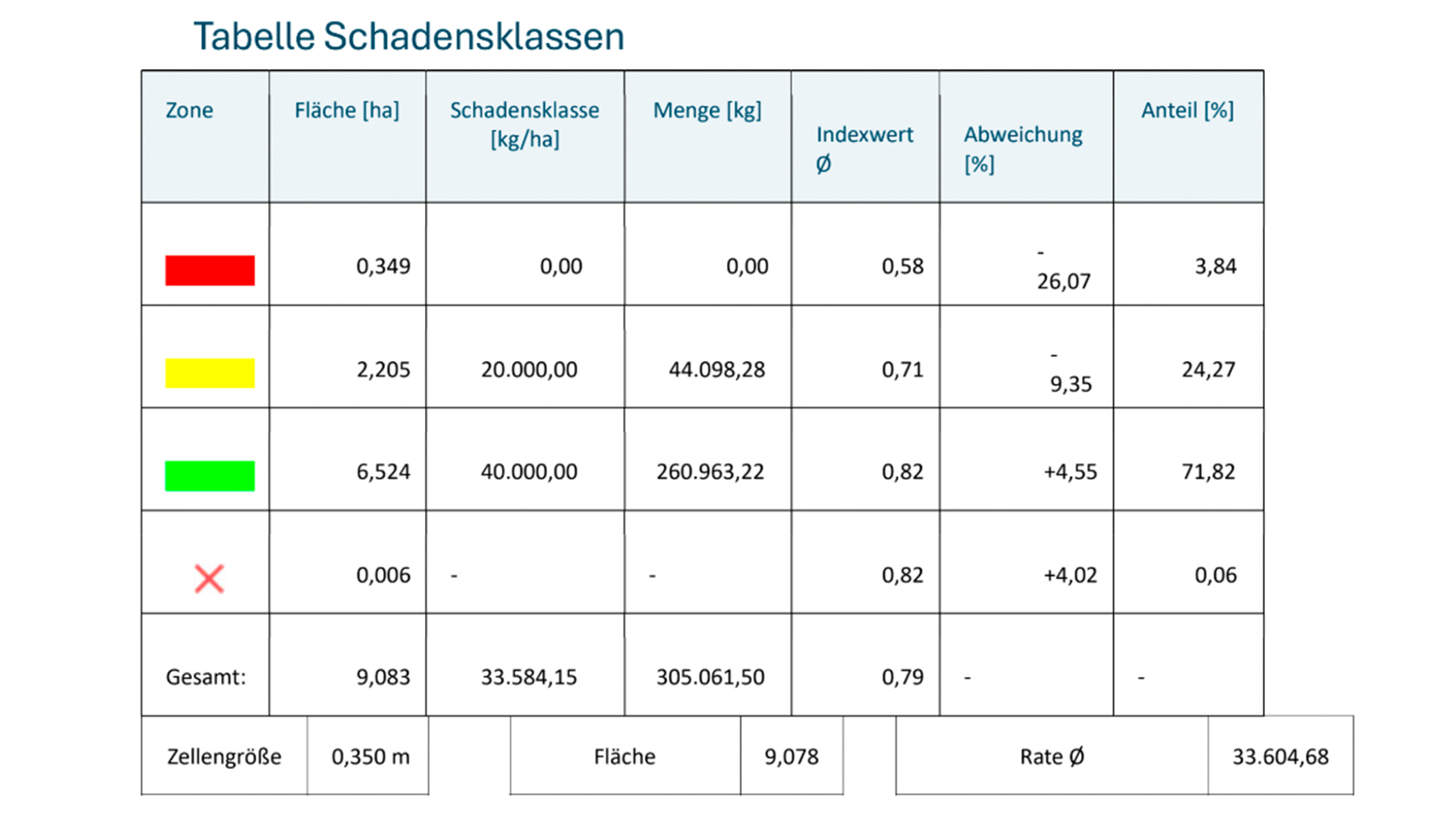
After the drone flight, Henri processed and analyzed the images in PIX4Dfields. He was then able to identify vegetation damage that was caused by other factors like water logging and mark and exclude it using PIX4Dfields’ obstacle functionality. By generating an NDVI map, he identified areas with less vegetation and created a variable rate biomass map with three levels indicating different biomass areas.
| Location | Germany |
| User | Henry Kühl |
| Project duration | 3 hours |
| Area surveyed | 14 hectares |
| Software used | PIX4Dfields |
| Hardware used | DJI Mavic 3 Multispectral with RTK, 7 batteries, power station, charger, 128GB SD storage |
| Processing hardware | Laptop: Fujitsu Celsius Core i7, Netgear Nighthawk router |
| Images captured | 500 |
| GSD | 0,9 |
Yield loss estimation for crop insurance
Using PIX4Dfields, Henry generated a detailed crop damage report in just 3 hours. Among various crop insights, he discovered wild boars preferred one corn variety over another. The report supports the farmer’s insurance claims, detailing compensation for the damage.
Results and benefits
- Complete losses and partial damages were zoned
- All data was incorporated into a PIX4Dfields report, providing the farmer and their insurer with a reliable basis for decision-making
- Total damage: around 109 metric tons of lost yield, worth more than €3,800 (excluding VAT)
“Without Pix4D, I wouldn’t have taken on this project, nor would I be able to work as a service provider.” Henry Kühl, Copterinspect
PIX4Dfields enables effective agricultural use, such as assessing wild boar damage. With multispectral drone imagery, fast offline processing, and an intuitive interface, it empowers providers like Copterinspect to deliver farmers actionable data for damage and yield analysis, requiring no prior expertise.
Since insurance claims for wild boar damage rely on accurate data collection, all parties benefit from the precise mapping, application, and documentation options that PIX4Dfields provides:
- Farmers gain a clear factual basis for their claims
- Insurance companies can rely on robust, objective data
- Service providers such as Copterinspect establish themselves as competent and reliable partners