Drone mapping trees with PIX4Dmatic
A standard survey typically focuses on terrain and boundaries, but in this project, the client wanted to preserve as many trees as possible by designing the building around the existing landscape. This project required the exact location and count of every single tree to allow for nature-first architectural design.
We spoke with Federico Bonet, surveyor and owner of Aereal Pro Solutions SL, a drone company specializing in aerial photogrammetry and inspections, about solving the technical hurdles of mapping a dense forest where traditional tools fail, using drone mapping and PIX4Dmatic.
To do this, they had to map the exact location and count of every single tree on the property. This allowed the architects to design the building around the nature already there, rather than clearing the land.
They encountered three technical hurdles:
- The thick tree cover made the job tricky
- Limitations of traditional surveying equipment, such as a total station
- Difficulty in differentiating which trees have been measured and which have not been measured
Solving survey hurdles with drones and PIX4Dmatic
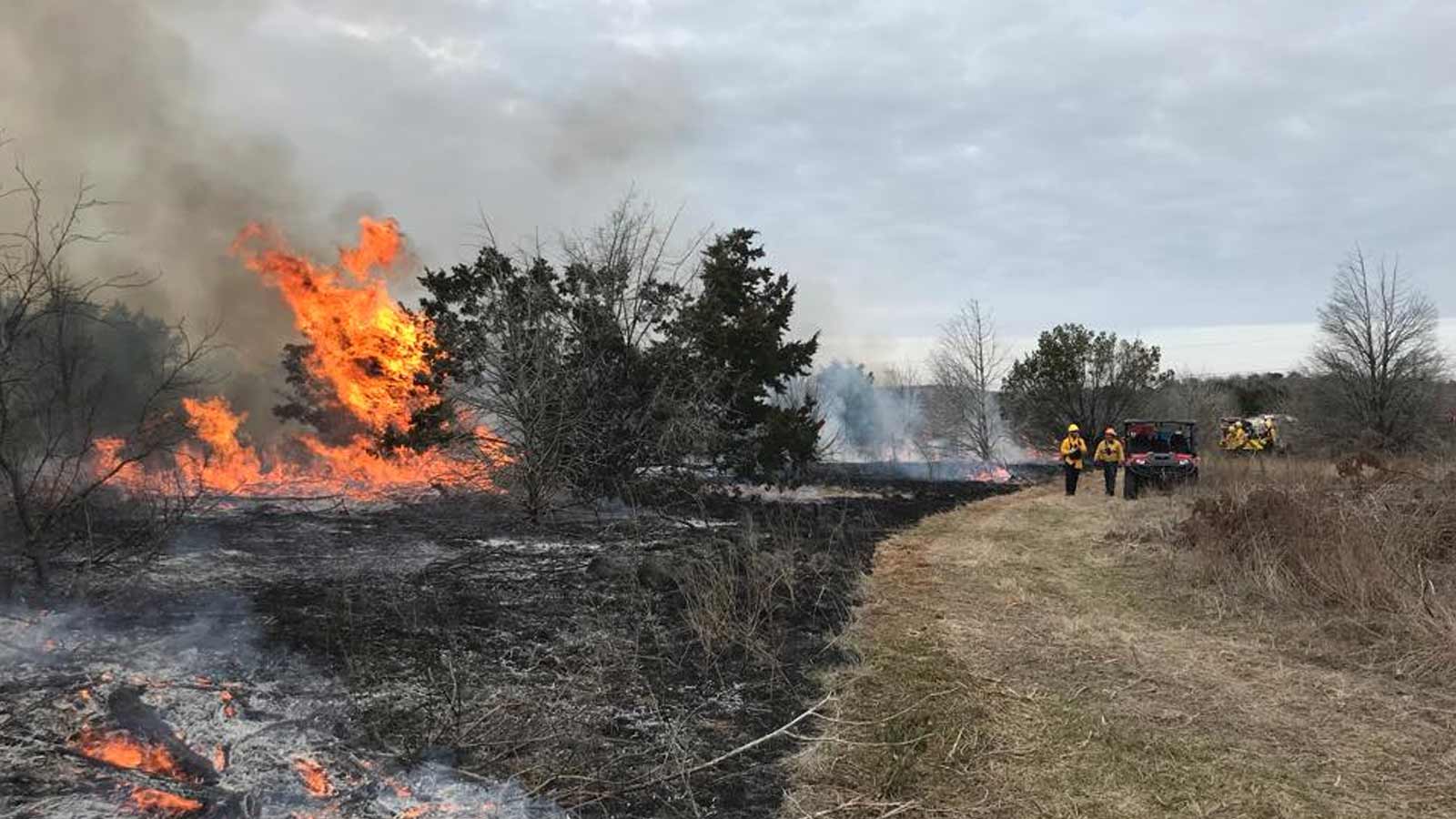
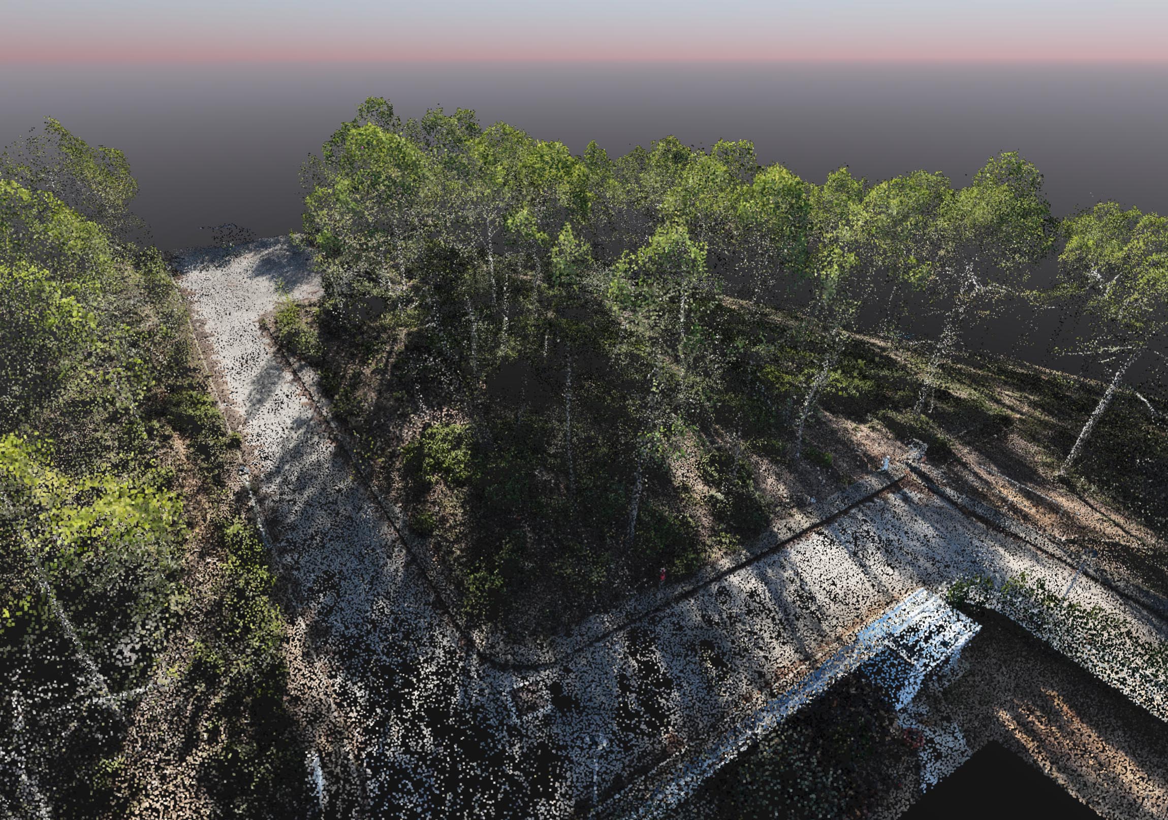
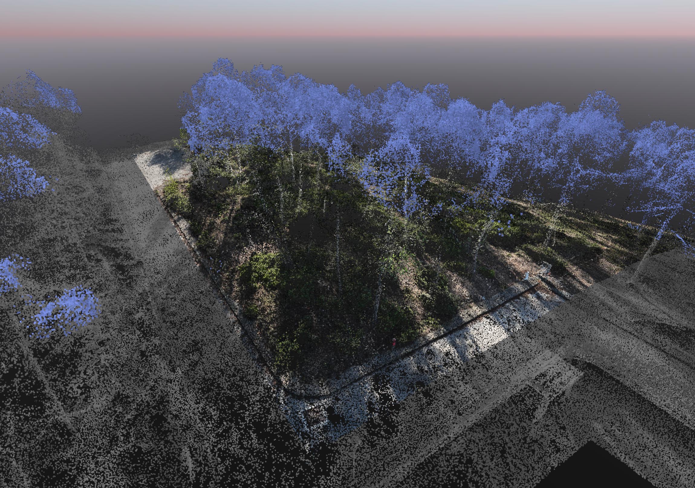
The dense canopy made the work extremely difficult. Traditional GPS failed because the branches blocked satellite signals, and standard ground equipment, like total stations, was unusable because the thick vegetation limited visibility to just a few feet. Additionally, the lack of a clear view made it nearly impossible to track which trees had already been measured. To overcome this, the team used a drone to capture the site from above, "stitching" the images together to create a map that was both faster and more accurate than traditional methods.
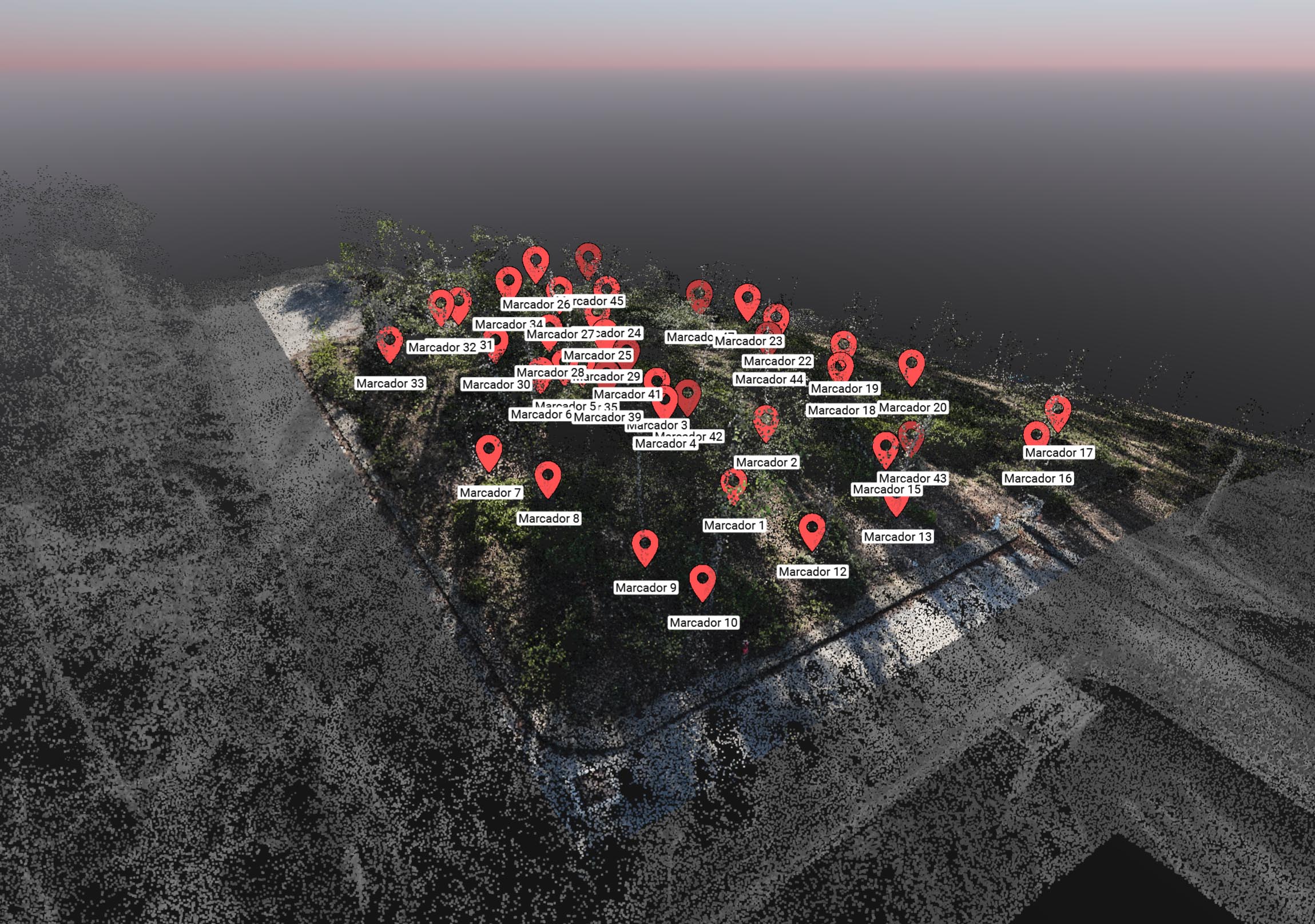
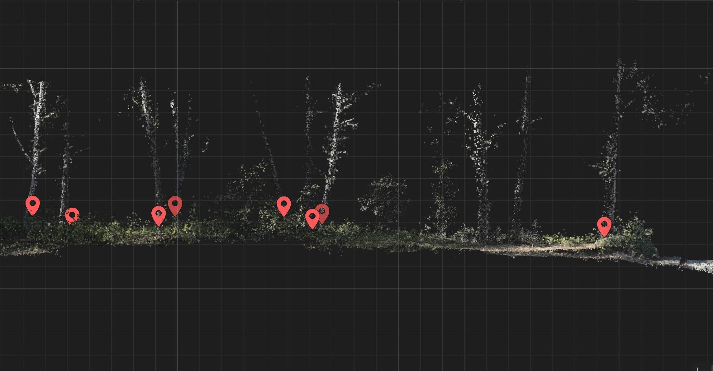
Capturing trees in 3D requires more than just an overhead view. Federico combined an automated flight—which covers the broad area quickly—with manual piloting to get 'eyes' under the canopy. This 'hybrid' approach ensured they had enough data to pinpoint the base of every trunk, not just the tops of the leaves.
The drone survey in detail
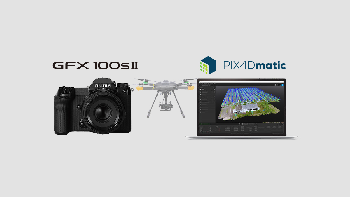
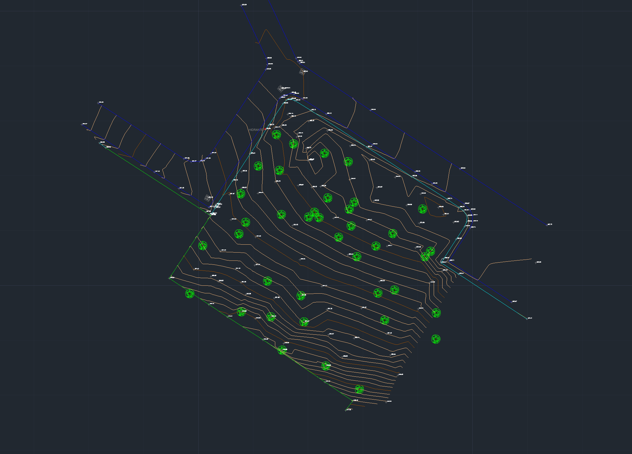
He flew a DJI Mavic 3M with RTK with a nadir and oblique flight, capturing 649 images. The dataset was processed in PIX4Dmatic with a 0.5 cm GSD. The crowns were filtered to leave the part of the trunks, and from profiles, each of the trees of the plot was located. The final delivery is a CAD file with the boundaries, slopes, and position of each of the trees. Just one more example of how drone mapping has become part of the day-to-day life of topography.
“PIX4Dmatic helped us classify the point cloud and create cross-sections to better identify the trunks of the trees present on the plot." - Federico Bonet, Surveyor, Aereal Pro Solutions SL
The drone and PIX4Dmatic bypassed the previous struggles by shifting the work from manually counting on the ground to an organized, digital inventory on a computer screen. Instead of disorienting themselves in the dense brush to measure trees one by one, the surveyors used a drone to capture the entire forest plot all at once from above.
PIX4Dmatic then processed these images into a 3D digital model, allowing the team to digitally strip away the thick canopy leaves and slice the forest into clear cross-sections. This effectively gave them X-ray vision to easily pinpoint, count, and plot every single tree trunk systematically on a map without risking missing one or measuring it twice.