Fighting disease: mosquito control with photogrammetry
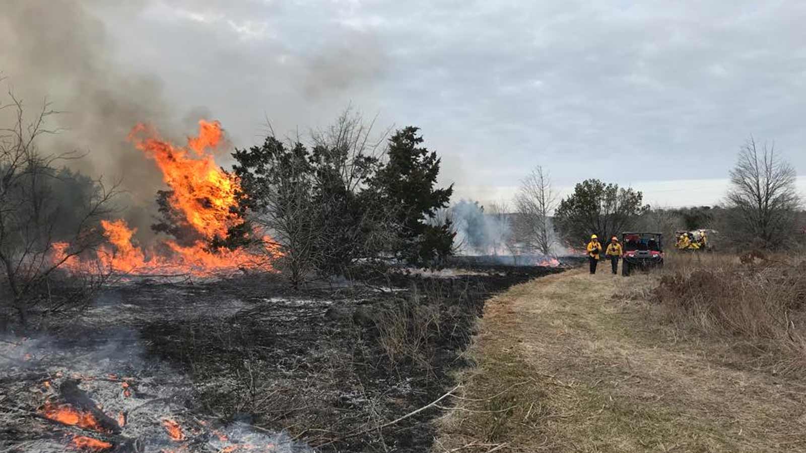
Mosquito-borne illnesses like West Nile virus and Dengue fever present a rising threat in California due to warming weather. Given the insects' ability to mature from egg to adult in just one week, traditional methods of control prove slow and inefficient.
The Los Angeles-based father-and-son team at West Coast Aerial Photography, Inc.—experts in high-quality oblique and vertical aerial imaging from manned aircraft—have adopted PIX4Dmatic photogrammetry as a highly efficient new technique for mosquito control, moving beyond slow ground-based methods.
Mapping mosquito hotspots
West Coast Aerial Photography, Inc. is run by Mark Holtzman, an award-winning photographer and a commercial pilot, and his son Steven, who manages all technical operations on the ground. As traditional methods for for mosquito control are slow and inefficent, this project involved using aerial photogrammetry to map the mosquito hotspots.
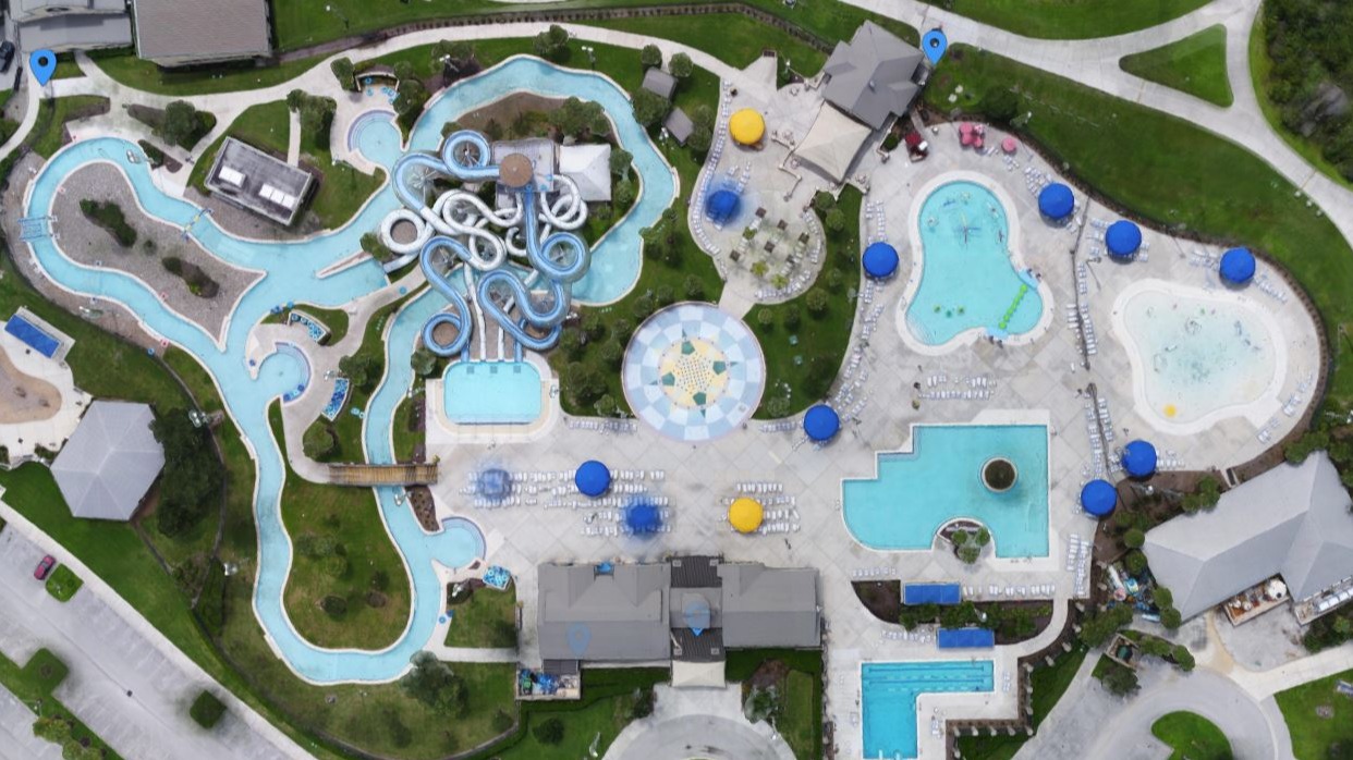
The project involved a detailed aerial survey of a 37-square-mile area over the City of Los Banos, California. Using a manned aircraft equipped with a high-resolution DSLR camera, they captured vertical imagery of the entire city. This imagery was then rapidly processed to specifically identify neglected, green swimming pools—prime breeding sites for mosquitoes. The final deliverable was not just raw data, but a collaborative, online map pinpointing each problem pool, allowing for targeted and efficient eradication efforts.
Aerial mapping for efficient control
Instead of waiting for public complaints and dispatching teams to individual locations, this project provided a city-wide, data-driven action plan. It allowed the mosquito control district to identify and address hundreds of previously unknown breeding sites simultaneously, leading to a much more significant and immediate impact on minimizing the population of disease-carrying mosquitoes.
The use of a manned aircraft allowed for the rapid collection of data over a large urban area. On the software side, PIX4Dmatic's rapid processing ability was essential to analyze the vast amount of imagery and produce results within the tight 24-hour timeframe. Furthermore, PIX4Dcloud was the key to overcoming delivery challenges, providing a seamless and collaborative platform for the client.
Geospatial solutions for public health
The primary challenge was not in collecting or processing the data, but in delivering it to the mosquito control district in a truly usable format. Initial ideas, like local Google Earth KML files, were too restrictive, limiting access to a single computer, while other online mapping services couldn't handle the large file sizes or display the imagery effectively. The solution was PIX4Dcloud. It provided a live, web-based portal where the entire district team—both in the office and in the field—could access the map, view the underlying imagery, and collaborate in real-time to coordinate their response efficiently.
The project had a significant impact on the mosquito control district's ability to combat mosquito-borne diseases. The data provided was described as "very helpful" in successfully identifying and addressing previously unknown mosquito breeding grounds, which in turn helps to control the populations of mosquitoes that can carry West Nile virus and Dengue fever.
Project details
| Location | Los Banos, California |
| User | West Coast Aerial Photography, Inc. |
| Area surveyed | 37m² |
| Software used | PIX4Dmatic, PIX4Dcloud |
| Hardware used | Manned aircraft, DSLR camera, custom-built workstation with AMD Threadripper CPU, NVDIA GPU, AND 256GB of RAM |
| Images captured | 2162 |
| Processing time | Flew, processed, and delivered data to client within 24 hours |
| GSD | 10 cm GSD (?) |
PIX4Dmatic's rapid processing capabilities were crucial for the project's success, allowing for a quick turnaround from data collection to delivery. PIX4Dcloud provided a "live portal" that enabled seamless collaboration between teams in the field and in the office, allowing them to work together efficiently to address the identified mosquito breeding grounds. The team at West Coast Aerial Photography, Inc. has been using Pix4D software for over a decade and trusts the quality and accuracy of the data it produces.
Photogrammetry protects the community
This project was critically necessary to provide timely, accurate, and comprehensive data. This new approach enabled health officials to effectively disrupt the mosquito breeding cycle and protect the community.
“We've been with Pix4D since the beginning, and their software's growth has directly empowered ours. On a project like this, where every hour counted, the processing speed of PIX4Dmatic was a game-changer. Being able to process a city-wide dataset and then share it instantly on PIX4Dcloud for collaborative action is a testament to how PIX4D’s software has evolved. The team at Pix4D is able to provide the tools that let us deliver not just data, but critical, time-sensitive solutions" – Steven Holtzman, COO, West Coast Aerial Photography, Inc.
This project represented a significant leap forward in public health and vector control, transforming the fight against mosquito-borne diseases from a reactive to a proactive strategy. Its special nature lies in the unprecedented speed and efficiency with which a large area was surveyed and actionable data was delivered. By providing the mosquito control district with a comprehensive map of breeding grounds within 24 hours, it enabled them to get ahead of the mosquito life cycle, a critical factor that traditional ground-based methods could not achieve.