Fighting fire with fire - and drone mapping
“Prescription burning is counterintuitive,” says Coitt Kessler, Austin Fire Department’s Robotic Emergency Deployment (RED) Team Program Manager.
“We think that fire is dangerous, but it thins out the fuel on the ground, and actually reduces the risk of uncontrolled fires.”
With wildfires a constant and growing risk in Texas, Kessler and his team work hard on preventing them before they break out. Prescription fires and fuel mitigation are one way to do that.
Project details: Preventing fire with fire
| Location | Austin, Texas, USA |
| Teams | Austin Fire Department Robotic Emergency Deployment (RED) Team Austin Fire Department Wildfire Division |
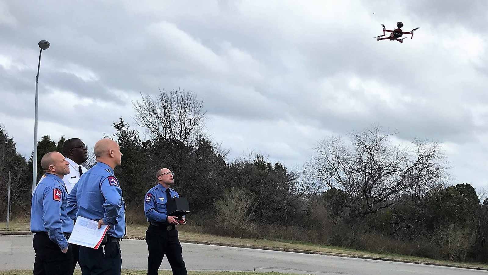
| Drone | Phantom 4 Pro V2 |
| Software | Pix4Dcapture Pix4Dreact |
| Area | 146 acres |
| Time | 37 minutes to capture images and process in Pix4Dreact |
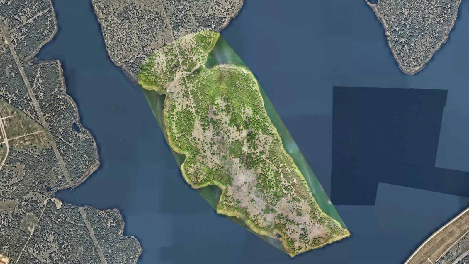
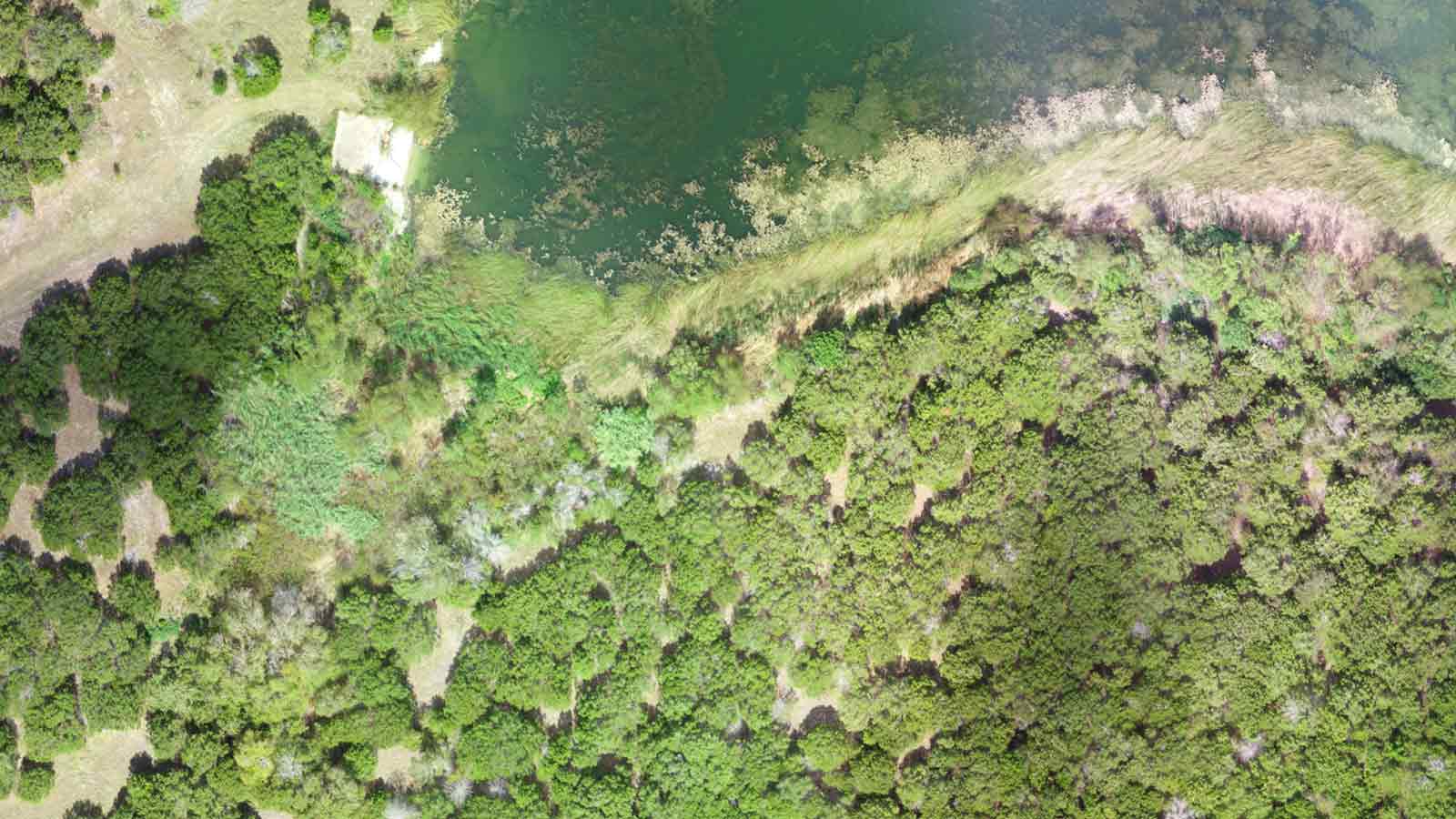
One such burn took place on Decker Peninsula South. Just a few miles from the center of Austin, Texas, Decker Lake is a popular spot for fishing, boating and hiking. Prescribed burns are necessary to push back invasive trees, and maintain the two prairie preserves on the Peninsula.
Before beginning the Decker Peninsula burn, Kessler and the RED team planned it down to the last detail. The team carefully watch the weather forecast, and pinpoint the ideal weather conditions: humidity, wind and temperature are all taken into account. Moisture in leaves and grass from the burn area are measured to calculate the total energy released component, or ERC.
“It is incredible, just how much goes into it before we even go out into the field,” says Kessler.
To help with the planning, Kessler and the RED team map the area.
When the fire starts, it’s a long day for the people on the ground. Starting early in the morning, the firefighters strategically places fires on the ground. With a command team directing, the firefighters lay fires, feed them with fuel and direct them with leaf blowers (“Just like you’d use at your house,” explains Kessler), and prevents the fire from spreading outside of the prescribed zone.
“I played rugby for a long time,” says Kessler. “Whenever my friends and family watched it, they thought it was just chaos. But when you know the rules and you’re out on the pitch, it was nothing but a chess game. Burns are a bit like that.”
What is a prescribed burn?
A prescription or prescribed burn is a carefully planned and managed fire. It can suppress the growth of invasive species, or clear a firebreak to prevent uncontrolled fires from spreading.
Prescribed or RX burns are a vital tool in places which are vulnerable to wildfires. In Texas, teams like the Austin Fire Department’s Wildfire Division carry out prescribed burns year-round, especially on public land, or land managed by utility companies.
All the pre-planning is essential. “Decker Peninsula is almost an island,” adds Kessler. “We had the effects of the wind coming off the water to pull this thing around.”
The burn is watched both on the ground and from above. “We always fly during a burn,” says Kessler. “It was really smoky but we could absolutely discern good information out of Pix4Dreact. It took 37 minutes to take the images, process the images, and then get them to the bosses.”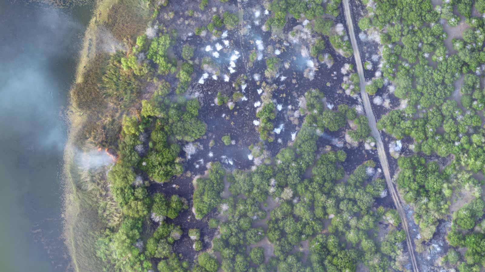
The end result: the area is stripped of grass, and many of the invasive trees are dead. The next day, the team returned to check for smoldering embers, and cut down any trees standing ‘in the black’, the area consumed by fire.
The native prairie grasses can be reseeded and spring back after a burn. Fires add valuable nutrients back into the soil, and create a rich environment, where the perfectly-adapted grasses can thrive.
Mapping in the black
Immediately after the fire, the RED team remaps the area to check that everything that should have burned, was consumed by the fire. “The moisture content in the trees wasn’t optimal,” says Kessler. “We didn’t get to burn as many trees as we wanted. We’ll be able to take them out later on - we’ll discuss timelines with the biologists, but we could be back a couple of times a year.”
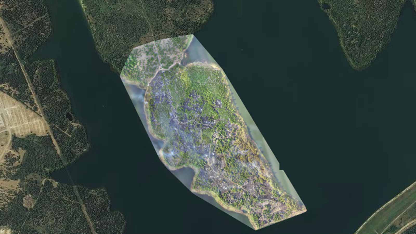
“Every time we burn, we map it,” continues Kessler. “It doesn’t make any sense not to. We have the technology and the opportunity so we’re taking advantage of that.”
The team fly their fleet of eleven drones with flight planning app Pix4Dcapture. “We have other software we could use, but I use Pix4Dcapture because it works so easily,”says Kessler. “This is my full time job, but my guys fight fires, they do car accidents and medical calls - they can’t have anything that’s going to be really complicated.”
The RED team don’t typically place ground control points, for controlled burns both because of time constraints, the risk of losing them in a fire, and because they find that for their needs, the accuracy they can achieve is more than sufficient.One of the first to try Pix4Dreact, the RED team found it integrated seamlessly into their existing workflow. “Using Pix4Dcapture to put a polygon around an area, pressing start and then going to Pix4Dreact and say ‘Upload’ and ‘Process’ - that’s simple,” explains Kessler.
In an emergency situation, internet connections are often stretched too thin, or destroyed entirely, such as in the 2017 Santa Rosa Fires. Pix4Dreact doesn’t require an internet connection to process maps, and the results can be shared over email when back at base or back online.
“We’ve always been able to gather information rapidly,” says Kessler. “But we haven't been able to produce an item that we can then share with our decision makers and commanders to allow them to quantify acreage. When the media and property owners get involved, one of the first things they want to know is how much has been burned, how many properties have been affected. We can quantify that with an orthomosaic, and use the algorithms to measure it, very, very quickly.”
After the prescribed burn, maps are shared with team members as a training and planning tool, and with stakeholders such as the biologists who are responsible for maintaining the area’s plants and wildlife.
Longer term, the information gathered by the RED team may feed into Austin Wildfire and Vulnerable Populations Tool. The online tool, developed in partnership with the Austin Fire Department’s Wildfire Division and the City of Austin’s Office of Sustainability, highlights the areas which are most at risk of wildfire. In many cases, they are home to Austin’s most vulnerable populations.
Working in the community
Another tool the team uses to fight wildfire involves community engagement and boots on the ground.
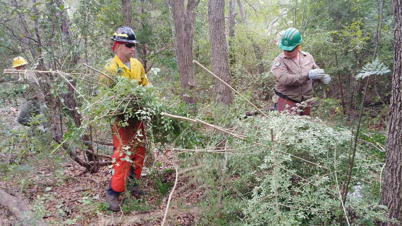
“We have teams that go out and cut trees and bushes in local neighbourhoods. Reducing fuel assists communities by preventing fires from coming into their backyard. Prescription burns are a way to remove fuel on a large scale, but we can also do that with saws, just dragging brush piles.”
“We’re working as hard and as fast as we can to enhance public safety in our space,” says Kessler. “When I show the public what’s in one of our firetrucks, people say ‘Wow! There’s a lot of tools in there.’ And what I tell them is, ‘I may have a hundred tools, but they’re for a thousand jobs.’ There's not one tool that works for public safety. There’s not one tool that works for each of our required applications - having that diversity is very valuable. It’s really nice having Pix4Dreact in place now.”
| Lead image: Austin Fire Department Wildfire Division - Facebook |