Interview: forensic accident reconstruction with Pix4D
We interviewed Corporal James Lantz from the Maryland State Police (MSP) Crash Team to understand how the MSP uses Pix4D solutions in their workflow. The Crash Team merges aerial captures with terrestrial scans (drone and phone) in PIX4Dmatic photogrammetry software for comprehensive scene documentation.
What is accident reconstruction?
Accident reconstruction teams investigate collisions and incidents to determine exactly how they occurred. This is crucial for understanding the contributing factors, assigning responsibility, and informing legal proceedings and safety improvements.
One of the main challenges faced by these teams is documenting the evidence in the aftermath of a crash, while minimizing disruption to the public. Traditionally, this balance has been difficult to manage.
Methods like hand-drawn diagrams and tape measures are time-consuming and often lead to prolonged scene closures, causing significant impact on traffic flow and daily routines, while also posing a security risk for the on-site team, especially on a motorway. While technologies like total stations and GPS brought improvements, the need for faster, more comprehensive scene mapping remains a concern.
This is where digital mapping solutions step in. Faced with pressure to clear scenes efficiently without compromising the integrity of evidence, we sought a solution that could reduce documentation time while maintaining accuracy and detail.
Who is the MSP Crash Team, and what is its mission?
We are a law enforcement agency with statewide jurisdiction, tackling life-threatening injury and fatality crashes. We are authorized to operate drones in some of the most restricted airspaces in the United States.
When using traditional methods (total stations), we had an average scene mapping time of between one and a half and two hours. With drone mapping, this time is now an average of only 20 minutes, saving about one and a half hours in incident investigative time! We have mapped over 700 crash and crime scenes since our drone mapping program began.
“What stands out about Pix4D for us is its ease of use and the power to combine multiple data sources into a single project. That flexibility is critical for our crash investigations." - Corporal James Lantz, Maryland State Police, Crash Team
Drone mapping also provides a more realistic and accurate map of the scene instead of a traditional line diagram. In circumstances where drones cannot be used, we first use an Emlid RS+ GPS station and 3D scanning application PIX4Dcatch. We later document the scene with a drone and merge the projects together in PIX4Dmatic.
Can you tell us about a project where you successfully used this method?
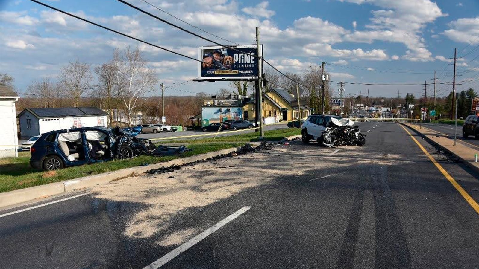
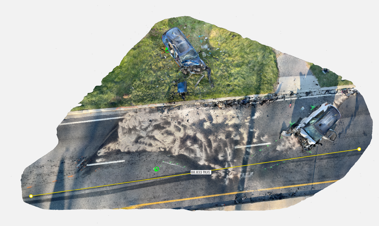
Yes, we recently used this method in a case that resulted in the successful prosecution for vehicular manslaughter. It showcased the capability to merge aerial and terrestrial data sources for the reconstruction of an accident into one project. Despite data collection occurring over two separate days, the resulting model accurately represented the scene as if it were on the date of the crash.
How did Pix4D help this case?
The Pix4D software suite allowed us to integrate traditional methods of evidence collection with nontraditional data sets. This meant we could combine information from different techniques, like GPS point collection with drone captures, into a single, unified project. This flexibility was crucial for creating a complete and accurate accident scene reconstruction, no matter how or when the individual pieces of evidence were gathered. It provided one central platform for all our data, simplifying the entire reconstruction process.
What were your learnings with drone mapping?
Implementing new technology or equipment always involves a learning curve, requiring team members to undergo training and become familiar with the tools. In the beginning, many lessons were learnt from trial and error, such as learning what techniques provided the best results for the conditions present.
Most team members transitioned from a standard autonomous grid pattern with a nadir camera angle to a manual flight pattern with an oblique camera angle. This provided greater control of the data captured to minimize privacy concerns and to ensure maximum data coverage at the incident. Because of the increased coverage, this flight pattern also produced better results. The team members were able to see the impact that different flight styles had on their final products.
Why did you choose PIX4Dmatic?
We chose PIX4Dmatic because it offered greater control over content and features in the final output compared to PIX4Dmapper. This was particularly important for a case like this, where the initial crash occurred during the daytime with weather conditions that prevented immediate drone flight. Even with these challenges, the entire process—including data capture, processing, and generating the final deliverable—was completed in approximately 8 hours.
Project Details
| Location | Maryland, USA |
| Public safety organization | The Maryland State Police Crash Team |
| Project duration | Approx. 8 hours, including data capture, processing, and final deliverable |
| Flight time | 2 flights, 35 mins (Per flight) |
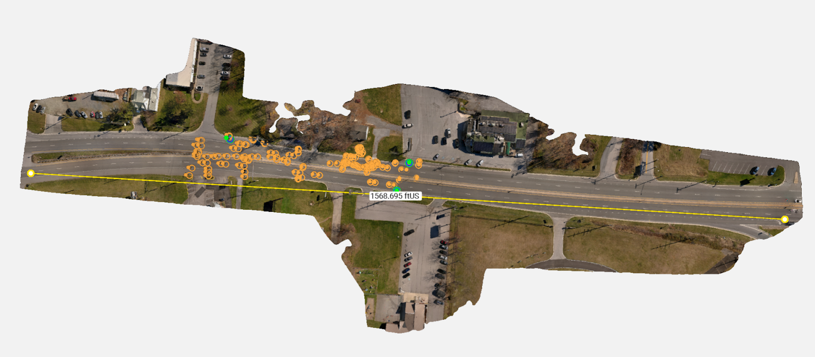
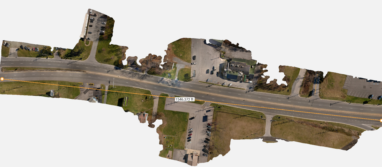
| Area surveyed | 1600 feet of roadway and surrounding area |
| Software used | PIX4Dcatch, PIX4Dmatic |
| Hardware used | Autel Evo2 Version 1, iPhone 13 Pro, Emlid Reach RS+ |
| Processing hardware | Laptop: Asus |
| Images captured | 3266 |
| GSD | PIX4Dcatch 0.008 ft (0.24 cm) Drone 0.004 ft (0.12 cm) Merge 0.021 ft (0.64 cm) |
Technical details: tell us about your workflow for the digital reconstruction of an accident?
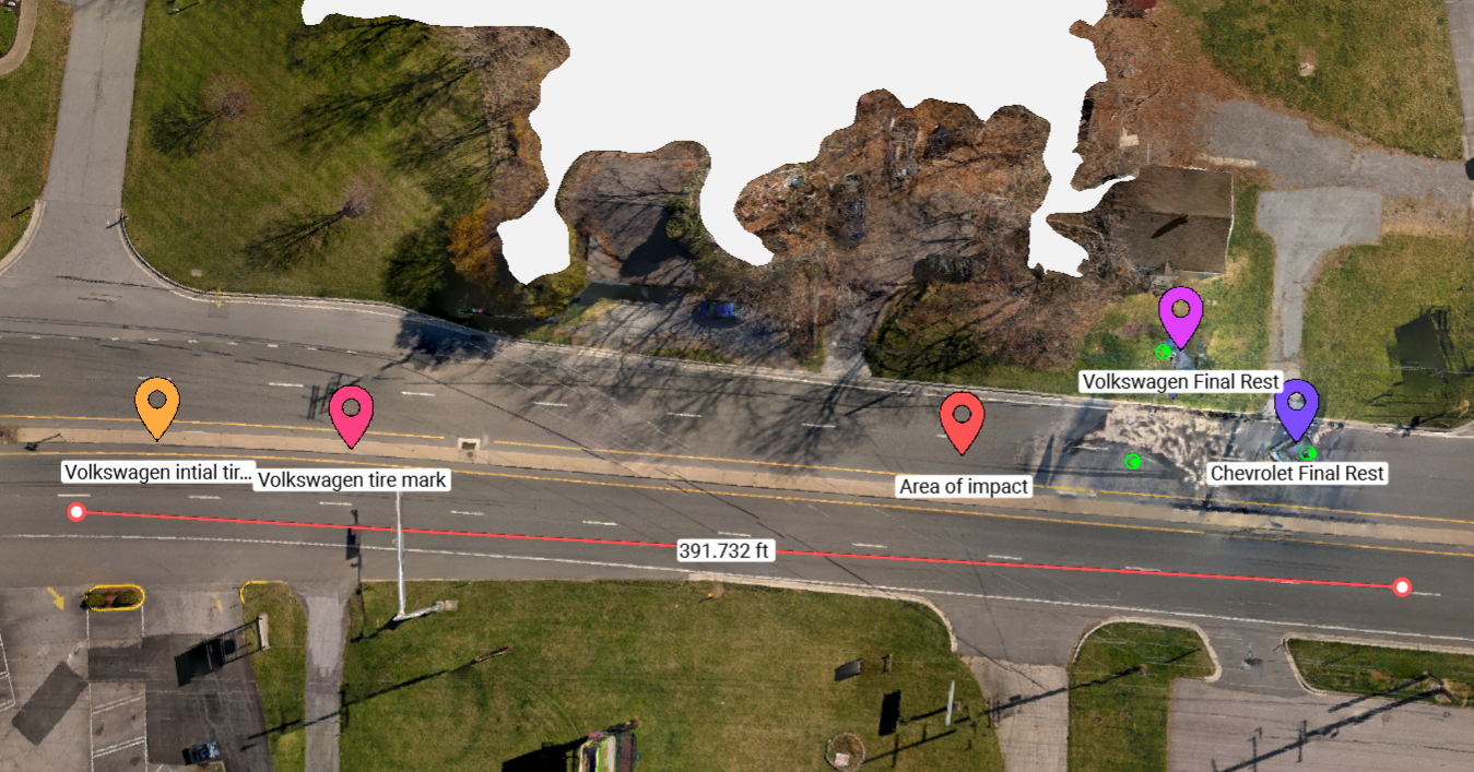
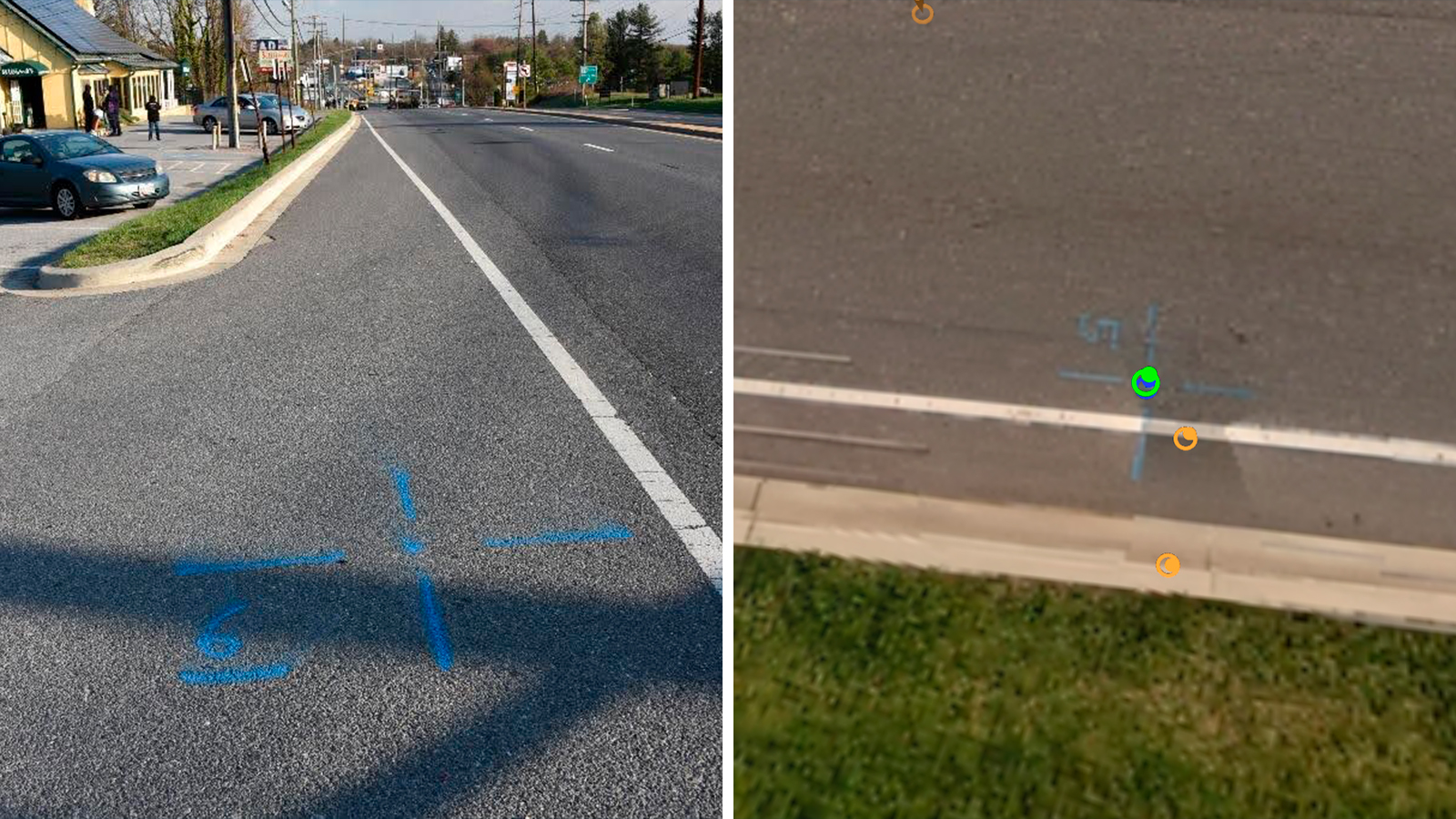
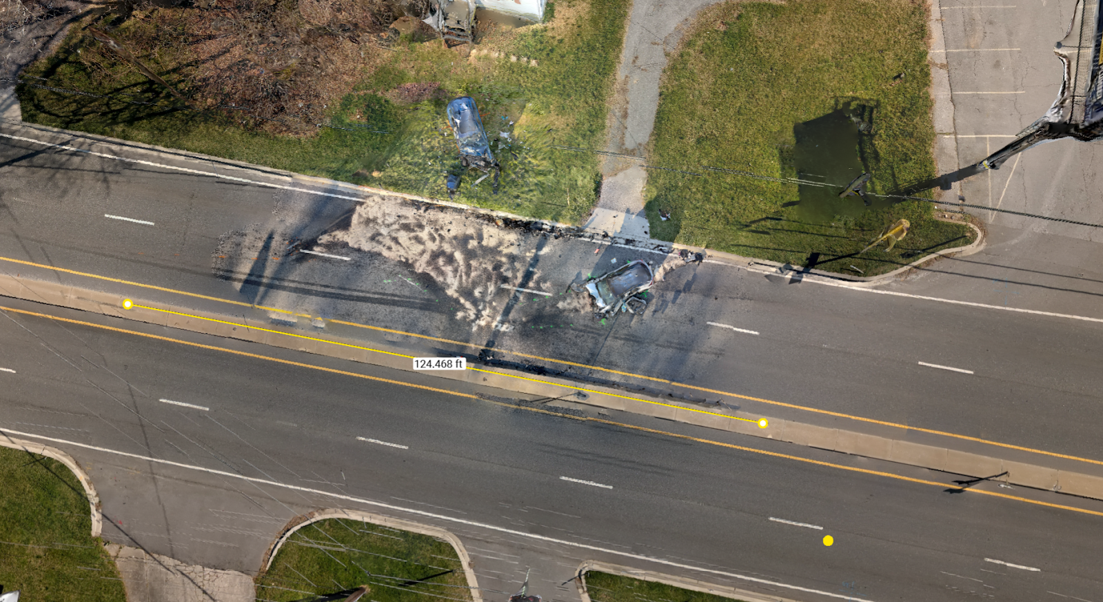
The scene was mapped using the Emlid RS+ GPS station, with ground control points to precisely connect it with the drone project. The area of impact and vehicle resting places were documented using an Apple iPhone 13 Pro, utilizing the PIX4Dcatch application (no RTK device).
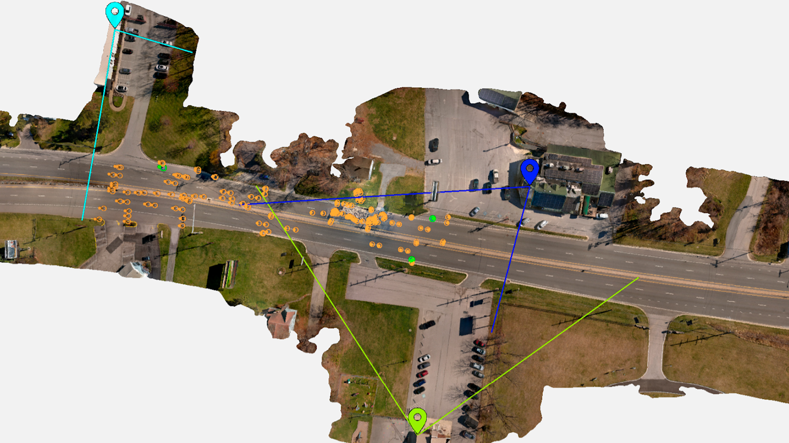
When weather conditions improved, the scene was then mapped with a drone (Autel Evo 2). The drone and iPhone project were processed separately in PIX4Dmatic. The projects were then merged into the final project using common tie points. The GPS data was added using the GCPs. There were multiple cameras that showed the crash events. These cameras were also marked in the mesh, and the fields of view were displayed.
Pix4D's integrated tools for marking and labeling allowed for the creation of a complete final product within one program, ensuring all data contributed to a single, comprehensive reconstruction.
A big thank you to Corporal James Lantz for his time in answering our questions! We also extend our gratitude to the Maryland State Police Crash Team for their service to public safety.