Locating underground pipes with AR using Pix4D
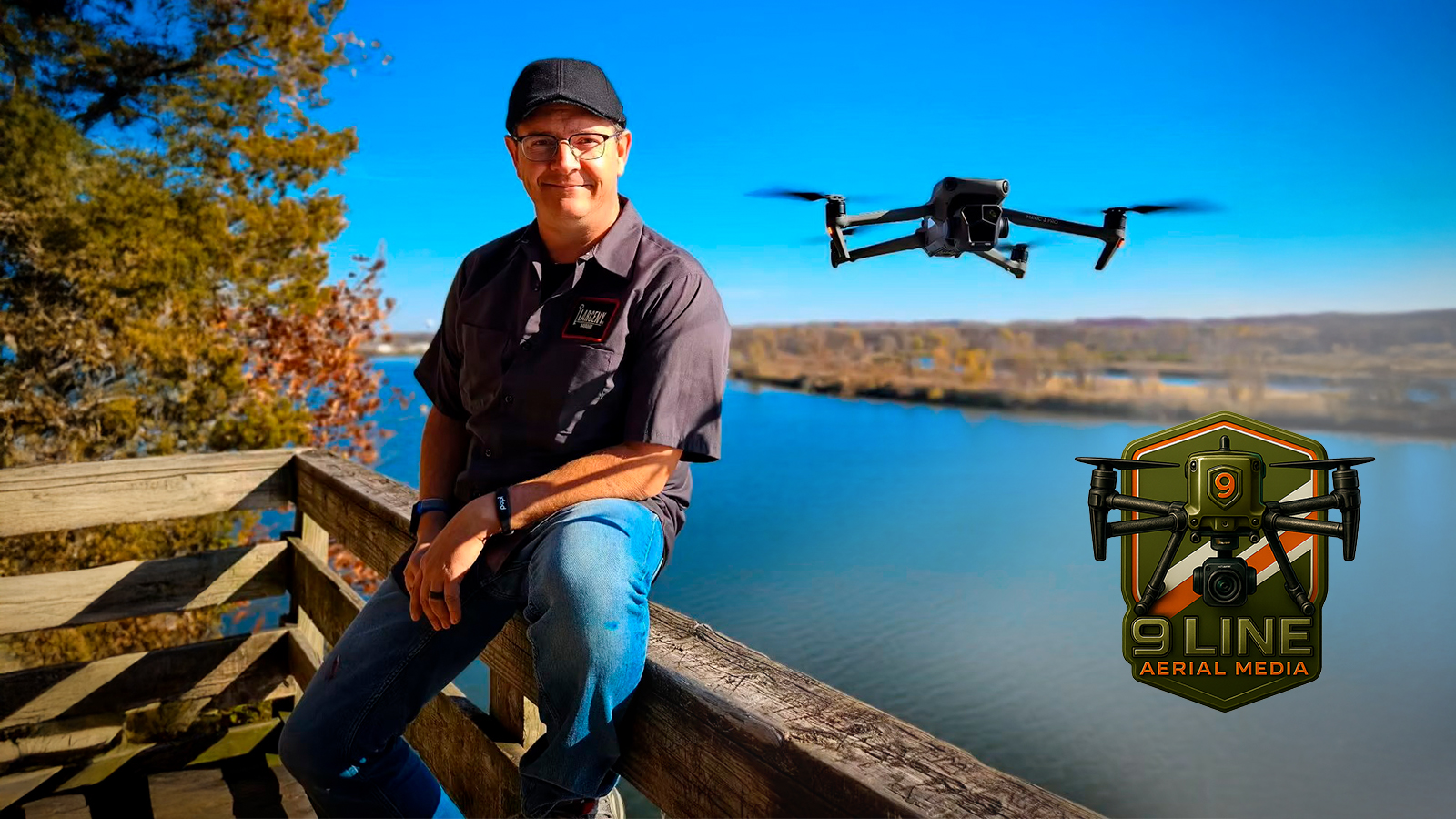
Pix4D spoke with Brian Layhew, founder of 9 Line Aerial Media. After a 23-year career in the United States Air Force, where he flew military aircraft, Brian retired and discovered his passion for drones and geospatial data. This led him to establish his company, where he now applies his skills to generate high-resolution maps with Pix4D software for city entities and utility companies, assisting them in managing and documenting underground utilities across all phases of construction.
What drew you to digital mapping?
Managing large-scale infrastructure and utility projects and locating underground pipes requires precise situational awareness and real-time insights into every aspect of a site. However, professionals frequently face the challenge of maintaining up-to-date information and documentation with constantly evolving real-world conditions.
I was both immersed and fascinated by coordinate systems and model/data accuracy, and how to give a customer the end product they were truly looking for. At first, I didn’t realize what the demand was going to be for drone services!
I wanted to bring situational awareness to my projects and also provide real-time insights into project planning and scheduling. My clients realize that time is money, and when poor decisions are made due to a lack of data, that costs more time and more money than if they had digital models and data to look at and work with.
Do you have a utility project in mind where you found Pix4D particularly useful?
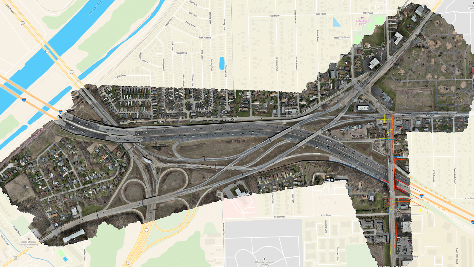
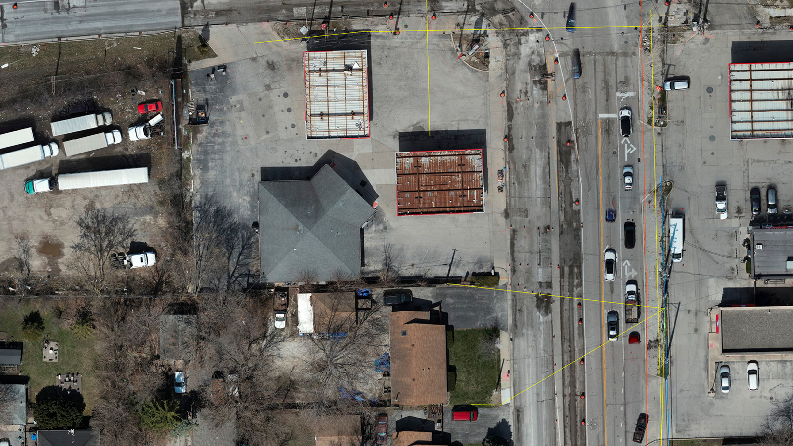
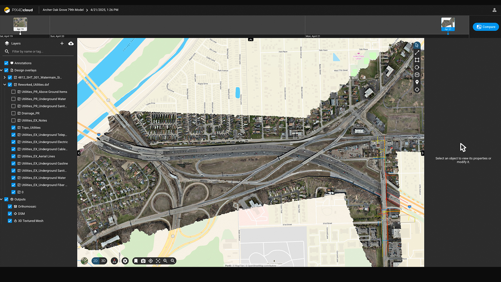
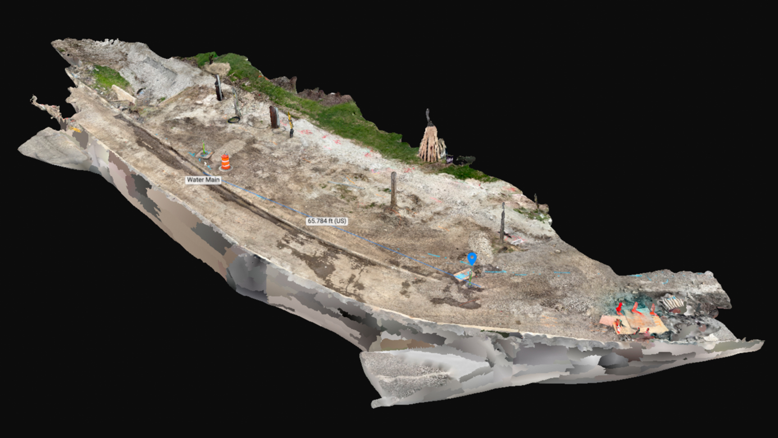
Yes, the village Justice in Illinois is undergoing a lot of construction on its roadways, and requires digital mapping to manage and document entities and utilities. The project spans over 300 acres of city property with a major interstate running right through the middle of it all. The intricacies involved are not only rerouting traffic, but having multiple areas being heavily worked on sporadically throughout the weeks and months. Water lines are being removed and replaced throughout the entire area.
How did Pix4D help locate underground pipes?
Because the project is so large and slow-moving at times, the utility markings were constantly being worn away — they never seemed to be in the same location twice! There was an underground water main that they needed to find. Having a digital map of its exact location to be re-marked regularly was invaluable!
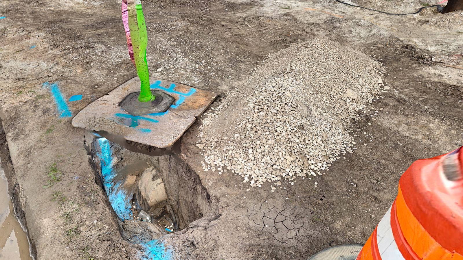
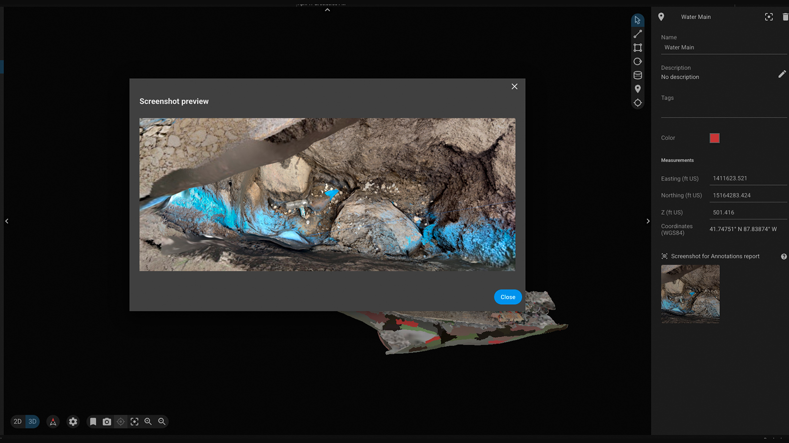
This is where PIX4Dcatch was truly able to shine. They found it and cleared the earth around it. I was able to utilize PIX4Dcatch with an RTK rover to supply not only an astounding digital twin of the area, but also the ability to look down into the hole and visually see the pipe! From here, I could provide a DXF file to overlay its exact location!
Moving forward, we will be able to use PIX4Dcatch’s AR (augmented reality) to visually see the pipe as we are walking and remark it with extreme accuracy. If this water main were to get damaged during excavation, the city would be in a HUGE mess of problems. So this was critical.
Project details
| Location | Justice, Illinois, USA |
| User | 9 Line Aerial Media |
| Area surveyed | 300+ acres |
| Total number of images | 7000 for the entire map 1447 for PIX4Dcatch |
| Software used | PIX4Dcatch PIX4Dmatic PIX4Dcloud |
| Hardware used | Matrice 350RTK, P1 35mm, RTK for overall map. iPhone 15 Pro Max for PIX4Dcatch data |
| Computer System | Windows 11 Pro 64-bit. CPU: AMD Ryzen 9 7950X. RAM: 96GB. Motherboard: ASUSTeK COMPUTER INC. TUF GAMING X670E-PLUS WIFI (AM5). |
| Computer Graphics & Display | SAMSUNG. (3840x2160@60Hz). 4087MB NVIDIA GeForce RTX 4080 SUPER (ASUStek Computer Inc) |
| Processing time | A little over a day |
| GSD | 0.36 |
How did you use PIX4Dcatch as underground utility mapping software?
PIX4Dcatch served as my primary tool for capturing ground-level data, which has had a gigantic impact on this project. Monitoring and planning were just a small part, believe it or not! I’m being fed utility DXF files from the engineer working with the city to plug into my models and verify locations. Once they’re loaded, I’m able to use PIX4Dcatch’s AR augmented reality to verify the accuracy and update not only the engineering schematics for the project, but also utility locations for the city records.
My main challenge here was ensuring full coverage of the remote site two hours from the office, with a mobile device. To avoid revisits, I captured extra images from multiple angles, ensuring completeness on the first attempt.
What made you choose Pix4D?
The biggest advantage of Pix4D, and why I chose it, is because of its accuracy and versatility. Having a suite of software that all speaks to each other is such a huge advantage. I use PIX4Dmatic, PIX4Dsurvey, PIX4Dcatch, and PIX4Dcloud. That’s one huge family that does everything that any city entity or construction company could ever want, on top of unparalleled data acquisition and evidence to aid in engineering schematics and planning. They know there’s nothing I can’t provide them with this suite, and it makes it impossible for them to do business with anyone else but me.
“Having a suite like PIX4Dcatch, PIX4Dmatic, PIX4Dsurvey, and PIX4Dcloud gives me every tool I need. It’s all in the same family and works seamlessly together. In the end, it makes it impossible for city entities, construction companies, and engineering firms to do business with anyone else because of what Pix4D allows me to bring to the table." - Brian Layhew, 9 Line Aerial Media