Drone mapping the Galápagos with PIX4Dmatic
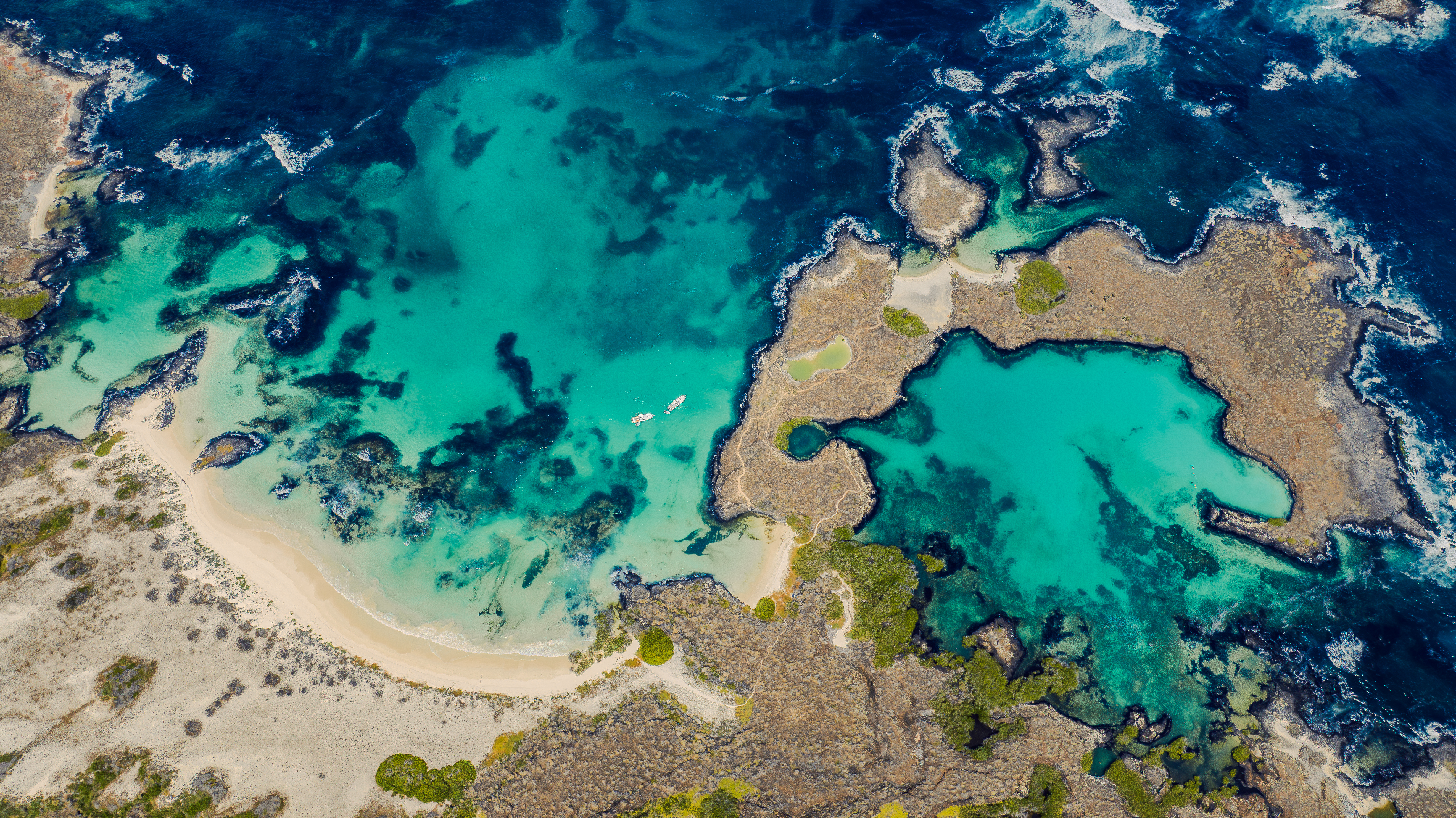
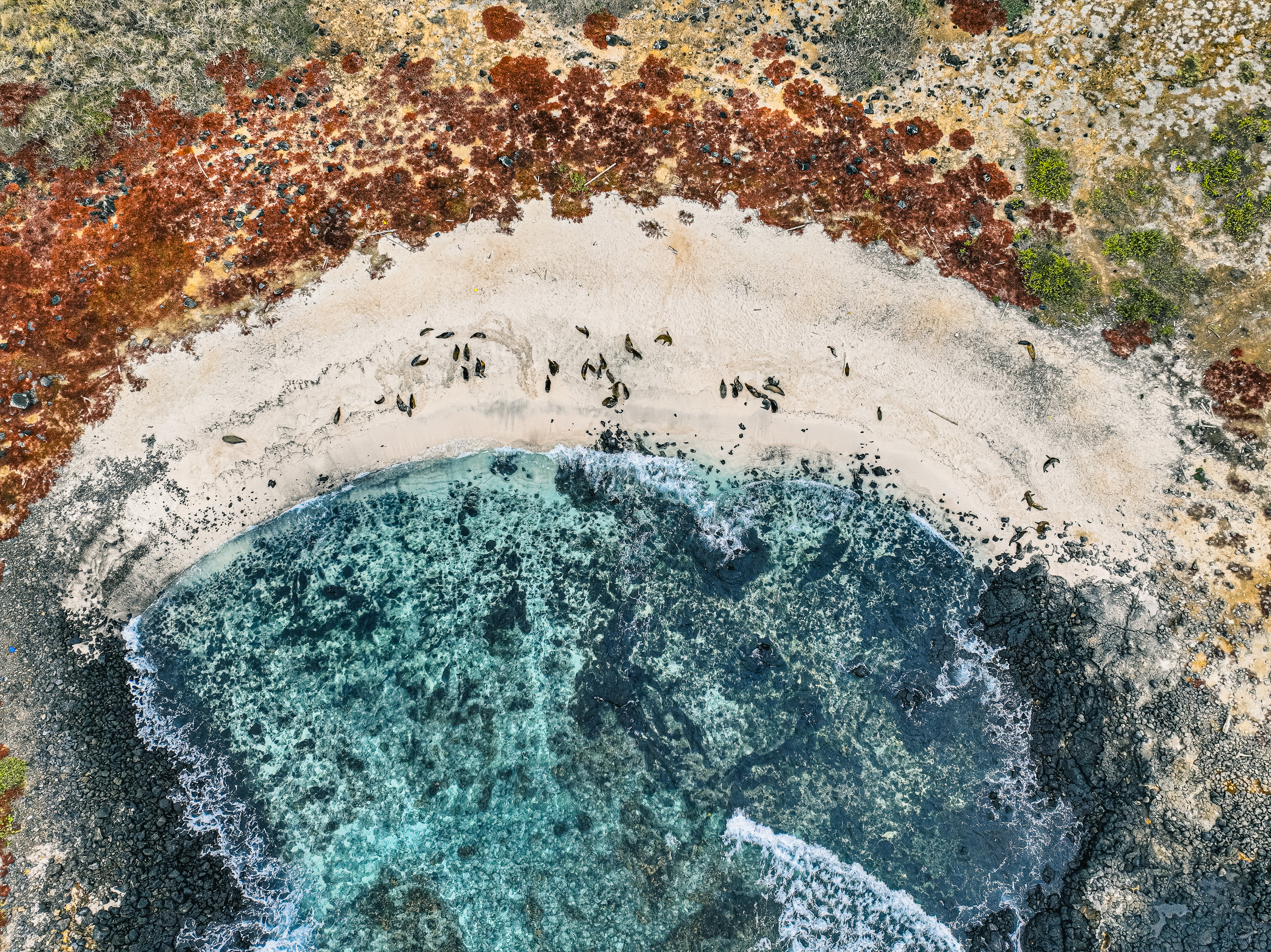
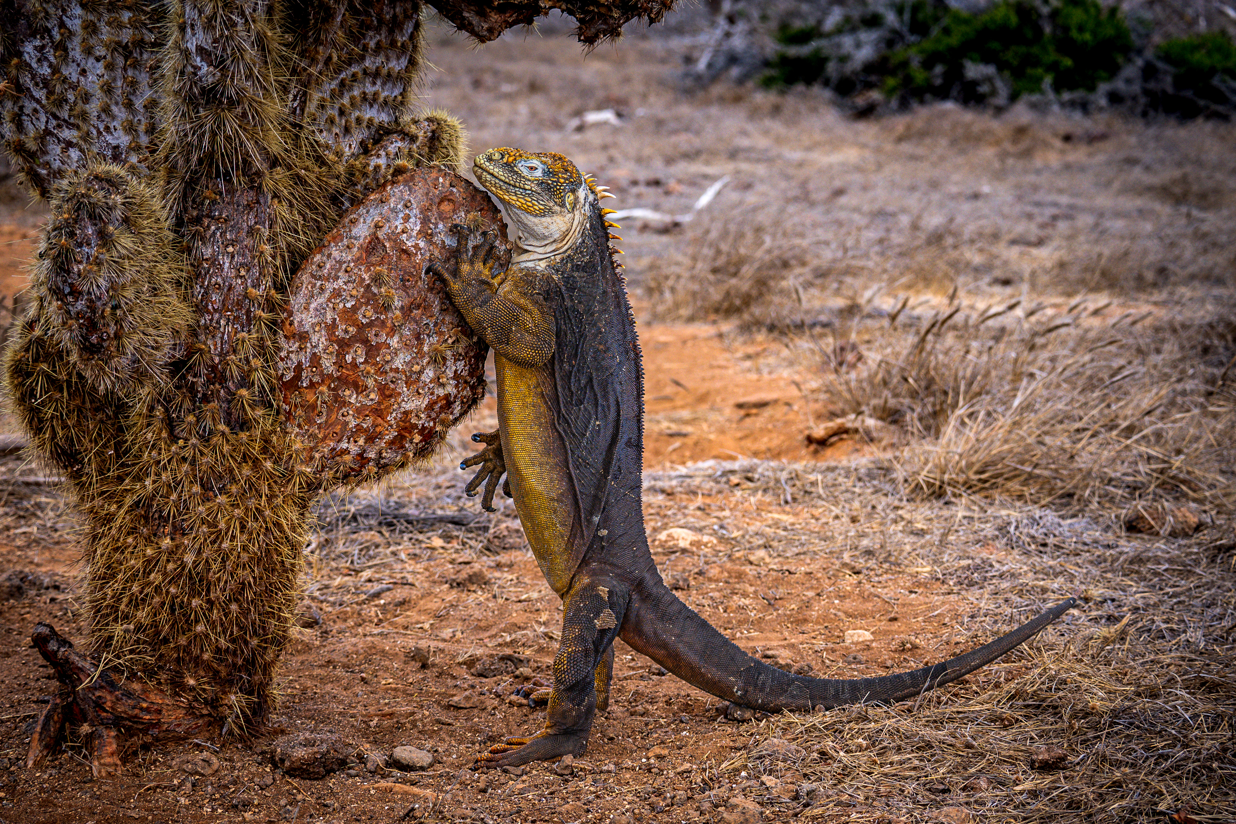
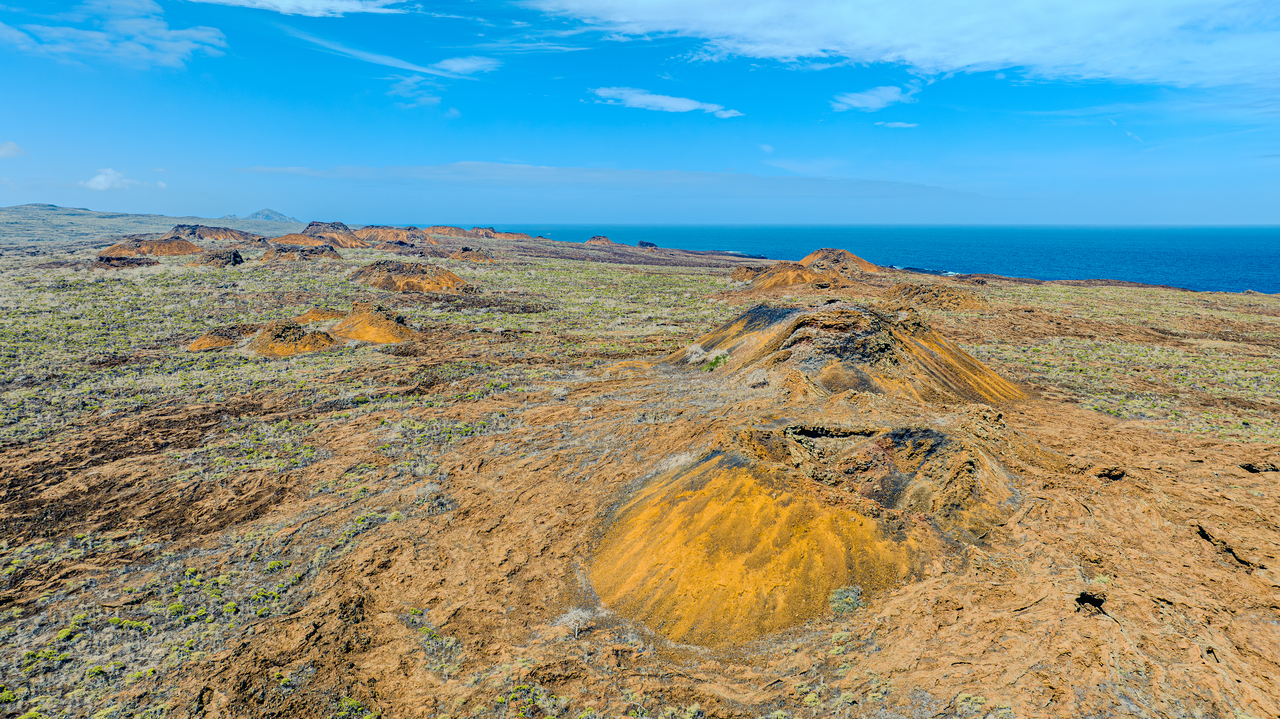
Situated off the coast of Ecuador, the Galápagos Islands are one of the world’s richest marine ecosystems. The Galápagos is host to a large number of endemic species and are the site that inspired Darwin’s theory of evolution. Often referred to as a living museum, it has a vast number of species that exist nowhere else, and many are threatened.
We spoke with Johannes Fernando Ramírez Kastdalen who is Head of Insular Control for the entire archipelago. Johannes, who has been with the Galapagos National Park since 2013, is currently using drone mapping to monitor the islands and protect the local ecosystems.
Who are you and what do you do?
We are the environmental authority responsible for the conservation and management of the Galapagos National Park and the Galapagos Marine Reserve. These are both UNESCO World Heritage sites. The institution has approximately 350 park rangers distributed across the four inhabited islands.
Our projects focus primarily on the conservation of island and marine ecosystems through biological monitoring and restoration projects.
How has drone mapping and PIX4D helped conservation in the Galápagos?
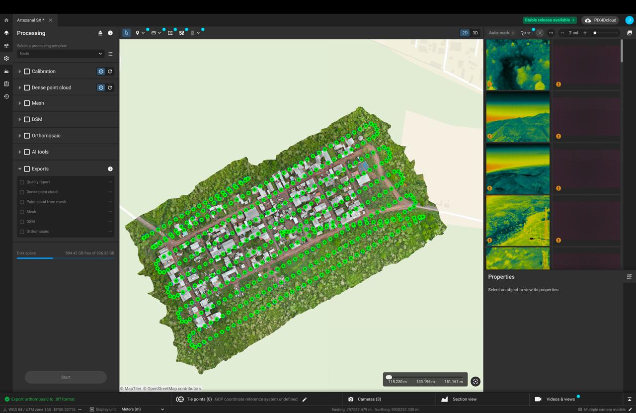
By monitoring the environment and surveilling for threats. With monitoring, we collect high-resolution data via orthophomosaics to track the health of flora and fauna. This allows us to count nests and fledglings, identify plastic pollution or invasive species, and evaluate seasonal changes in wildlife colonies.
With surveillance, we focus on detecting immediate threats. We use geospatial surveys to identify land-use violations and illegal encroachment, providing the data necessary for legal and administrative action.
For both projects, tools like PIX4D are essential because they allow for the fast and efficient processing of high-resolution orthomosaics. This facilitates immediate response and improves the ability to react to conflicts or urgent environmental situations.
What are the main challenges you face?
The primary hurdle is a lack of institutional awareness regarding the ROI of geospatial technology. Many decision-makers view high-end software and hardware as "too expensive." There is still limited knowledge about the operational value of drones and specialized software like PIX4D for generating accurate, fast, and reliable geospatial information.
My goal is to demonstrate their enormous value within the Galápagos conservation community and to ensure their integration as a fundamental part of the Park's technical and operational management.
Why did you choose PIX4D?
I've tried various alternatives, but they're complex and impractical for daily operations. That's why I found PIX4D to be the ideal tool: easy to use, with excellent processing quality and highly accurate results.
At least five other major platforms for drone image processing were considered and tested. Each offered certain results, but they presented limitations in terms of ease of use, processing speed, compatibility, or final quality. PIX4D was ultimately chosen because it offers an extremely user-friendly interface, processes information quickly, generates high-precision products, and integrates seamlessly with both Mac and Windows systems, facilitating operational work in the Galápagos .
“What I value most about PIX4D is its intuitive interface and the speed with which it processes massive datasets without sacrificing quality. Its ability to generate sharp, high-precision orthomosaics has been a game-changer for our monitoring and enforcement efforts. It is an indispensable tool for modern environmental conservation.” Johannes Fernando Ramírez Kastdalen, Head of Insular Control, Galápagos National Park Directorate
These characteristics make it the most effective and practical tool for generating professional-quality orthomosaics for monitoring and control projects.
Project details
| Location | Galápagos National Park, The Galápagos Islands, Ecuador |
| User | Galapagos National Park Directorate |
| Project area | Several sites, depending on the conflicts presented, but an approximate 1500ha |
| Software used | PIX4Dmatic |
| Hardware used | Mavic 3 E |
| Images captured | More than 20,000 |
| Number of images in dataset | More than 1,000 |
| Processing time | Several days |
What has been the impact of this project?
- Habitat protection: We used precise visual evidence of sensitive habitats to deny development requests that would have harmed fragile coastal ecosystems.
- Invasive species control: We documented the damage caused by feral goats in visiting sites, providing the technical justification for successful culling interventions.
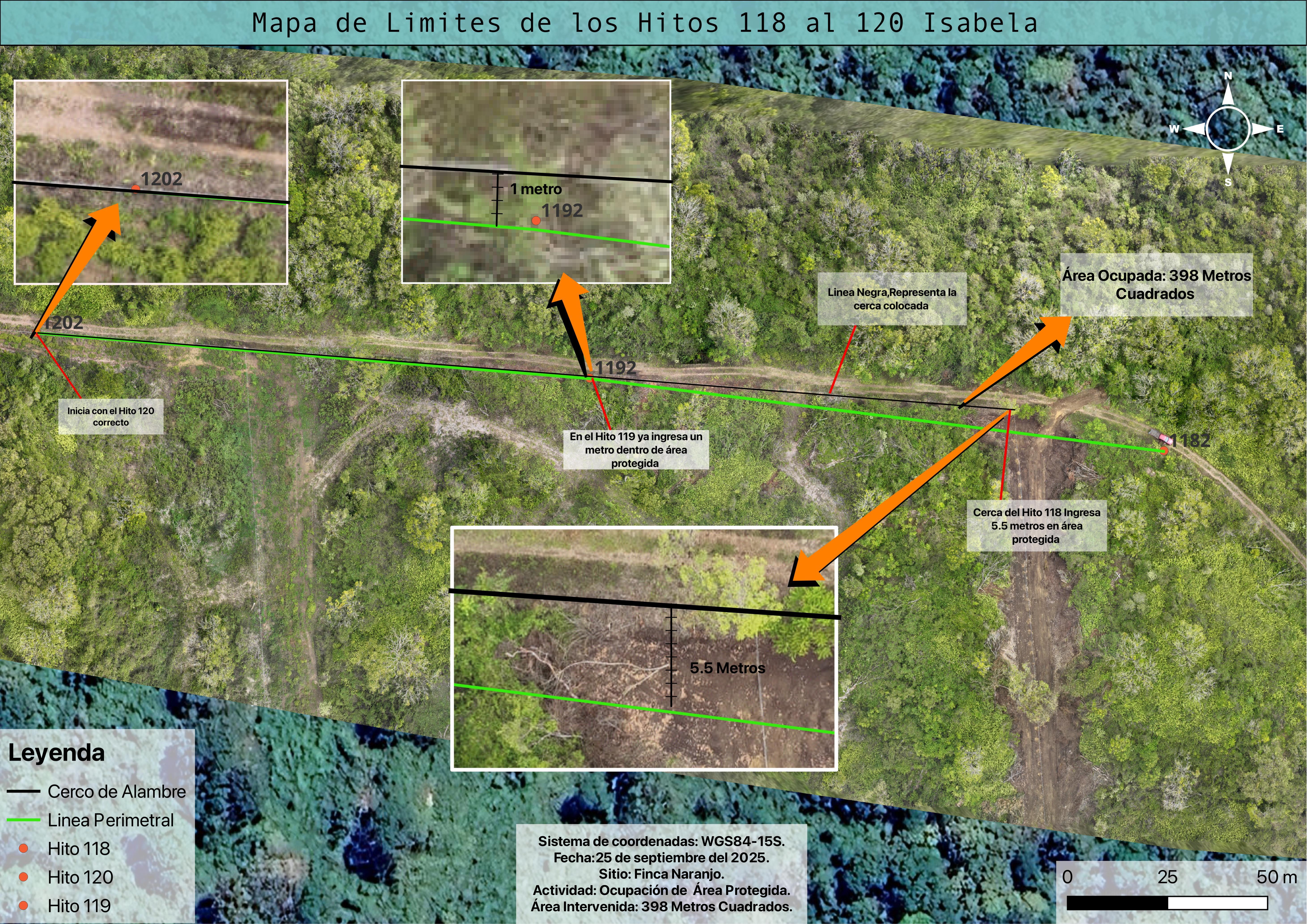
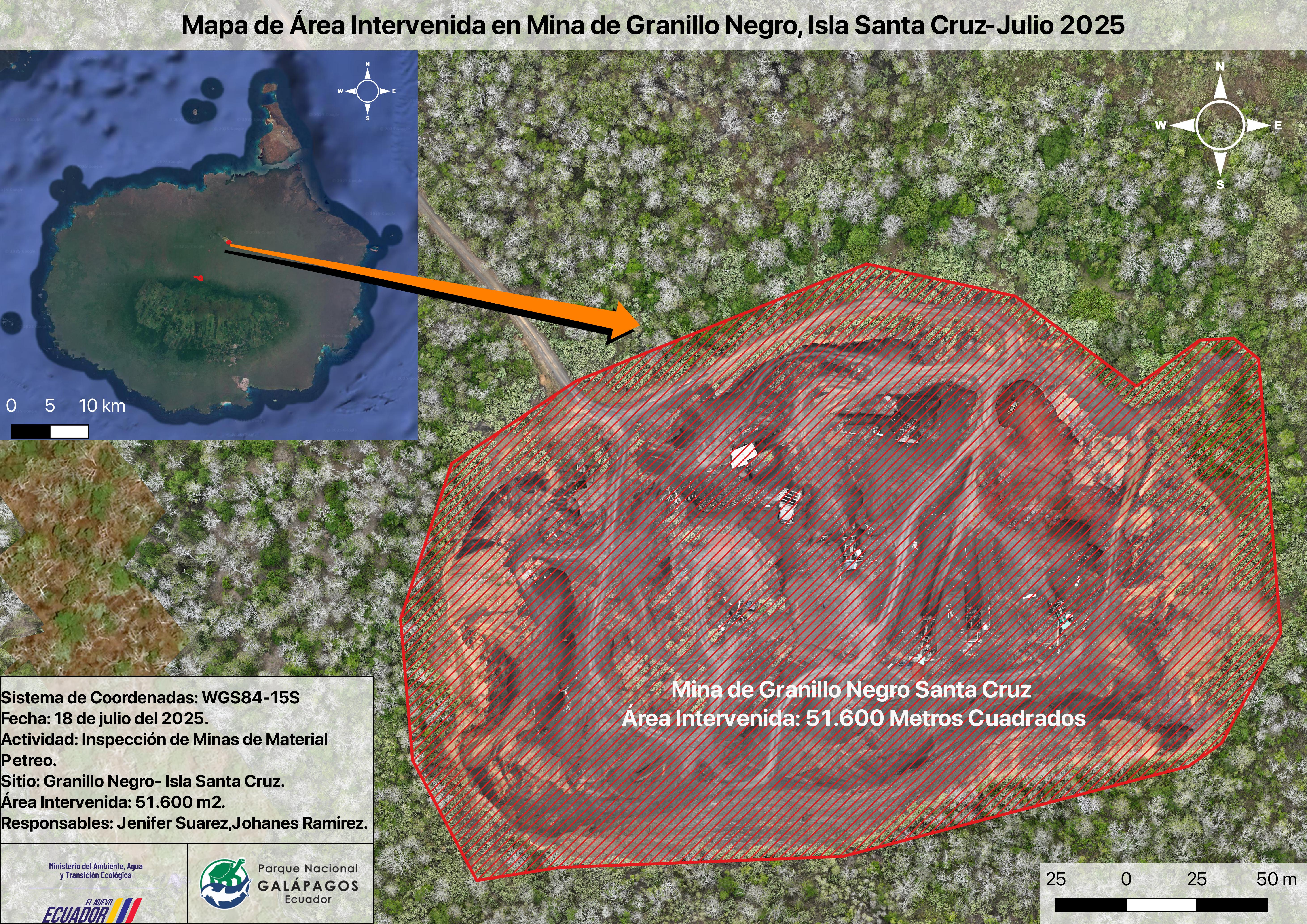
- Legal action: We identified illegal sewage discharge points in Puerto Baquerizo Moreno and mapped illegal stone mines. These maps served as critical technical evidence in court, leading to the closure of several illegal operations.
“Overall, the orthomosaics generated by PIX4D has raised the standard of analysis and technical support within the Park, becoming a reliable tool to demonstrate impacts, support management actions and more effectively protect the Galápagos ecosystems.” Johannes Fernando Ramírez Kastdalen, Head of Insular Control, Galápagos National Park Directorate
Due to the precision, clarity, and technical validity of these products, orthomosaics have become an essential tool not only for environmental management but also for justifying decisions and presenting evidence in administrative and judicial cases.