As-built trench survey with PIX4D & the Topcon CR-H1
INSERT SCHEMA MARK UP
Traditional as-built trench surveys rely on single-point data collection using total stations or GNSS receivers; despite their accuracy, these methods have notable limitations. They are time-consuming, require you to physically reach every feature you want to measure, and only capture specific points instead of the whole area.
The limits of a traditional as-built trench survey
With the rapid adoption of BIM and digital construction, modern engineers and site investors expect complete, error-free spatial datasets in the shortest time possible. We spoke with Tomasz Witkowski, Regional Sales Manager at TPI, a leading surveying solutions company, about using reality capture to overcome the limits of traditional surveying.
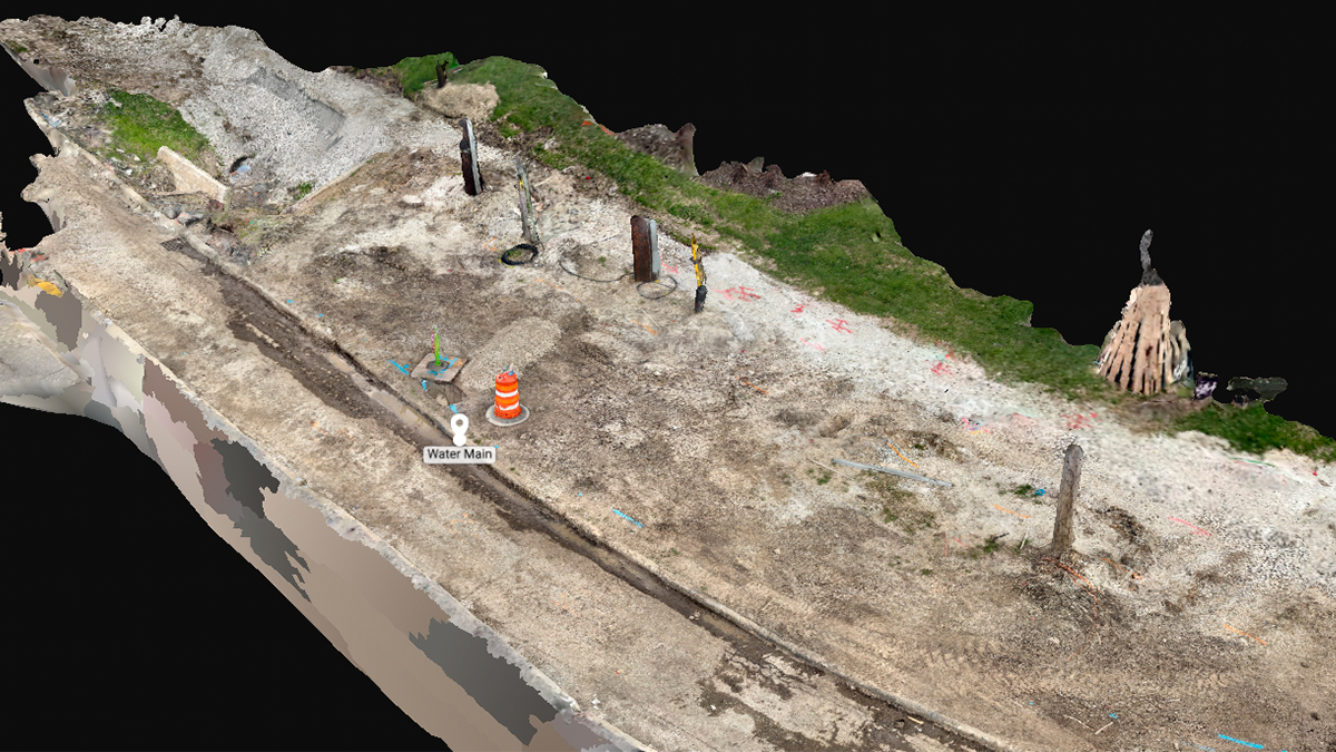
TPI uses reality capture app PIX4Dcatch backed by high-precision RTK GNSS positioning, the Topcon CR-H1. Instead of recording isolated points, the field team captures the scene using PIX4Dcatch. They then use PIX4Dmatic then processes to automatically generate a complete, measurable 3D environment.
The challenge: mapping underground water and sewage infrastructure
To illustrate how mobile scanning with PIX4Dcatch and the Topcon CR-H1 optimizes as-built surveys, Tomasz walks us through one of the most demanding tasks in fieldwork: mapping underground water and sewage infrastructure before backfilling.
In this case study, the surveyor had only a brief window to capture data. A standard point-based survey would have taken several times longer and failed to capture the true spatial alignment and physical dimensions of the fittings.
Speeding up trench documentation
To execute high-speed, centimeter-accurate trench documentation, TPI deployed an integrated mobile scanning and desktop processing setup:
- Field capture: The Topcon CR-H1 system, combining mobile scanning with a high-precision RTK device for real-time RTK positioning.
- Data collection app:PIX4Dcatch, running directly on the mobile device to handle sensor fusion
- Processing: PIX4Dmatic is optimized for large datasets and fast field-to-CAD processing.
Workflow: documenting a trench with a mobile device
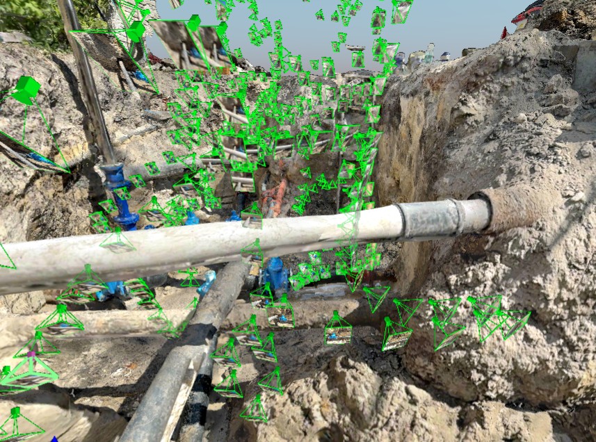
- Mobile data collection: Instead of single-point measurements, the operator simply walked along the trench with a smartphone, viewing the live trajectory in the app.
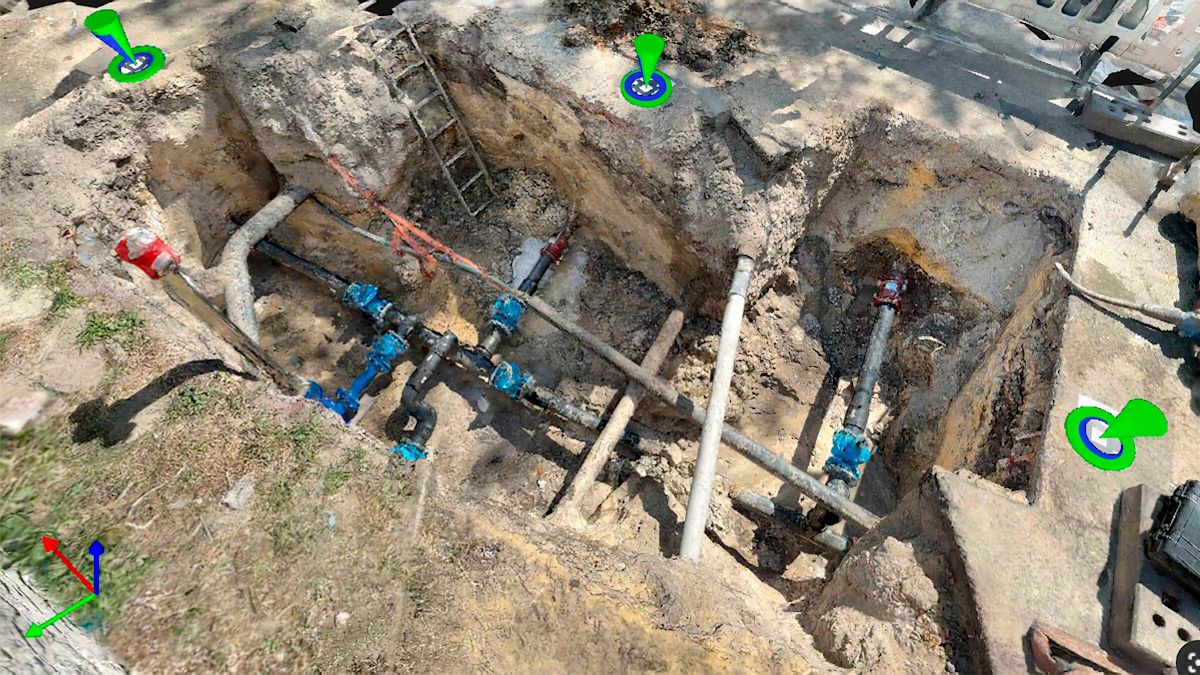
- Optimal geometry: Walking around the utility network from accessible angles (including under exposed pipes) ensured complete geometry coverage without entering hazardous zones. Green markers indicate the trajectory in the dataset visualizer.
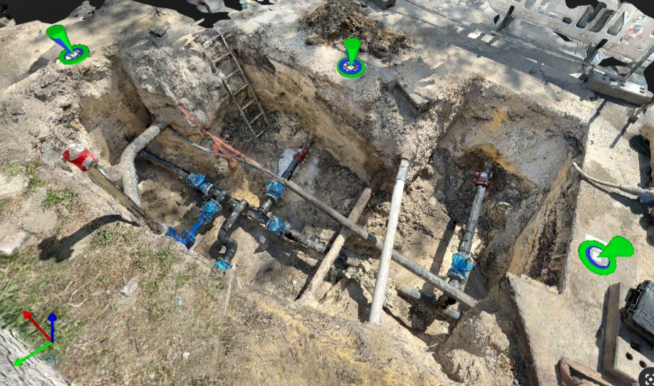
- Control & spatial accuracy: Three ground control points (GCPs) measured with the Topcon HiPer CR receiver ensured exact orientation in the project's coordinate reference system.
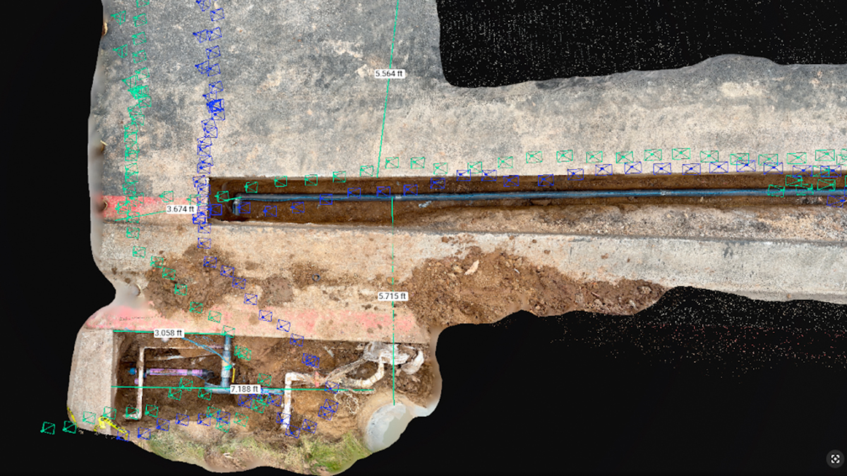
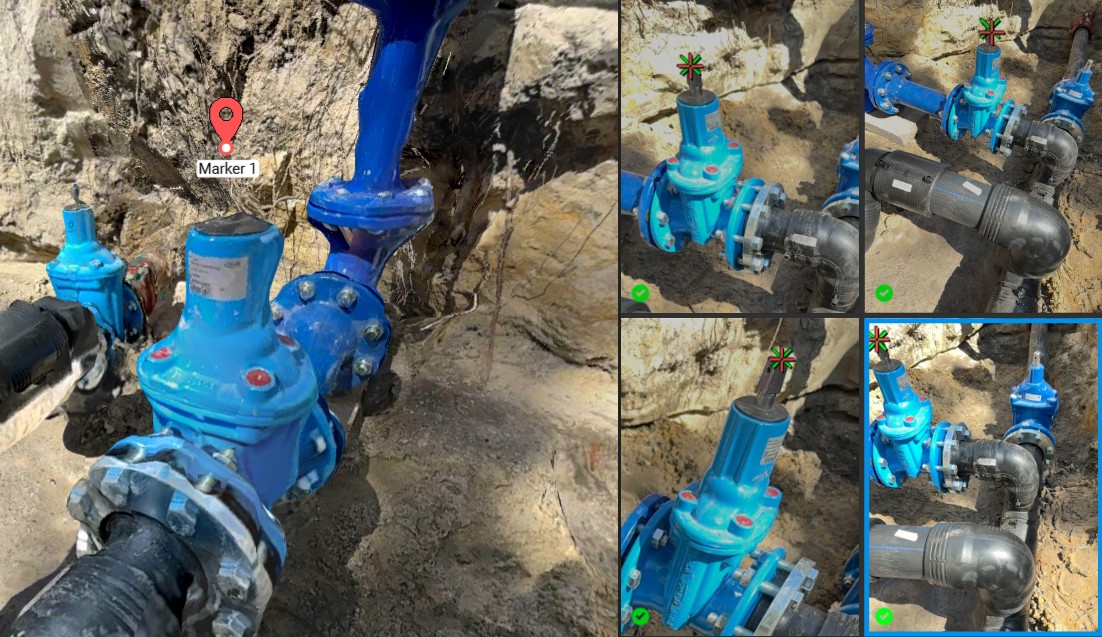
- Processing in PIX4Dmatic:Data was imported into PIX4Dmatic via simple drag-and-drop to generate a dense, geometrically accurate 3D point cloud and textured mesh. The software automatically identified and isolated specific features, terrain breaks, clear pipe outlines, and fine fitting details from the 3D data.
Results & key benefits
TPI achieved significant efficiency gains over traditional methods:
- Substantial time savings: Field scanning that previously took hours with a total station was completed in minutes. Office computation in PIX4Dmatic cut processing time nearly in half compared to standard photogrammetry tools.
- Zero omitted data: Rather than storing isolated coordinate points, the entire trench is saved to digital memory. Missing details (such as pipe diameters or coupling slopes) can be extracted from the point cloud anytime.
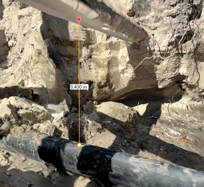
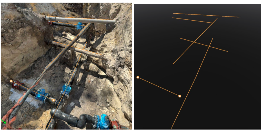
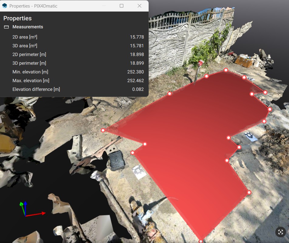
- In-software vectorization: Using PIX4Dmatic’s built-in tools, the team calculated trench surface areas, vectorized linear utility elements, and marked key structural points directly on fittings. The data can be exported to standard CAD/GIS formats.
- Enhanced field safety: High-precision data capture was completed entirely from the edge of the excavation, removing the need for field personnel to step into unsafe trenches.
From site documentation to long-term digital assets
Post-construction and emergency repair surveys are often impossible to repeat once buried. What used to be a static photo record or a sparse set of survey points is now a fully measurable 3D model ready for instant CAD drawing and long-term asset tracking.