Smartphone mapping vs. total station: report from a surveyor
What is the mapping accuracy of using a smartphone the PIX4Dcatch app, a LiDAR sensor, and an RTK device in comparison to a high accuracy surveying total station?
Rami Tamimi, a professional surveyor and geodetic engineer with over a decade of experience, answers this question in our article below. Rami tested the viability of using an iPhone as a mapping tool.
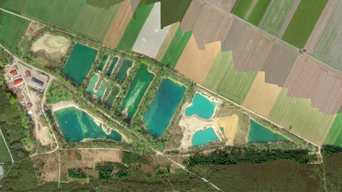
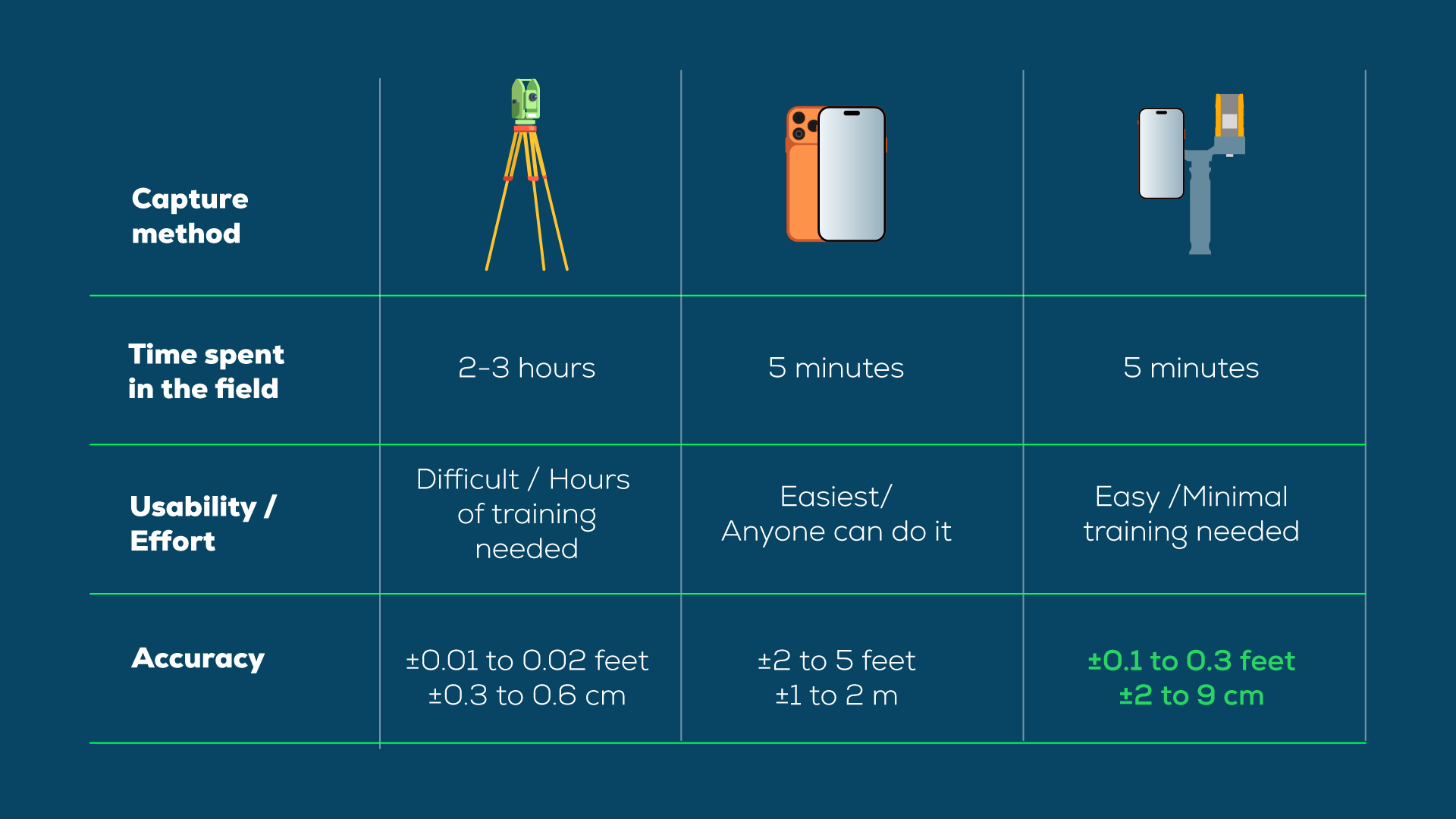
Rami’s comprehensive field study compares the traditional high-accuracy "gold standard", a Leica TS 16 robotic total station paired with a GS18 GNSS receiver, against the iPhone 17 Pro.
The experiment was structured in three parts:
- Capturing the site using a standalone iPhone 17 Pro scanning
- Establishing a "ground truth" benchmark using the professional Leica instrumentation.
- Capturing the site again using the iPhone integrated with a Bad Elf Flex Mini RTK receiver.
By overlaying these datasets in AutoCAD Civil 3D, the study reveals a significant shift in how topographic data can be collected, processed, and delivered with professional-grade accuracy.
Capturing survey-grade results with the iPhone 17 Pro LiDAR
A way to improve the accuracy of the iPhone 17 Pro is to introduce an RTK device, but how much does this device really improve the results? To find out, the study compared two distinct workflows:
Part 1:
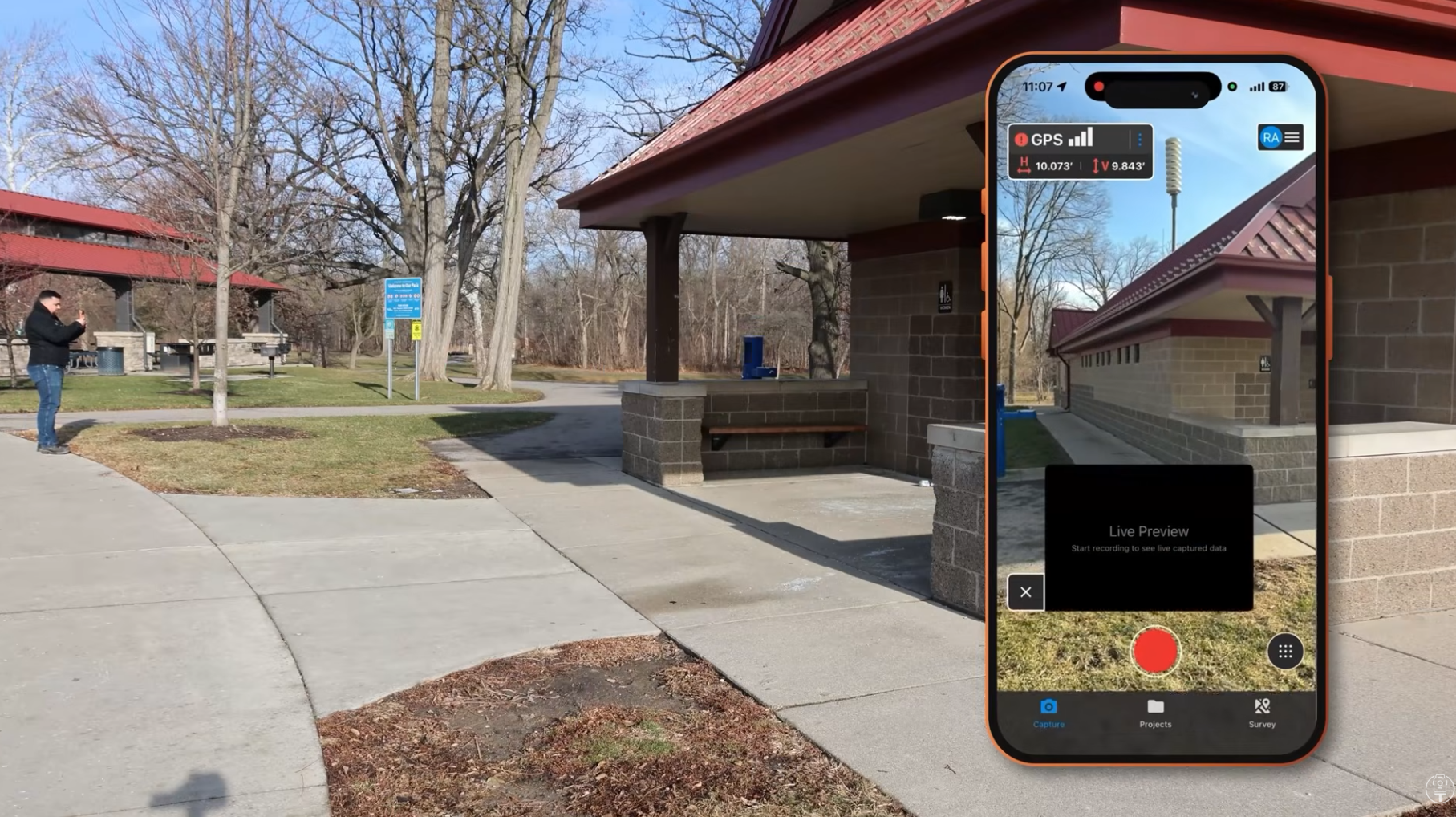
Rami first scanned the building with an iPhone standard internal GNSS: using only the iPhone’s internal GPS with no RTK receiver.
Part 2:
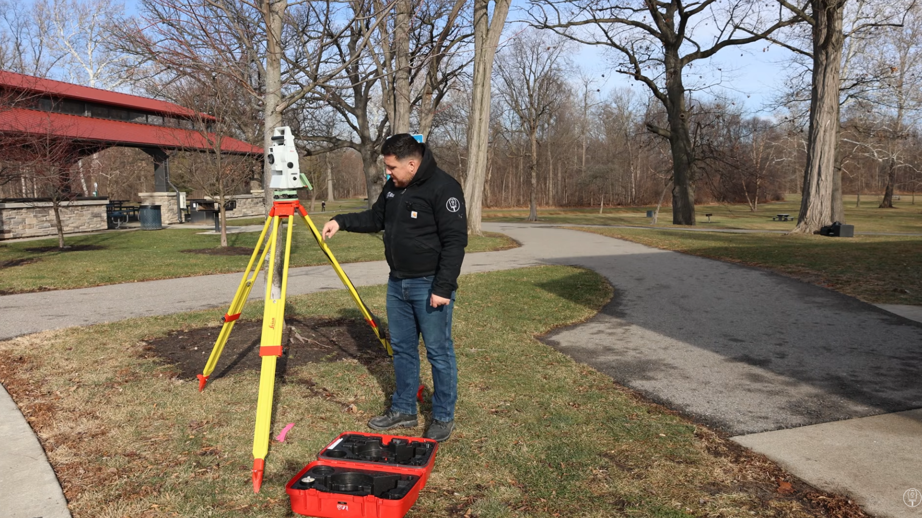
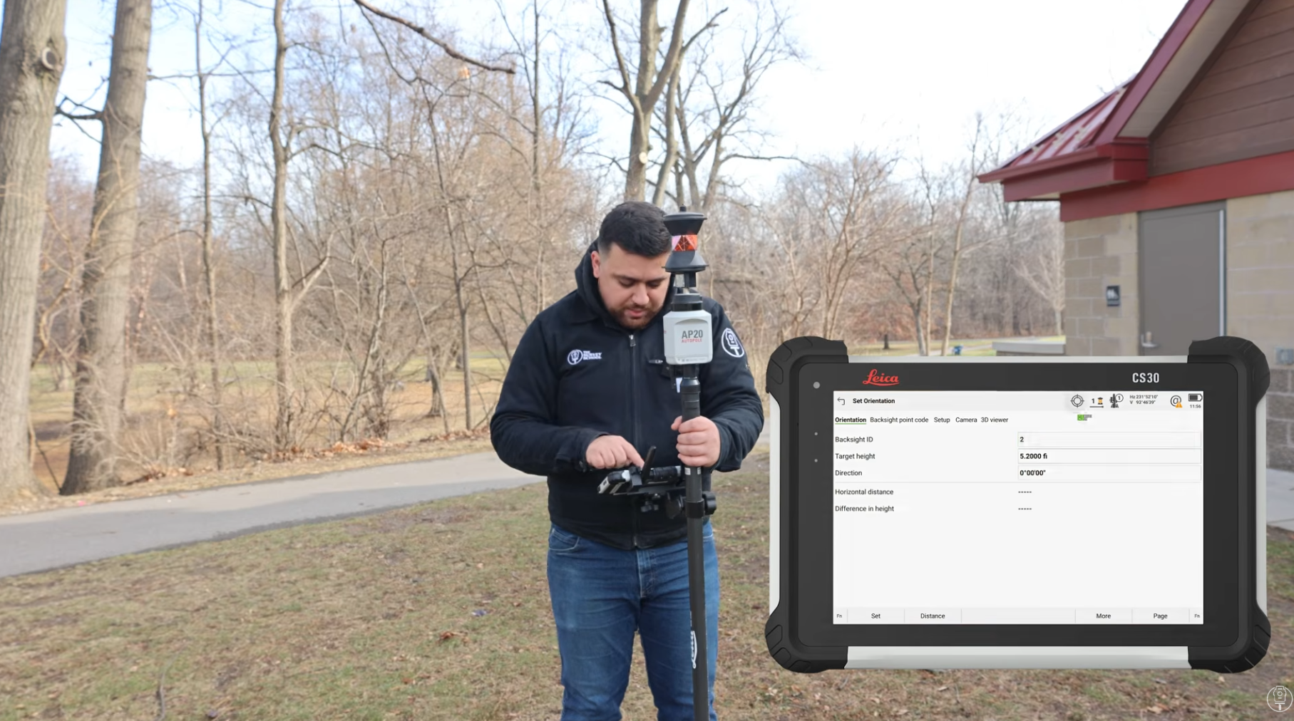
Establishing the 'ground truth' benchmark was done using the robotic total station and a prism pole. The robotic unit tracked Rami as he moved across the site, allowing him to precisely control when points were measured and recorded. This captured data set provided the baseline against which all other sensors were measured.
While the total station remains the bedrock of professional surveying, it is labor-intensive and costly. It took Rami 2-3 hours in the field to capture data using this traditional setup.
Part 3:
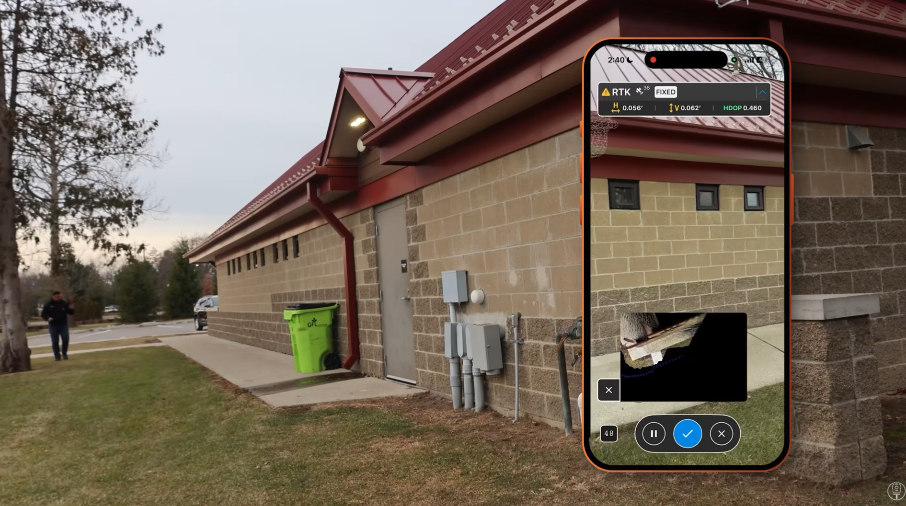
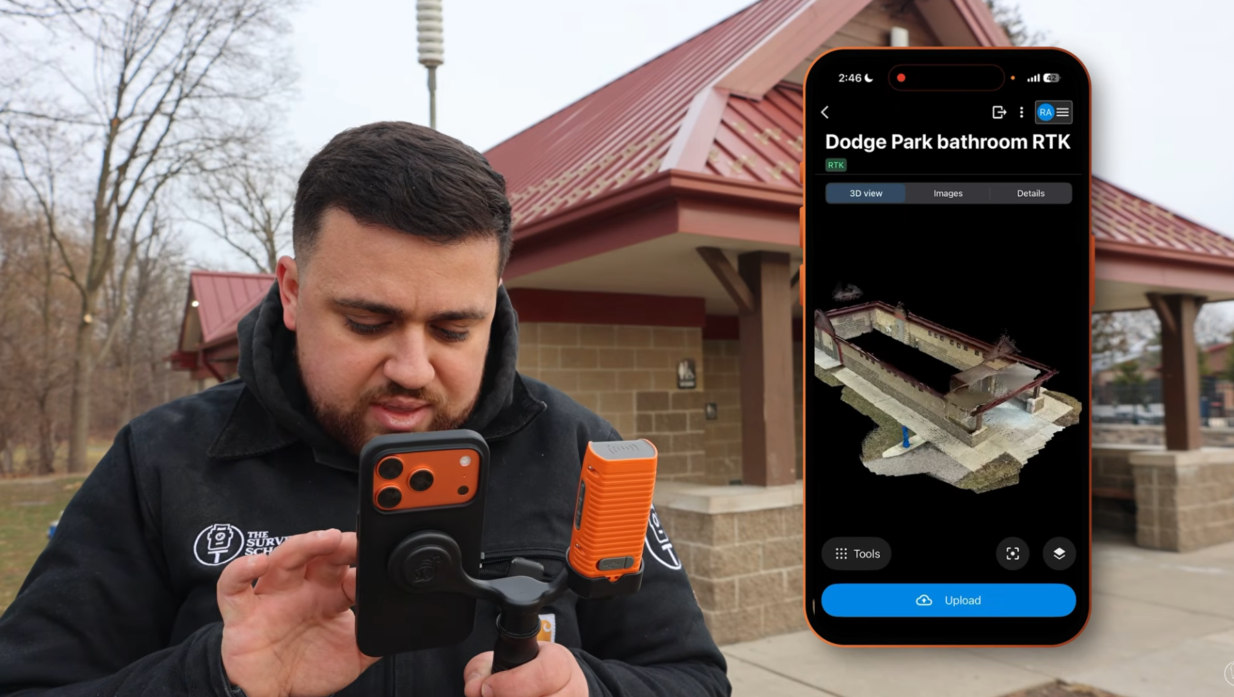
Finally, Rami scanned the building using the iPhone paired with the Bad Elf Flex Mini, enabling RTK positioning directly within PIX4Dcatch. This setup brings absolute accuracy into the workflow, allowing the scan to be reliably georeferenced, a key step toward replacing or complementing traditional surveying methods.
Processing the data
The next step was to process the data and then compare the results.
PIX4Dcloud: Rapid processing and instant sharing. PIX4Dcloud turns captures into a collaborative, accessible deliverable within minutes. PIX4Dmatic: Rami recommends PIX4Dmatic for this scenario, as it provides advanced editing over the dataset, enabling survey-grade outputs and deeper analysis tools.
Together, they support a complete workflow from quick insight to high-precision deliverables.
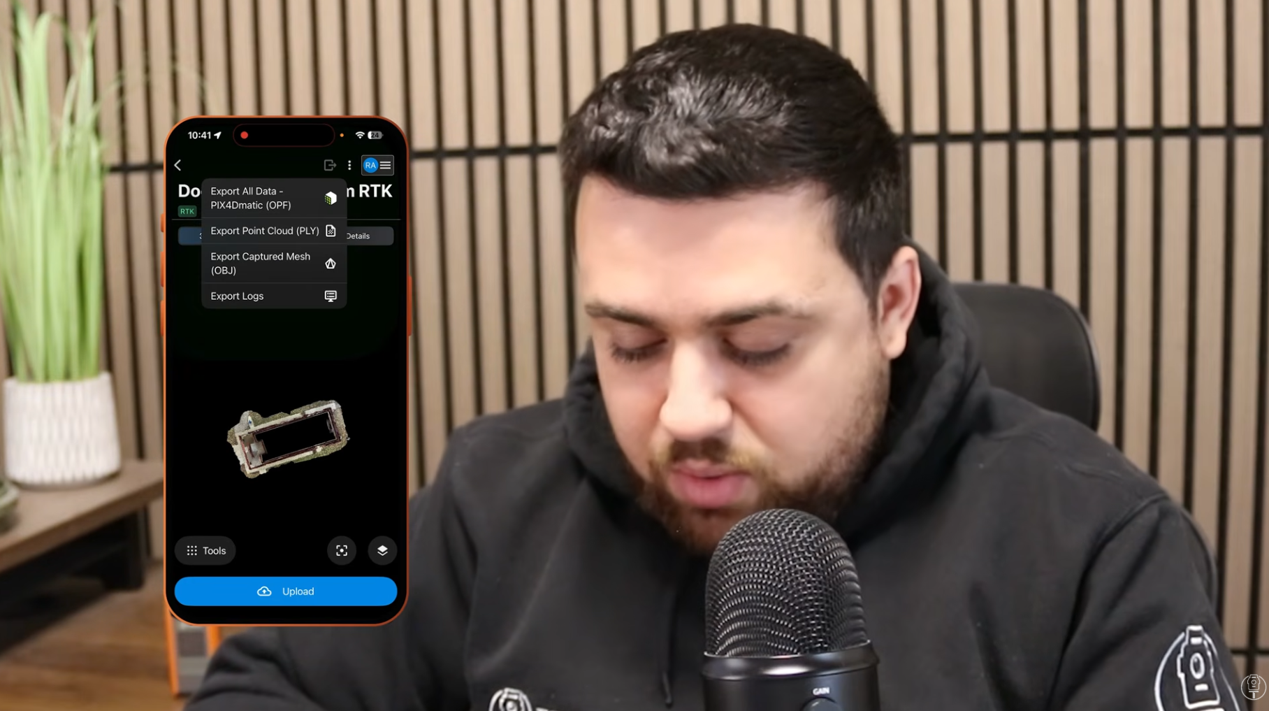
Rami processed the two different datasets (with and without RTK fix) and then exported them from PIX4Dmatic to AutoCAD Civil 3D to compare.
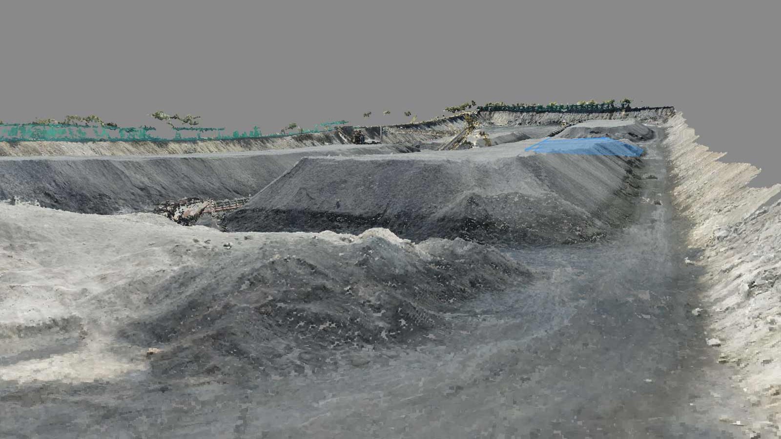
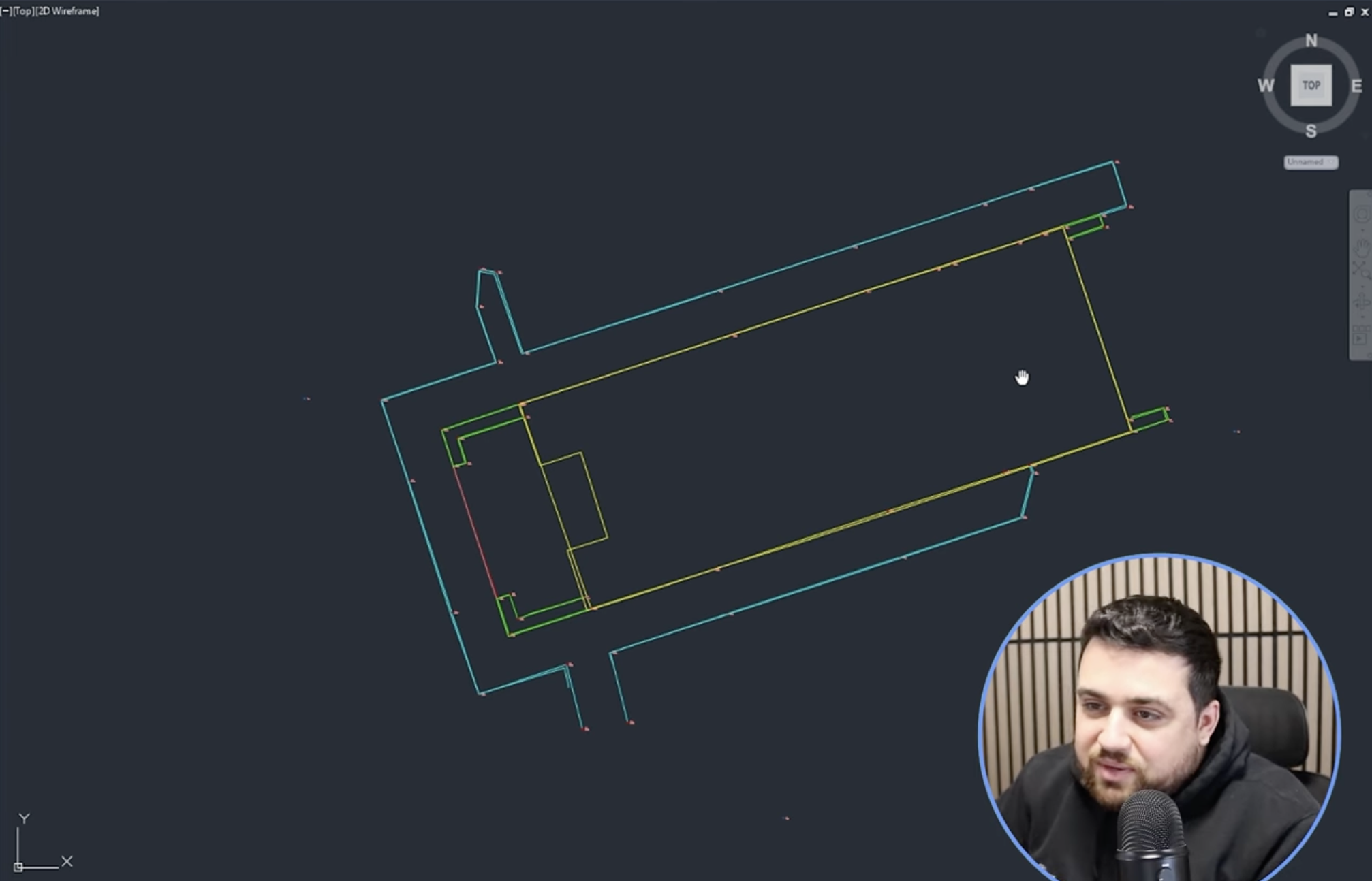
Tested assets in AutoCAD:
- Orthomosaic: 2D aerial perspective
- TIN model: surface model generated from DEM
- Actual features that were extracted
Quantitative results: side-by-side accuracy
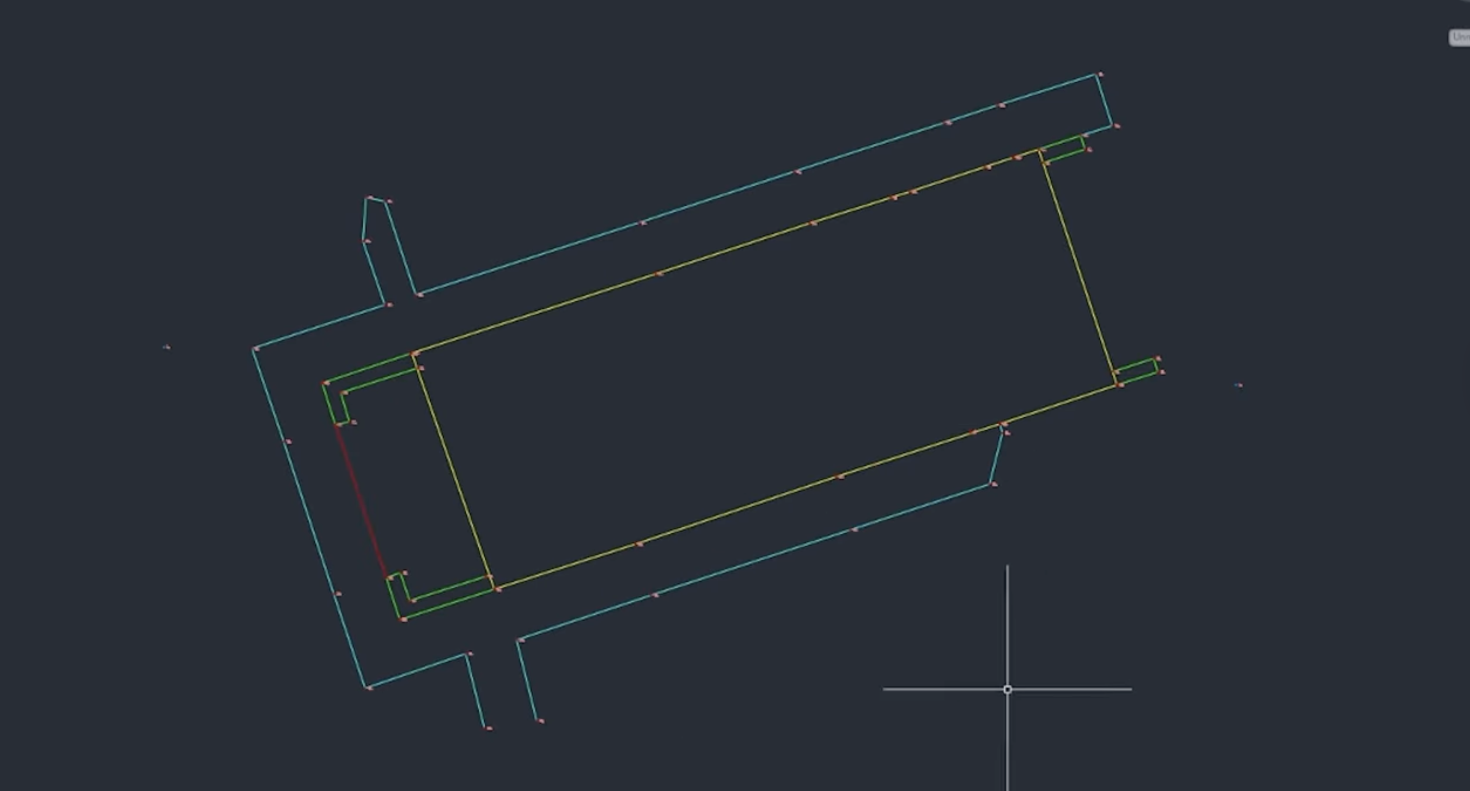
1. Orthomosaic
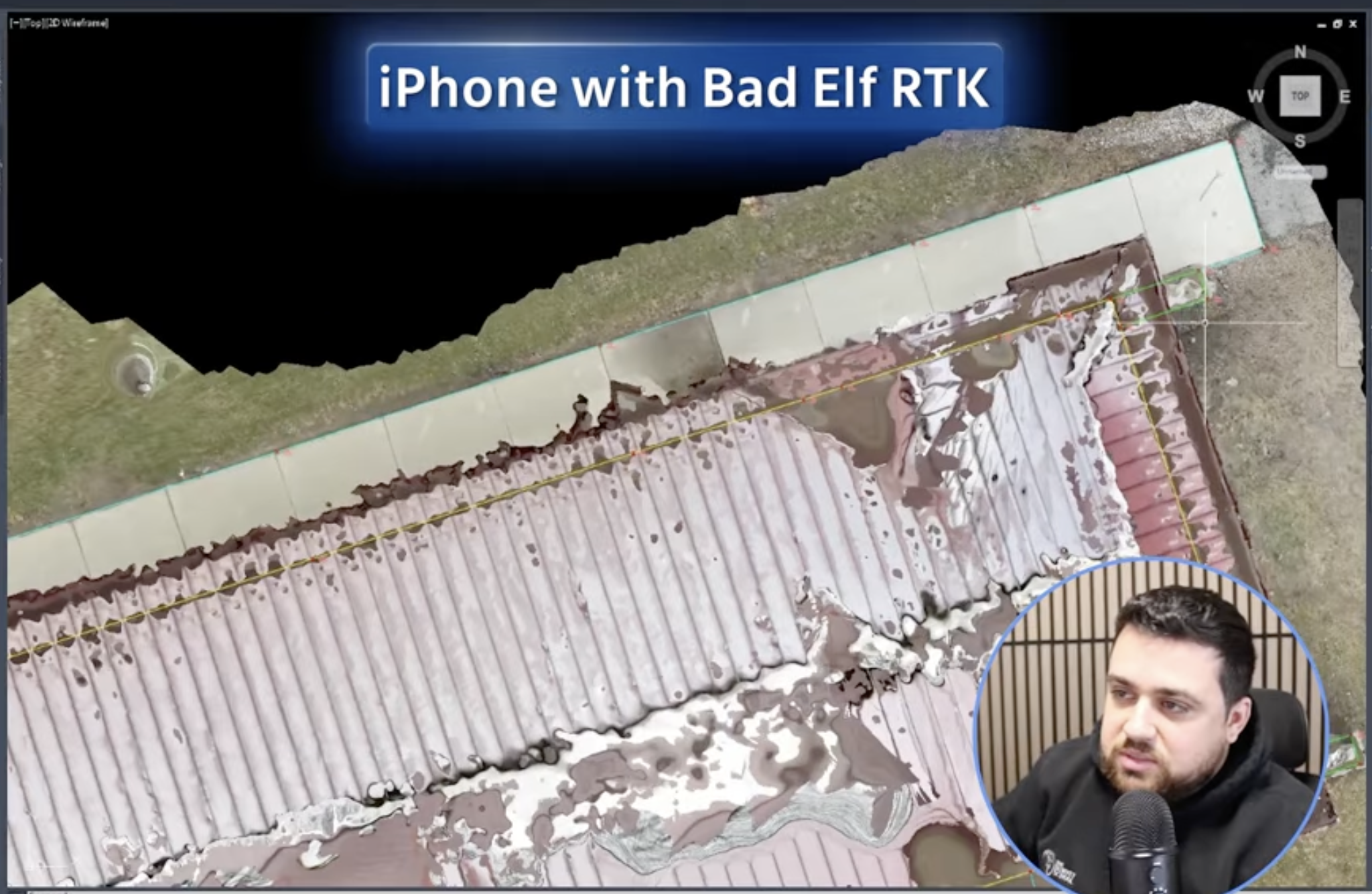
Result: TYou can see how closely the orthomosaic matches the line work of the total station along the sidewalk in the image above, while Rami says some users may not want to depend only on the orthomosaic; he found this result pretty accurate.
2. Surface model
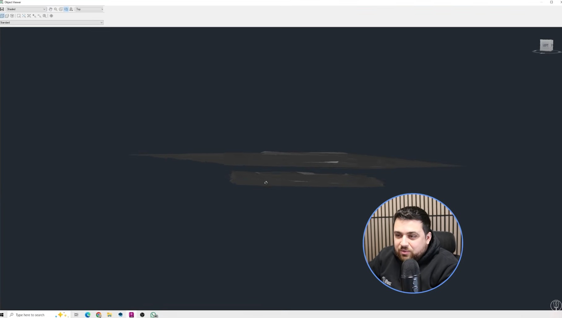
Result: While the RTK data aligns with the total station, the non-RTK model exhibits a vertical offset. Notably, this shift is uniform, demonstrating that the relative accuracy remains high within the surface model itself.
Although the absolute geographic position shifted roughly 2 meters from the coordinate reference system, the internal consistency is solid, which is an expected result for PIX4Dcatch when operating without an RTK fix.
Feature extractions:
1. No-RTK feature extractions: the ultimate test__
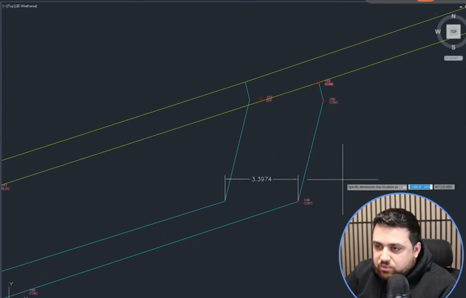
Result:
When using only a Single GNSS solution (a standard smartphone GPS without corrections), Rami found horizontal errors of 2.5 feet (76 cm) and elevation differences of 4.6 feet (140 cm). Rami noted that this 2-to-4-foot (60 cm - 120 cm) margin of error is typical for non-RTK setups, which is exactly why he used the RTK device.
2. RTK-fix feature extractions
The line work from the RTK device to the Total Station data matched almost perfectly. Walking through the digital model, Rami checked various points and found the variance stayed within a 2cm–9 cm range, and even below: "We are seeing a lot of 1.5 cm consistency, which is really nice to see," Rami remarked.
Final analysis:
Without RTK: the resulting 3D model suffered from significant "drift." With RTK: by mounting a Bad Elf Flex Mini to the device, the system received centimeter-level corrections.
The study concludes that using PIX4Dcatch on an iPhone 17 Pro with a rover like the Bad Elf Mini provides a viable alternative to a total station for topographic and utility mapping.
Thanks to Rami Tamimi for carrying out this test. The content of this article has been adapted from the video on Rami's youtube channel, where you can see the test in whole.