Drone mapping with PIX4Dmatic for a sustainable future
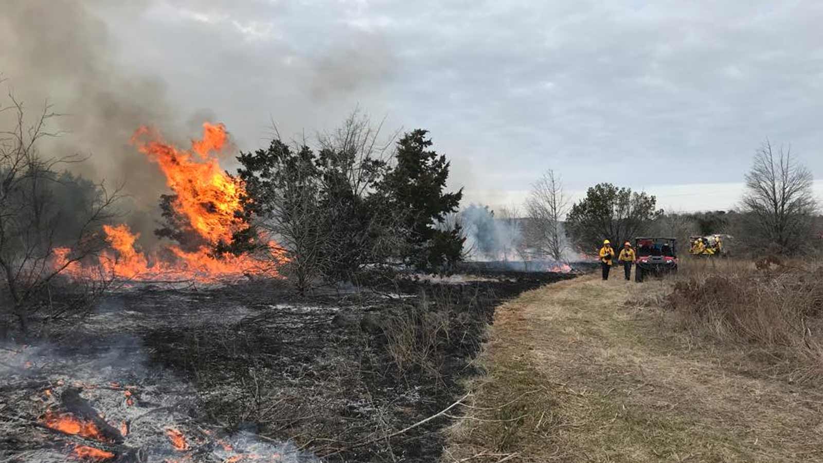
The Atlantic Forest in São Paulo stretches over roughly 3.46 million hectares—about 14% of the state's land. It includes the Great Atlantic Forest Reserve, the largest continuous forest in the biome, spanning 50 municipalities across São Paulo, Paraná, and Santa Catarina. Despite its immense ecological value, deforestation in São Paulo skyrocketed by 406% between 2019 and 2020, largely due to both regulated and unregulated real estate expansion and tourism.
The Atlantic Forest in São Paulo is under threat.
This rampant destruction puts immense pressure on this irreplaceable natural treasure. This remarkable ecosystem not only shelters countless unique species found nowhere else—it also plays a vital role in climate regulation, soil erosion control, and water quality maintenance.
Recognizing the urgency of this crisis, innovative solutions such as drone mapping and photogrammetry are emerging to help safeguard this ecosystem.
Drones for good
Brazil Flying Labs empowers communities through digital literacy, in order to boost quality of life, promote sustainability, and foster diversity and gender equality in tech. By using drones and orthomosaic maps, they are helping to preserve the Atlantic Forest—particularly in Águas da Billings State Park—supporting better management of this vital ecosystem.
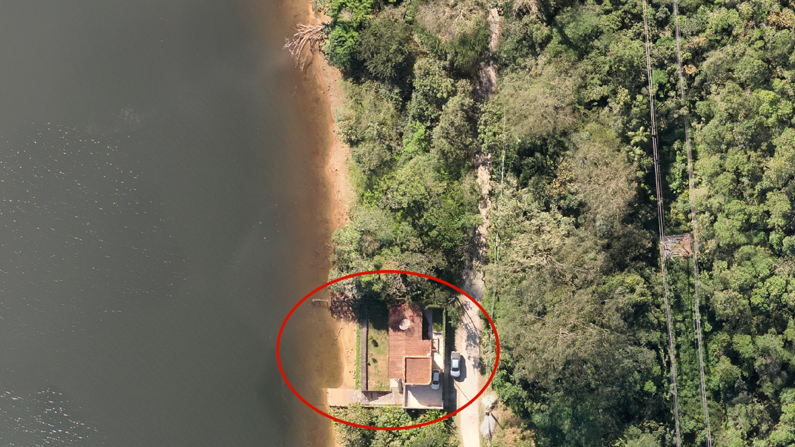
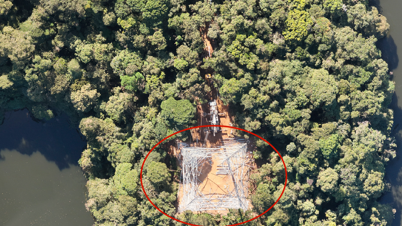
By capturing high-resolution aerial imagery, drones provide a bird's-eye view of the park, enabling park rangers to identify potential threats such as deforestation, poaching, or illegal construction. Orthomosaics, created from these images, offer a detailed and accurate representation of the park's terrain, aiding in long-term monitoring and change detection.
Flying Labs project objectives
- Generate actionable insights from photogrammetric products such as orthomosaics, digital surface models (DSM), and point clouds
- Raise community awareness about the importance of forest preservation and the transformative role of drone technology in conservation efforts
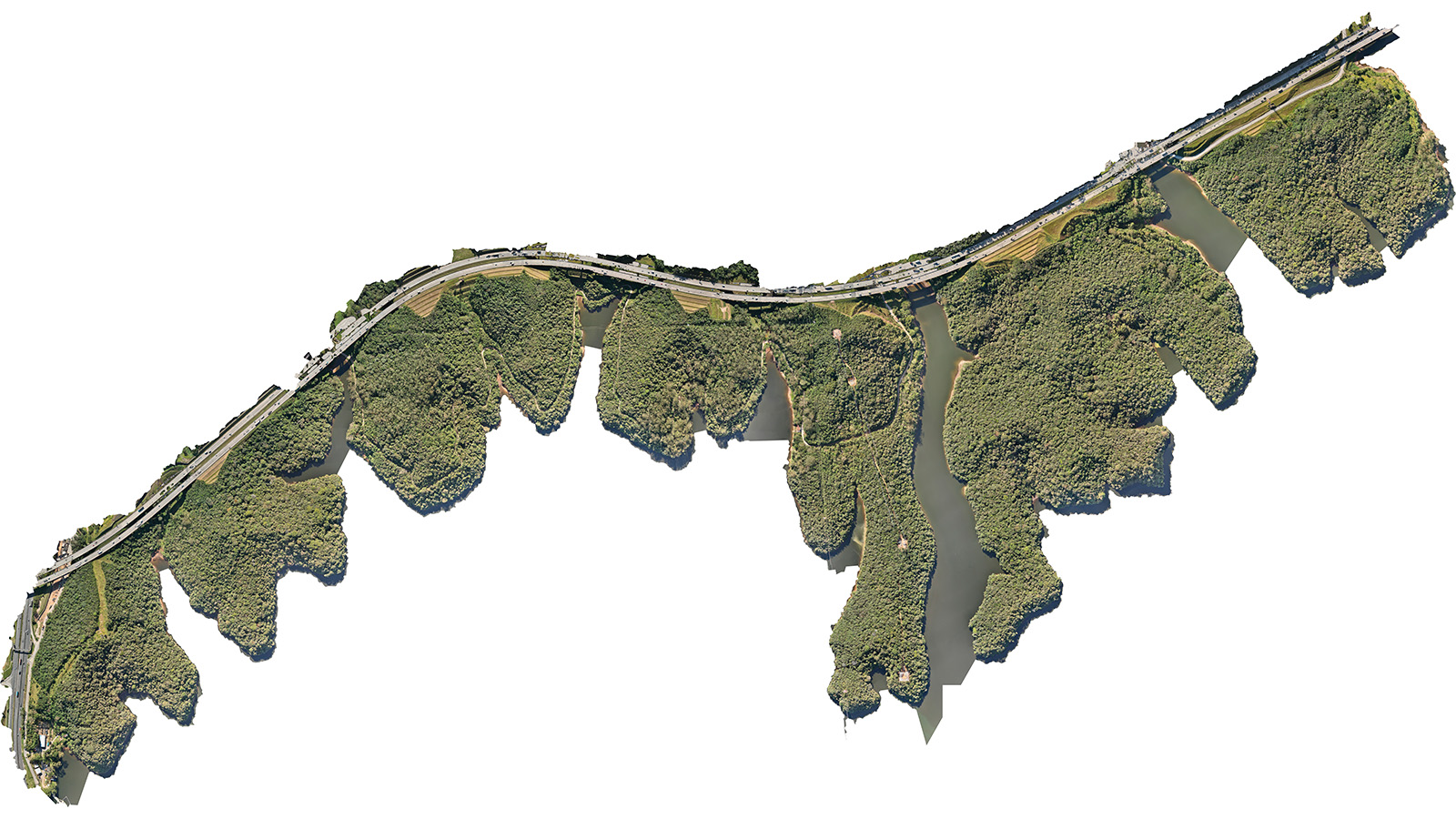
Creating high-precision orthomosaics and 3D models for conservation monitoring
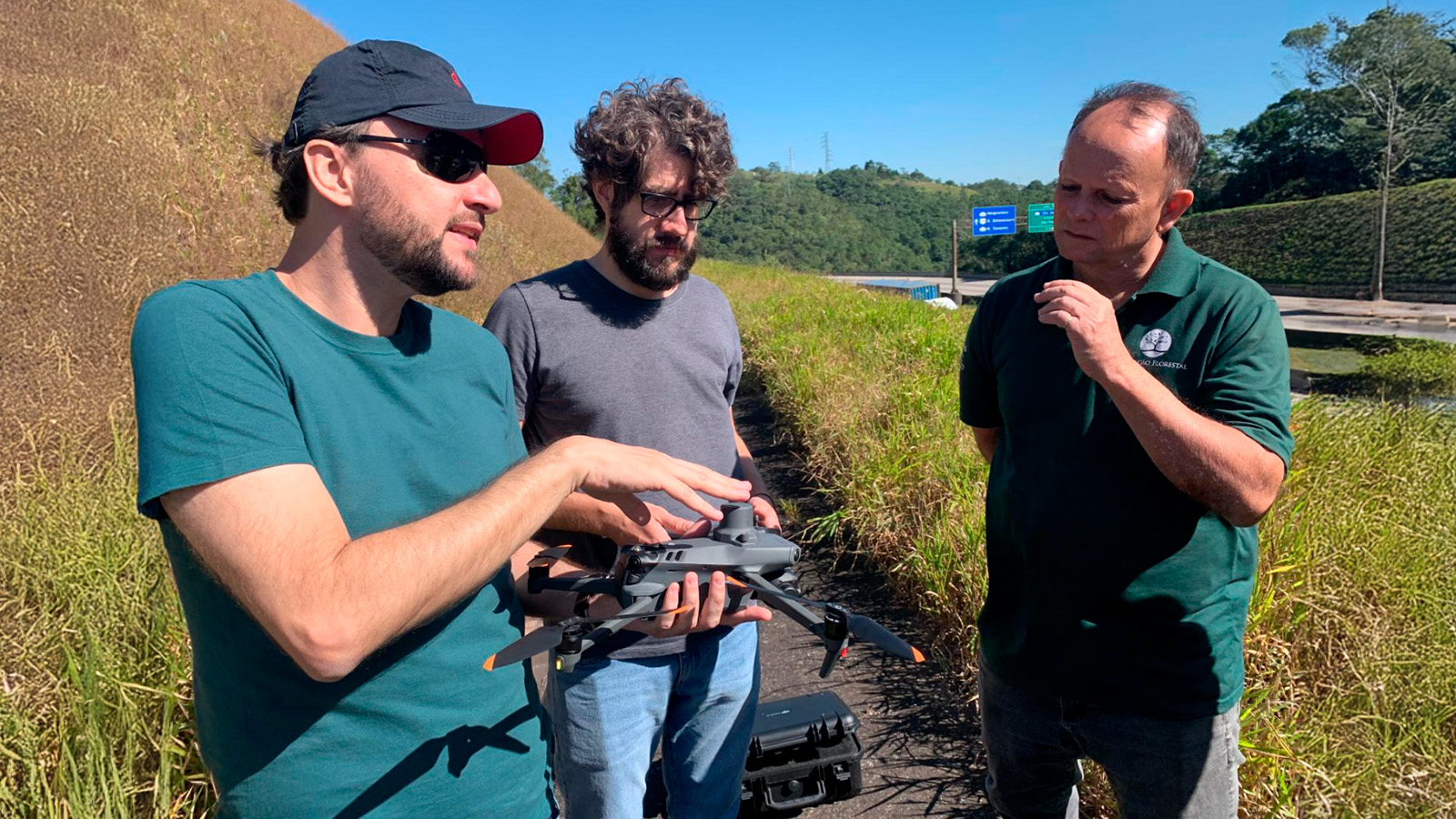
The Brazil Flying Labs team executed drone flights over 180 hectares of the Águas da Billings State Park, capturing more than 2,800 RGB images with a 4.7 x 4.7 cm per pixel resolution and 70% overlap. Flights were carefully planned over two days with a DJI Mavic 3T Enterprise, using only the RGB sensor for this project. Takeoffs were from the SP-021 highway (Rodoanel Mário Covas), which marks the park's boundary.
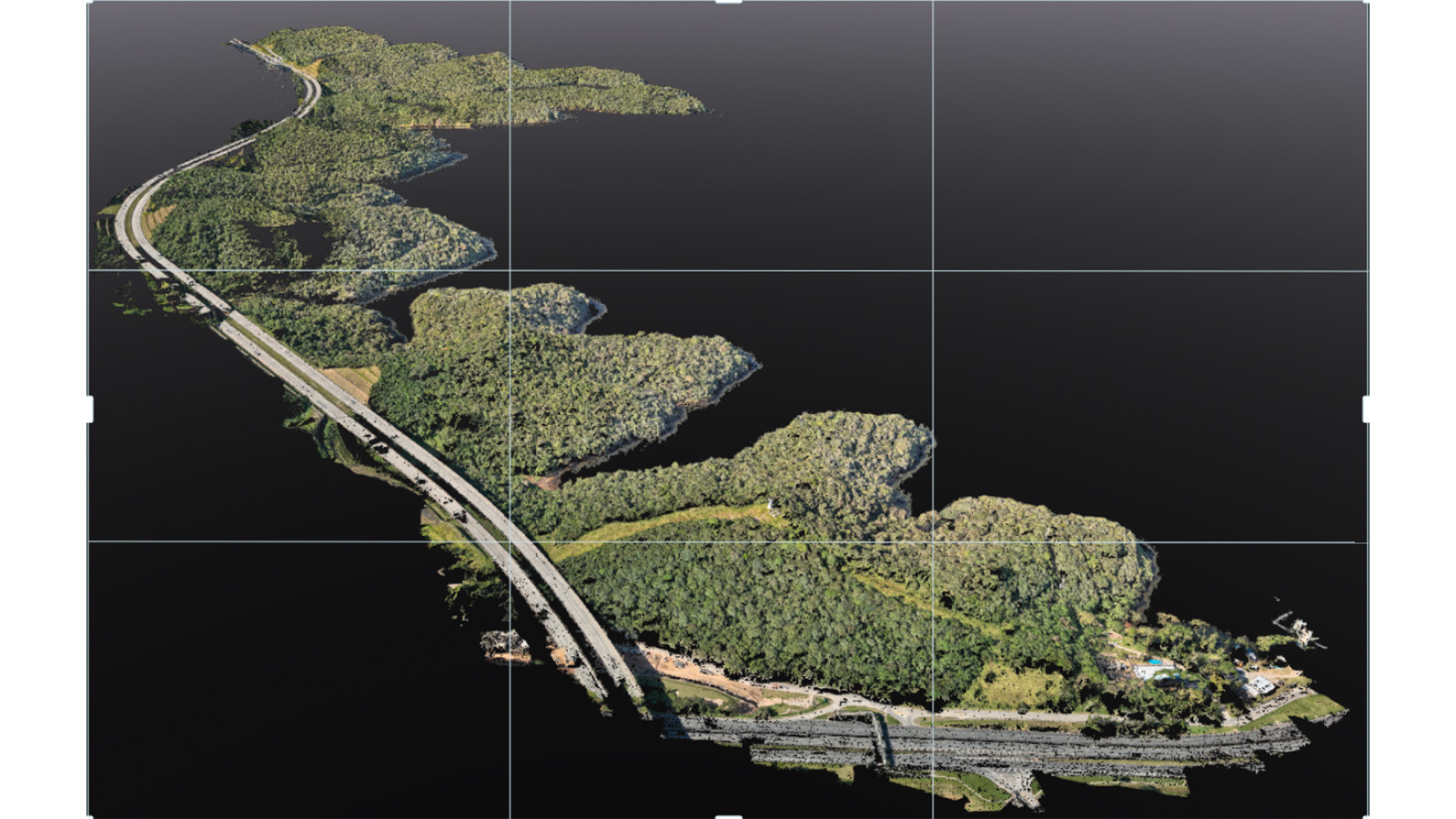
After processing the images in PIX4Dmatic, the team generated a high-precision orthomosaic covering the entire park, enabling detailed identification of structures and terrain features.
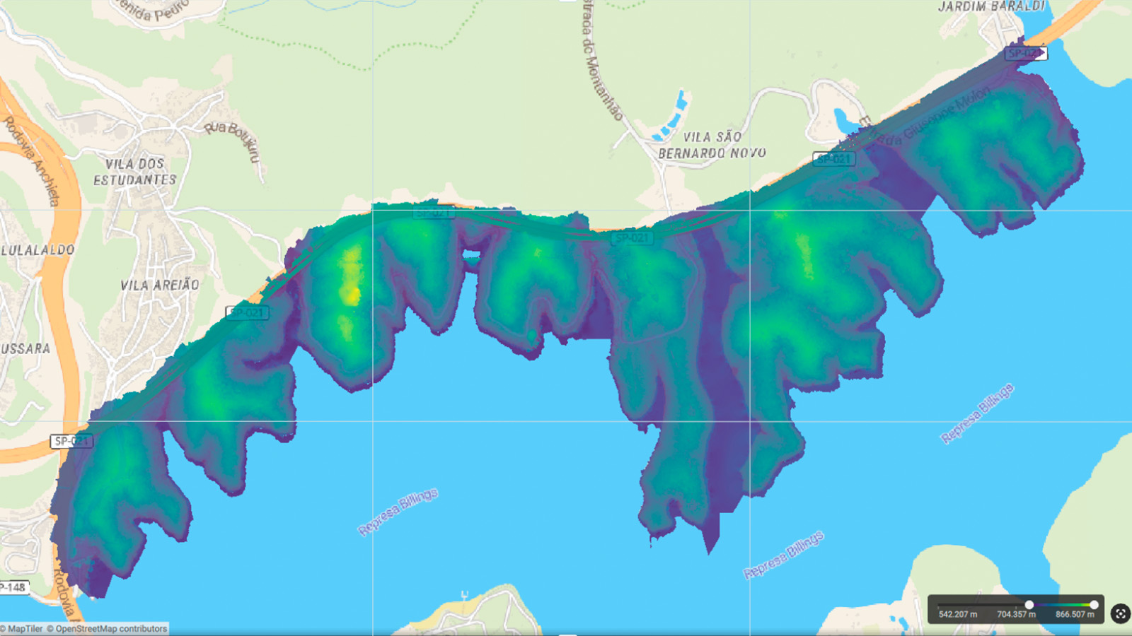
A Digital Surface Model (DSM) was created, revealing key elevation data—the highest point of the park reaching 861m a.s.l., while the lowest, at the dam’s water level, sits at 749m a.s.l. The resulting point cloud contained more than 1.8 billion geo-referenced points, providing an accurate 3D topographic survey to support conservation and monitoring efforts! The final report provided a clear summary of the processing time for each stage.
3D mapping to advance AI algorithms and machine learning
Currently, the team is conducting visual inspections using the orthomosaic to assess forest conditions. They are also working on training an AI algorithm to detect exotic species, an essential step in protecting native biodiversity. To support this, images are being tagged for machine learning development.
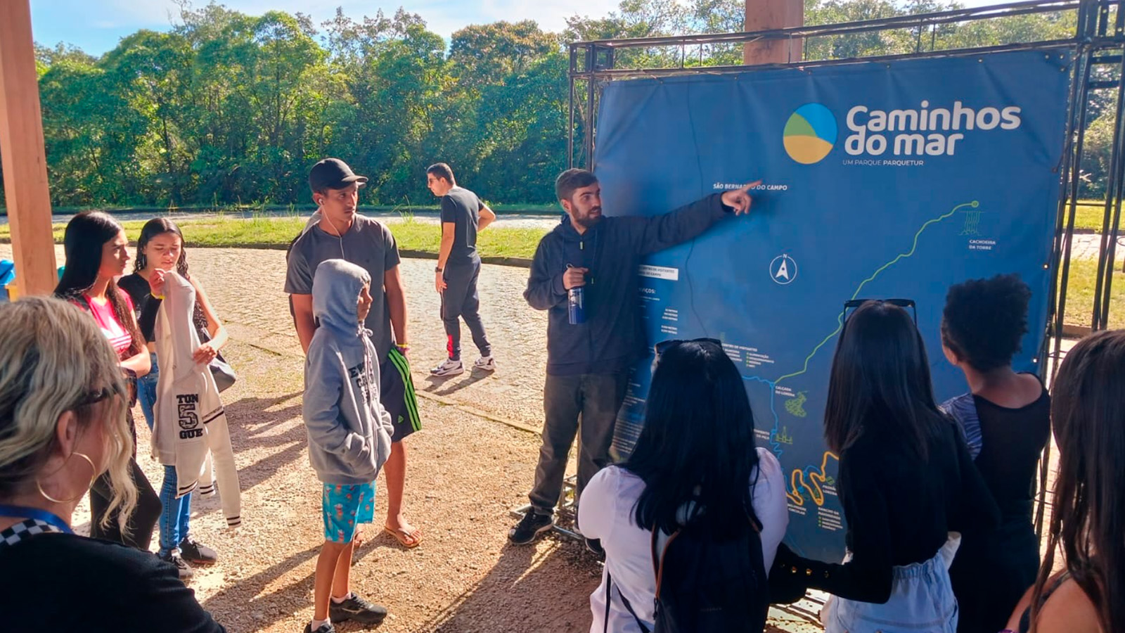
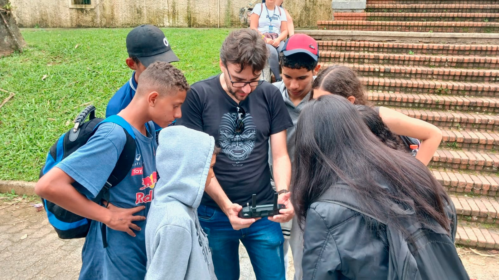
Beyond technical mapping, Flying Labs Brazil engaged with the community to raise awareness about conservation. A key initiative took place at Caminho do Mar, a conservation unit where over 30 high school students participated in a full-day event focused on environmental education and drone applications in conservation.
Efficient drone mapping with PIX4Dmatic
The software offered easy installation on both Mac and Windows, with automatic GPU detection across all platforms. Flying Labs Brazil found its user-friendly drag-and-drop interface and straightforward processing options streamlined the workflow. The team mapped an area of 187 hectares (1.87 km²), capturing 2,800 images over four flights in two days. They generated both the point cloud and the orthomosaic, and the final report provided a clear summary of the processing time for each stage.
Brazil Flying Labs’ “Fight for the Forest” project is a prime example of this innovative approach. The Atlantic Forest is essential—it regulates our climate, protects water sources, and preserves unique biodiversity. Drone mapping and data analytics transform conservation by providing information that empowers decision-makers to safeguard the forest.