Thermal inspection is now in PIX4Dmatic
PIX4Dmatic now supports thermal image processing, enabling inspection teams to transform radiometric datasets into measurable, georeferenced 2D and 3D thermal orthomosaics. Built to handle larger projects than legacy tools, PIX4Dmatic allows electrical utility, solar, and building diagnostic teams to preserve accurate temperature values, adjust fine-tuned parameters like emissivity, and visualize results alongside DSMs and DTMs.
Why thermal image processing matters for drone inspections
Across electrical utilities, solar energy, industrial facilities, and building diagnostics, temperature anomalies provide an early indication of equipment operating outside normal conditions, helping teams intervene before small issues become costly failures.
Thermal imagery helps inspection teams identify issues that conventional imagery cannot reveal, such as a loose electrical connection or a failing solar panel. Modern drones have made thermal cameras more accessible, but the challenge is turning hundreds or thousands of individual images into information that teams can locate, measure, inspect in context, and ultimately use to make decisions.
Thermal image processing in PIX4Dmatic
PIX4Dmatic transforms supported radiometric datasets into a single georeferenced thermal orthomosaic that preserves accurate temperature values across the entire asset. Unlike other solutions, PIX4Dmatic delivers actual temperature readings, allowing inspection teams to locate and analyze thermal anomalies within their real spatial context.
The same approach can extend beyond individual assets. Across larger areas, thermal orthomosaics can help reveal broader temperature patterns, such as urban heat islands, where understanding how heat is distributed across buildings, streets, and other surfaces requires processing and analyzing imagery at a much larger scale.
Fine-tune processing parameters
Users can fine-tune processing through parameters such as emissivity and ambient temperature, ensuring results better reflect real inspection conditions while remaining simple to generate within a single workflow.
Once generated, the thermal orthomosaic becomes part of a broader inspection environment. Orthomosaics, DSMs, and DTMs can now be visualized in 3D, helping teams understand results in relation to the shape and structure of the asset or surrounding terrain.
3D spatial visualization and hillshading
A new hillshading visualization mode provides an additional way to reveal surface patterns and interpret results, giving inspectors more spatial context when investigating areas of interest.
Post-analysis refinement and delivery
After the analysis is completed, teams can refine the final output without returning to processing. Generated orthomosaics, DSMs, and DTMs can be clipped to the region of interest, making it possible to adjust the area of the final deliverable without processing the project again.
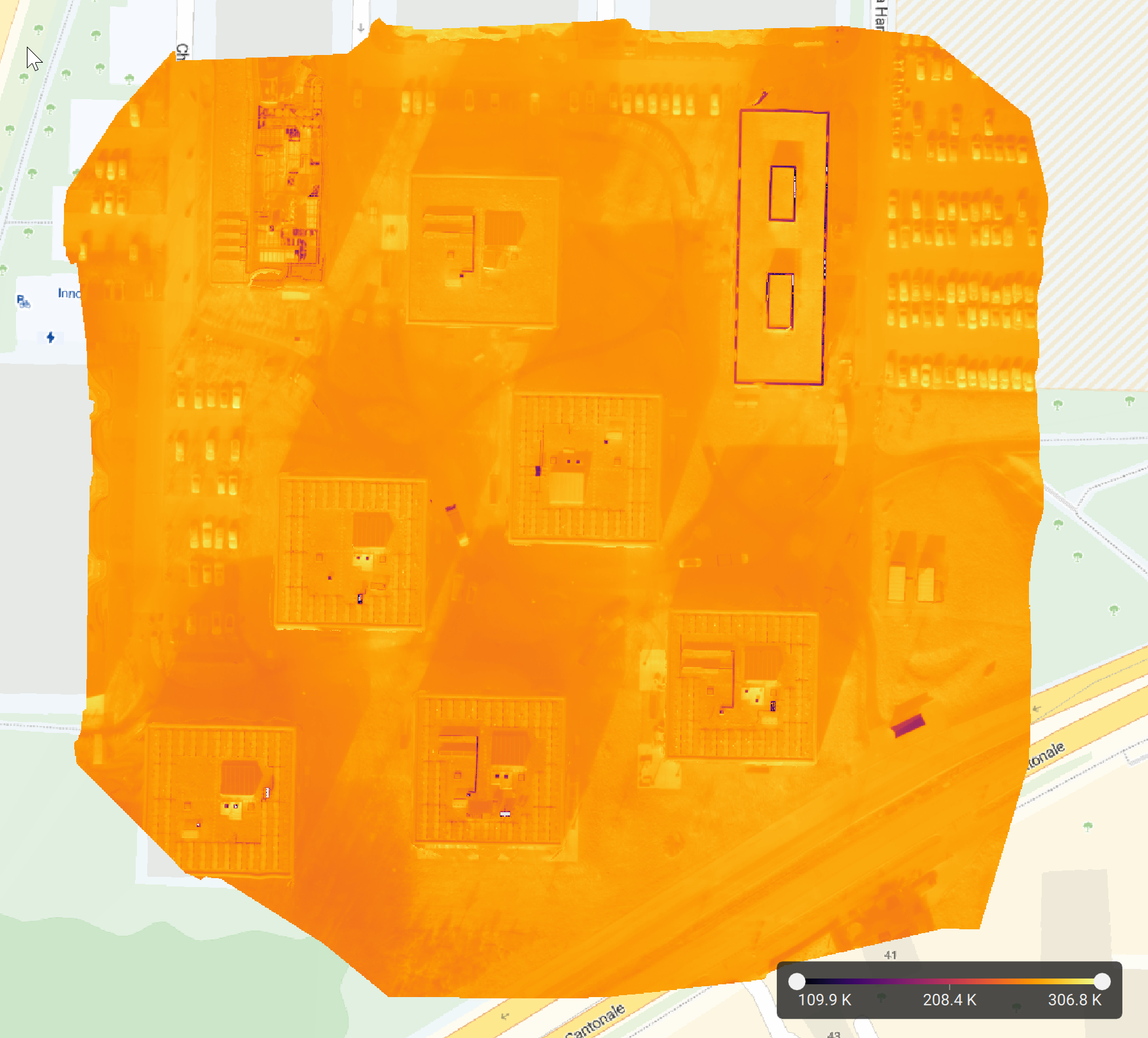
The result can then be shared with engineering and maintenance teams, compared with future inspections, and incorporated into the organization's long-term record of asset condition.
Building on PIX4Dmapper: the next generation of thermal processing in PIX4Dmatic
Bringing thermal processing to PIX4Dmatic means bringing an established inspection workflow into the processing environment where PIX4D continues to invest and innovate.
Legacy limitations: PIX4Dmapper has long been the trusted solution for processing thermal inspections, particularly across utilities, energy, and industrial applications, but it is not up to date, and its current thermal support is limited to legacy sensors.
Modern scale & upgraded algorithms: Thermal processing in PIX4Dmatic builds on that foundation, extending support to modern datasets through upgraded algorithms that deliver cleaner orthomosaics with fewer artifacts. Built into a processing engine designed for larger projects, it makes it possible to apply thermal workflows not only to individual assets, but also to increasingly large and complex datasets where temperature patterns need to be understood across a wider area.
Seamless transition: Existing PIX4Dmapper users can therefore continue established thermal inspection workflows in PIX4Dmatic while benefiting from more accurate thermal results and the broader set of tools now available for inspecting and delivering their outputs.
From thermal imagery to inspection-ready information
The workflow is designed to move from capture to decision-making without treating thermal data as an isolated output. Teams can process radiometric imagery into an absolute-temperature orthomosaic, inspect results alongside 3D spatial context, use visualization tools to investigate areas of interest, refine final outputs with the region of interest, and deliver georeferenced information that can support engineering and maintenance decisions.
Ultimately, thermal inspections are about understanding asset health well enough to act before failures happen. PIX4Dmatic helps transform thermal imagery into measurable, spatially referenced information that helps organizations identify issues, understand their context, and make informed maintenance decisions before problems escalate.