
How to use prescription maps for sustainable coffee farming
INSERT SCHEMA MARK UP
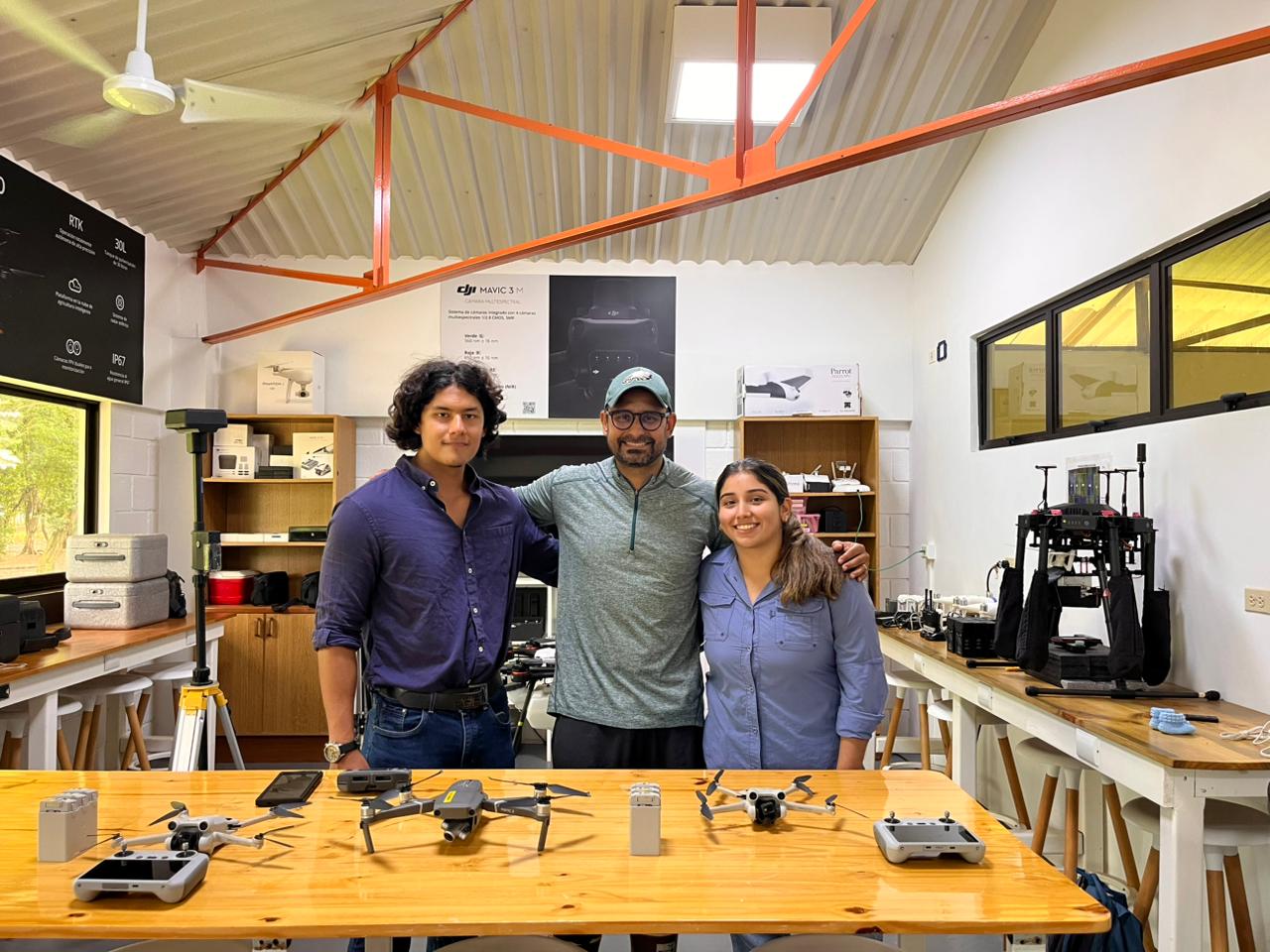
At EARTH University, education is hands-on. Through the university’s Smart Regenerative Agroforestry (ARI) program, students gain real-world experience in multispectral drone mapping. By collecting and processing aerial data, they generate precise variable-rate prescription maps in PIX4Dfields to target where the crops are stressed or unhealthy. This allows them to perform a targeted application of sustainable, algae-based bio-inputs on Coffea arabica crops in areas previously thought not suitable for cultivation.
Precision agriculture in Costa Rica
Leading this initiative is Professor Victor Hugo Morales Peña, an instructor for Dronity's international drone application program and a lecturer at EARTH university. Professor Morales Peña wishes to promote and strengthen drone technology and precision agriculture in the Caribbean region of Costa Rica. He has built a globally unique research project that blends thermal imaging, spectral analysis, and drone spraying into a regenerative farming workflow. The goal is simple: use technology to actively restore the ecosystem, swapping out harsh synthetic chemicals for eco-friendly, bio-based alternatives.
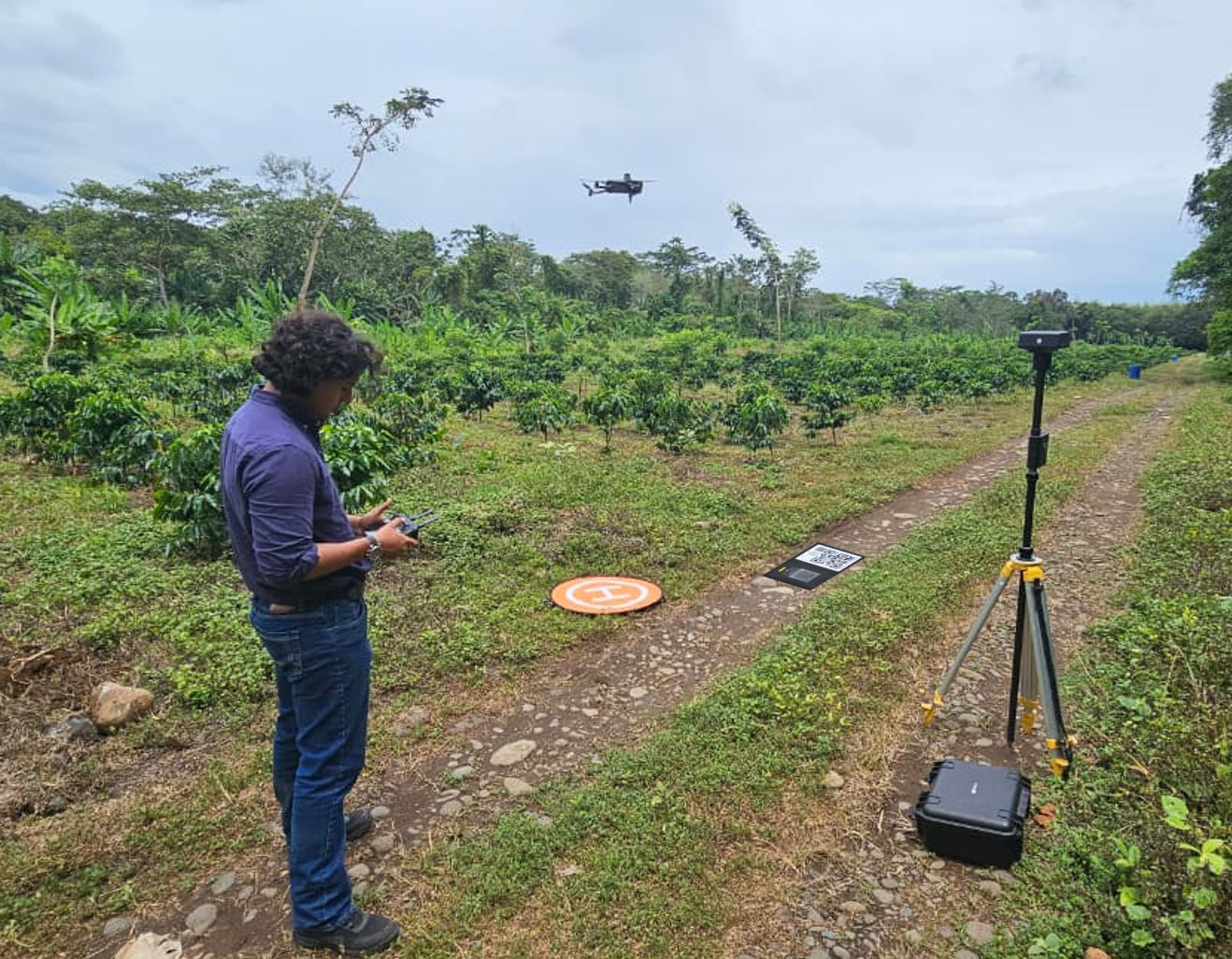
Drones allow students to scan the field and pinpoint which coffee plants are stressed or unhealthy. They use this data to create a prescription map for variable-rate spraying. The map applies a natural, seaweed-based fertilizer instead of harsh synthetic chemicals.
A workflow for regenerative agroforestry
The workflow starts in the air with a DJI Mavic 3 Multispectral drone. By planning flights, calibrating sensors for accurate data, and using high-precision RTK positioning, students map out the field from above.
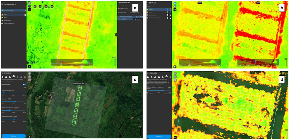
Next, students import the images into PIX4Dfields to generate an orthomosaic, giving them a detailed view of the entire field's layout. This map serves as their baseline.
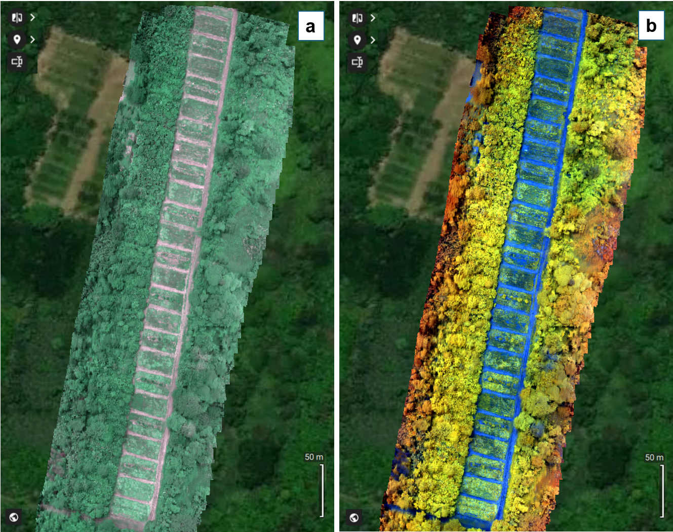
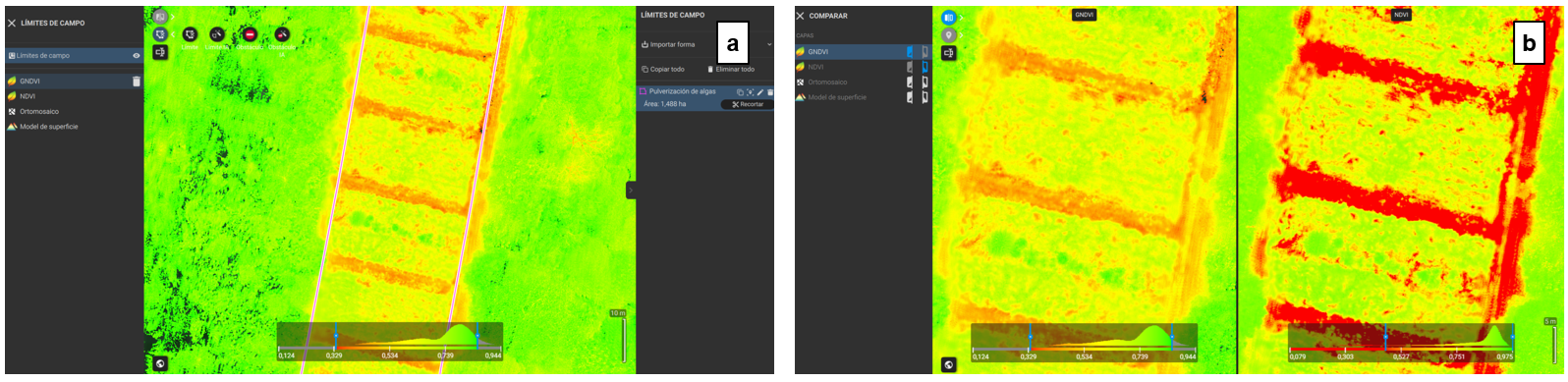
By analyzing the differences across the crop, they can generate specific vegetation indices that highlight hidden variations in plant health, which they then use to build the final variable-rate prescription map for spot-spraying.
The young Coffea arabica system in Costa Rica is just over a year old. Because the larger trees meant to shade the coffee plants are not yet fully grown, using spectral analysis is essential to understand how the crop is developing. By using vegetation indices like NDVI and NDRE, students can translate field variations into precise management decisions.
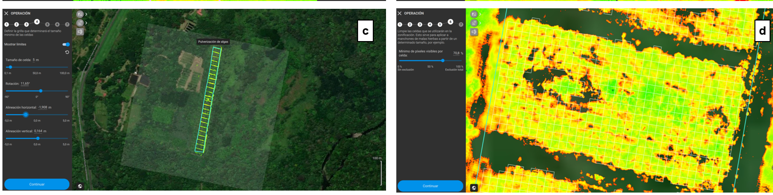
To create the final plan, students outline the target area, select the best vegetation index for the job, and generate a grid that dictates the variable-rate application. Finally, they remove any cells that do not require treatment, ensuring that the seaweed-based fertilizer is applied only where the coffee plants need it most.
Calculating variable-rate doses in PIX4Dfields for regenerative farming practices
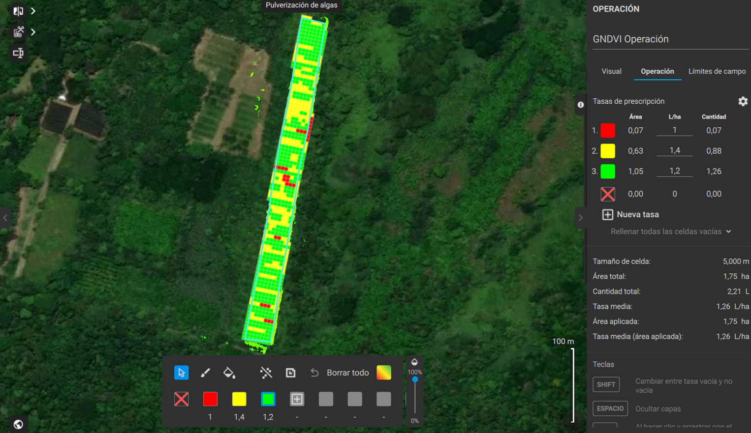
By generating prescription maps based on the GNDVI index in PIX4Dfields, students learn how to turn aerial data into practical agricultural decisions. On this 1.75-hectare coffee plot, they set up a 5-meter grid to apply variable doses of the seaweed fertilizer based on plant health.
Project details
| Location | Costa Rica |
| User | Dronity |
| Project area | 2.5 ha / 1,75 ha effective area |
| Software used | PIX4Dfields |
| Hardware used | DJI Mavic 3 Multispectral |
| GSD | 3.68 cm/pix |
Following the strategy of "more algae where there is less vigor," they applied 1.4 liters per hectare in low-health zones, 1.2 liters in intermediate zones, and 1.0 liter in the healthiest areas. This approach teaches students how to precisely target stressed plants, reduce waste, and manage crops sustainably.
The value of variable-rate mapping
While this workflow for regenerative farming practices uses seaweed extract on Coffea arabica, the agronomic principle applies to any crop or input type. By replacing uniform "blanket" spraying with targeted VRA zones in PIX4Dfields, agricultural operators can optimize resource efficiency across the board. Whether applying synthetic fertilizers, organic bio-inputs, or crop protection products, variable-rate application protects sensitive ecosystems from chemical over-saturation while significantly reducing input costs.


