Saving $6,000 in one VRA application using satellite imagery
DigitalAgro is a provider of precision agriculture and forestry services. They recently took on a project to convert 354 hectares of traditional cropland into dedicated livestock pasture. However, the operation immediately ran into an obstacle: adverse weather made fieldwork impossible.
This case study details how the team instead used satellite imagery* and PIX4Dfields software from their office, not only ensuring project delivery but also completing the complex zonation and variable rate prescription in 18 minutes.
Note: At the time of this project, only standard satellite image resolution was available. PIX4Dfields now offers high-resolution satellite imagery.
Overcoming weather delay with PIX4Dfields
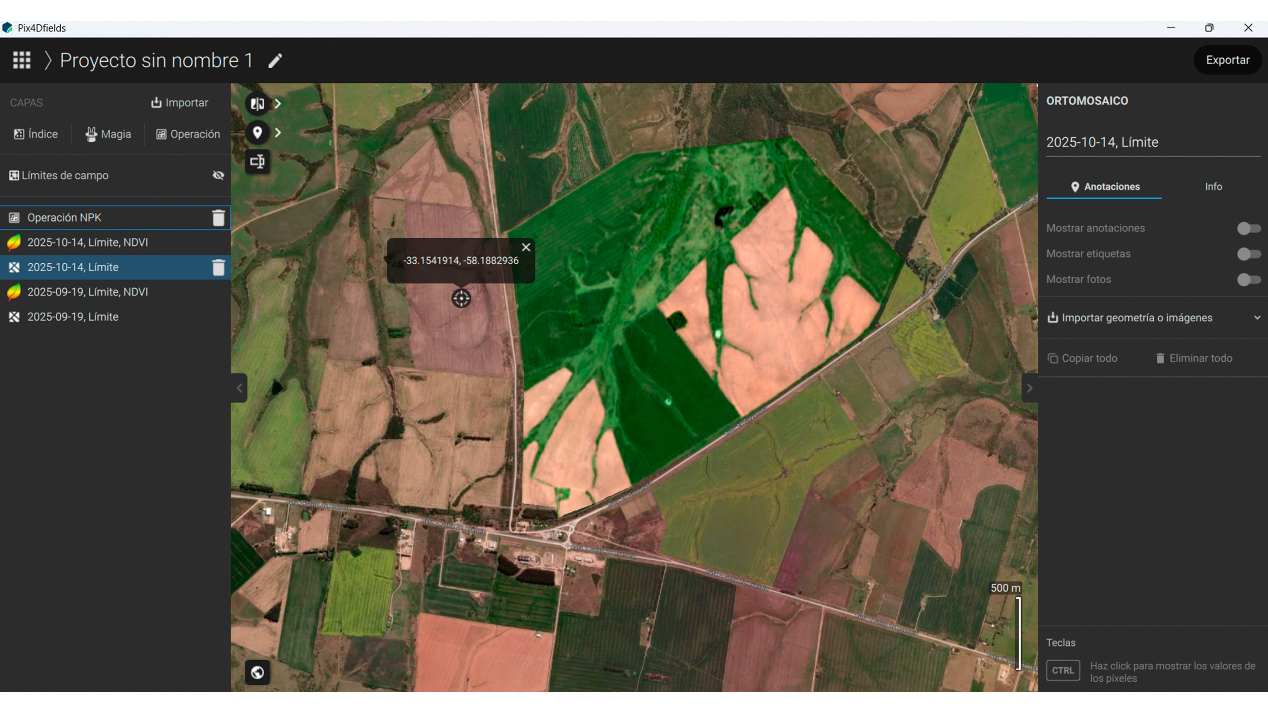
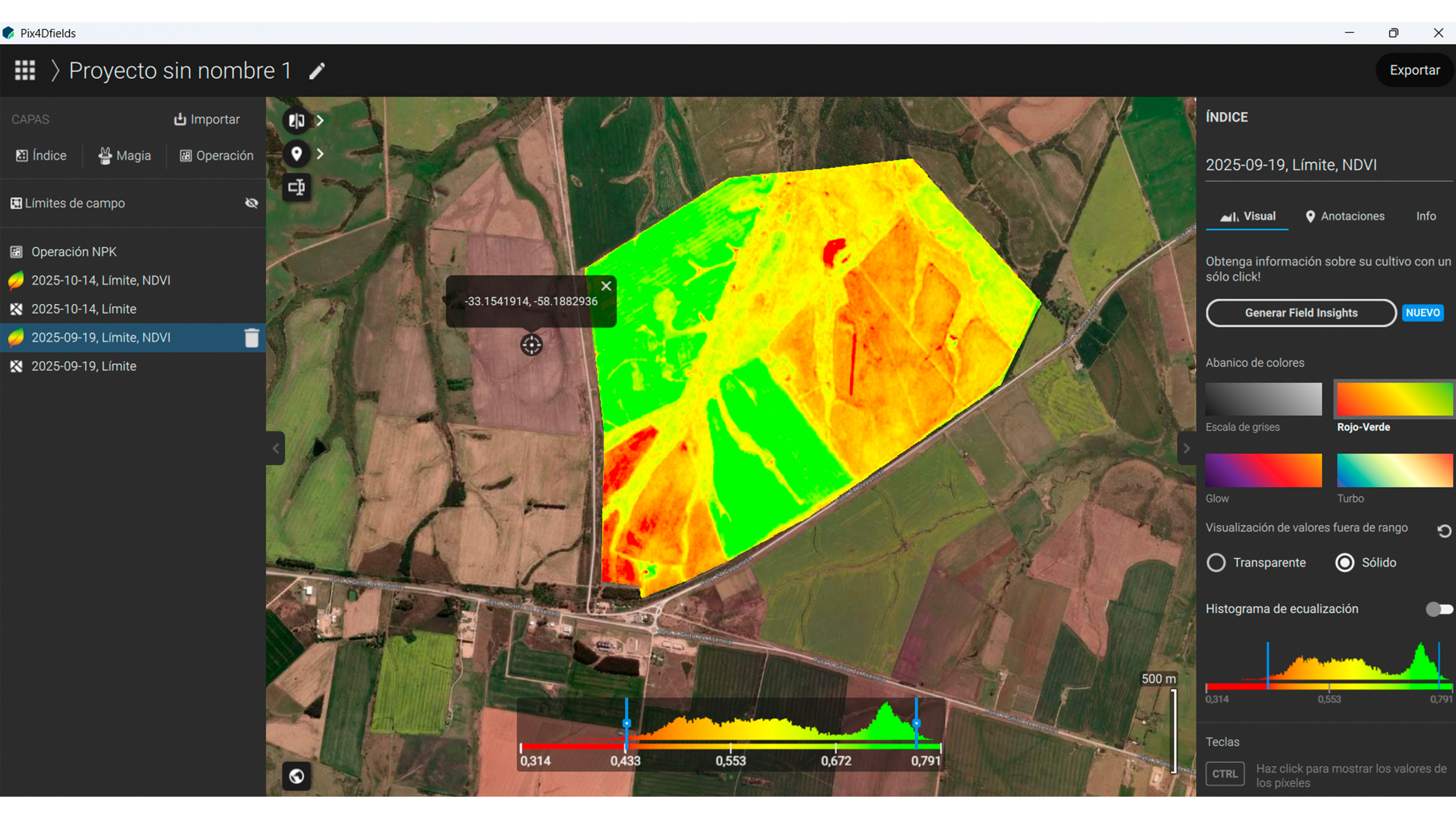
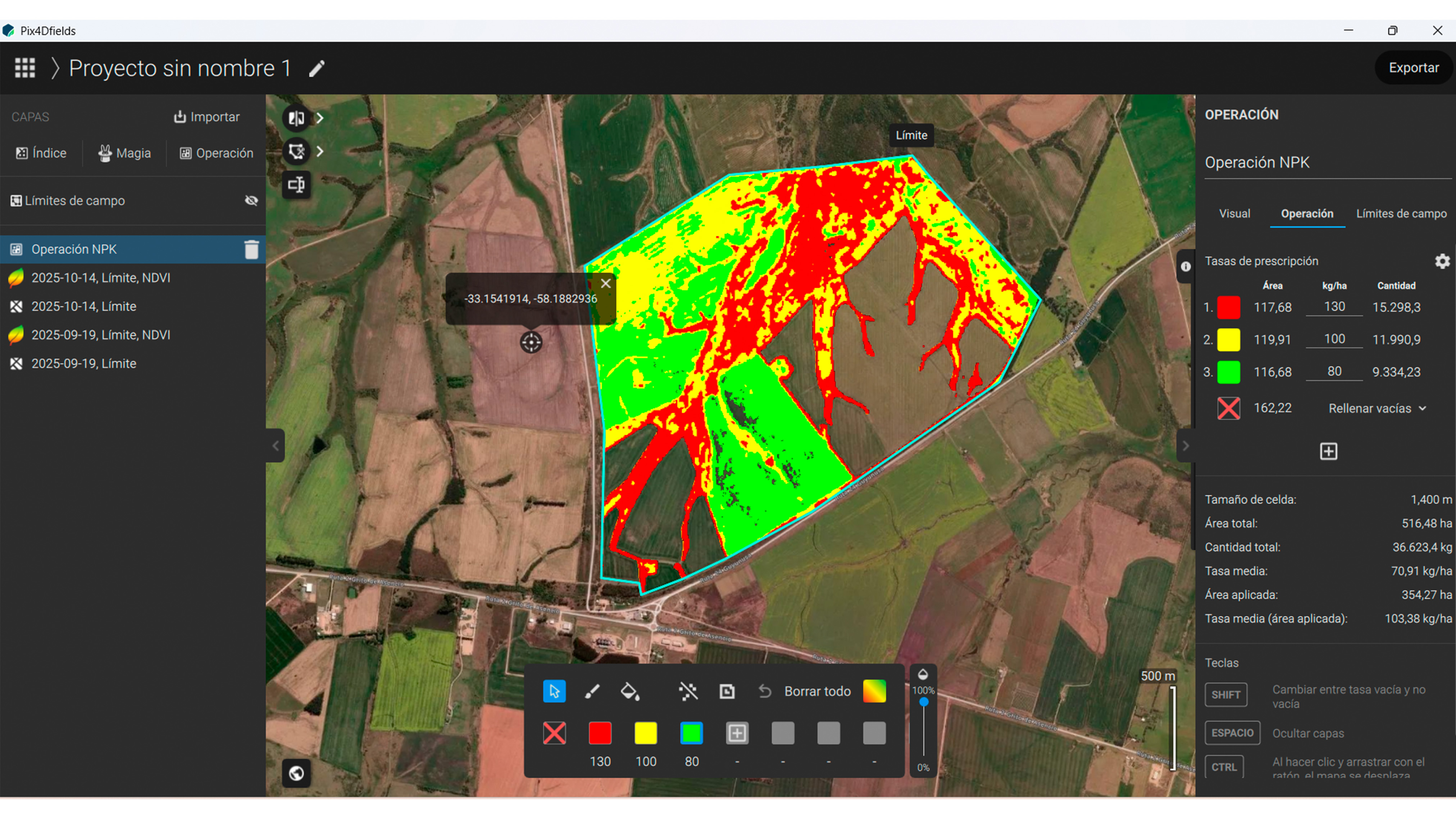
The day the team was scheduled to travel, heavy rain and dark clouds made task execution difficult. Rather than delaying the project, the team decided to stay in the office to carry out the zonation operation. This involved delineating a farm boundary and using Sentinel satellite imagery to calculate the NDVI index. The resulting analysis successfully identified three distinct zones within the area, enabling the application of variable rate dosage optimized for the crop's needs. Using this strategy they managed to save money and resources.
Project impact: over $6,000 USD in savings!
This method allowed for a high-precision task to be carried out from the comfort of the office or even at home! By eliminating the need for on-site drone flights in this instance, the team significantly lowered transportation costs, which translated into a more competitive fee for the client. Beyond logistics, the financial impact on the field was substantial:
A homogeneous application of 130 kg of Urea (N) per hectare would have required a total of 46,055.1 kg. By using zonation, the team generated a variable rate prescription requiring only 36,624 kg of fertilizer. This precision approach achieved a 20% reduction in input costs, saving the producer more than US$6,000 in a single operation.
Project details
| Location | Uruguay |
| User | DigitalAgro |
| Project duration | The project was completed in a total time of 18 minutes |
| Project area | 354.27 hectares |
| Software used | PIX4Dfields |
| Hardware used | Lenovo Intel Core I7 IRISx INTEL graphics card |
| Images captured | Total images: 1 |
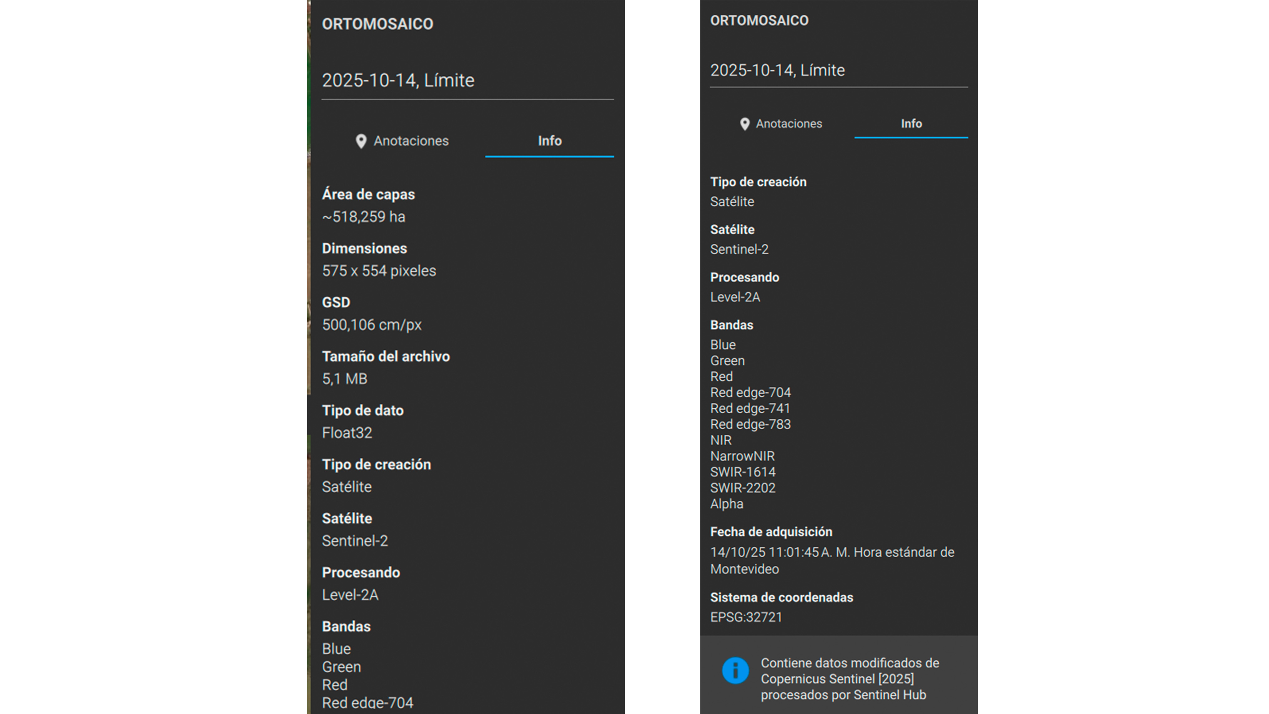
| Number of images in dataset | Sentinel images data |
| Processing time | The processing of all layers and the variable rate operation was completed in 4 minutes. |
Remote NDVI-zonation with PIX4Dfields
The primary benefit of PIX4Dfields was the ability to maintain operational continuity. The software's ability to analyze satellite imagery and create NDVI-based zonation operations meant the team could execute essential tasks from the office when adverse weather prevented field travel. This removed dependency on drone flight, allowing them to define three distinct zones for prescription application, thereby ensuring resource savings and project delivery.
“PIX4Dfields has become a real game changer that allows me to be in several places almost simultaneously and with the same precision I would have if I were physically at the intervention site.” Ernesto Claramunt, Environmental Control Technician, DigitalAgro
According to Ernesto the software has been a strategic investment that has enabled creative planning and promoted a more responsible, sustainable approach to managing the agricultural environments and biomes where they operate.