Variable rate insecticide application achieves 95% success
Soybean farming faces a costly challenge in managing toxins from pests like the brown stink bug. Vetorgeo, an agricultural technology company in São José do Rio Preto, Brazil, partnered with Bayer to create an advanced remote detection tool that enhances traditional toxin-checking methods. Utilizing high-precision remote sensing and PIX4Dfields, they can now accurately map 800 hectares daily. Last season, they processed over 80,000 hectares using PIX4Dfields for quick variable rate application and prescription map generation, improving efficiency in toxin management, reducing waste, and enhancing soybean yield quality.
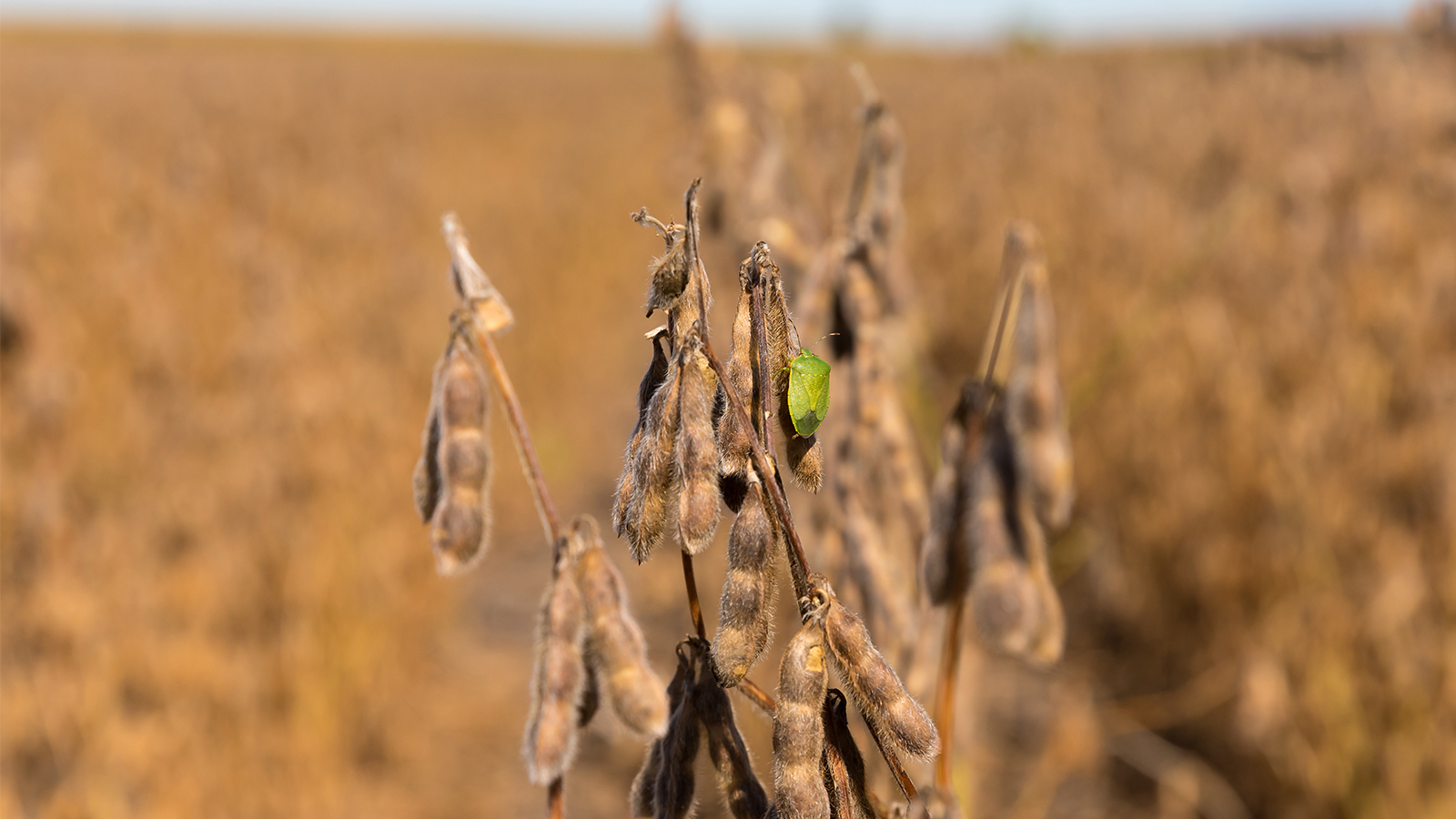
The company also focuses on creating variable-rate maps using algorithms for growth regulators in cotton, bedbug toxins in soybean and corn as well as detecting the absence of NPK, Zinc, Boron, and Manganese. They also have algorithms for identifying nematodes, rust fungus, and separating broadleaf from narrow leaf weeds, even in planted crops (Green on Green).
Project overview
The project aimed to enhance quality control in soybean production by using technology to quickly detect toxins, reduce waste, and improve crop health. Traditional methods were slow, so Vetorgeo’s tool, combined with PIX4Dfields, allowed for rapid remote analysis. Over the past year, they processed 4,000-5,000 images for every 900-1,000 hectares at a GSD of 3.64, benefiting from PIX4Dfields’ fast processing capabilities. Vetorgeo’s custom radiometric calibration software, utilizing XRite 24-color board for radiometric corrections, was also crucial for analysis. The hardware used included a mapping drone, laptop, and Agrowing’s 15-band and 10-band sensors. Automation through PIX4Dfields facilitated the quick creation of prescription maps for various agricultural machinery, reducing delivery times and streamlining workflows. This established Vetorgeo as the first company globally to implement Variable Rate Application (VRA) of insecticides.
Soybean infestation diagnosis using Agrowing’s sensor and PIX4Dfields
One of the project’s biggest challenges was identifying a sensor with the spectral precision needed to distinguish subtle spectral variations, including toxin indicators. Vetorgeo collaborated with Agrowing in Israel, using lab-grade radiometers to isolate relevant spectral signatures. Agrowing’s sensors, which go up to 15-bands, enabled even more detailed crop insights when combined with the custom vegetation index generator in PIX4Dfields.
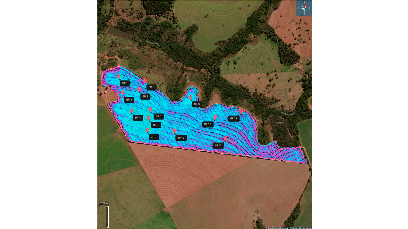
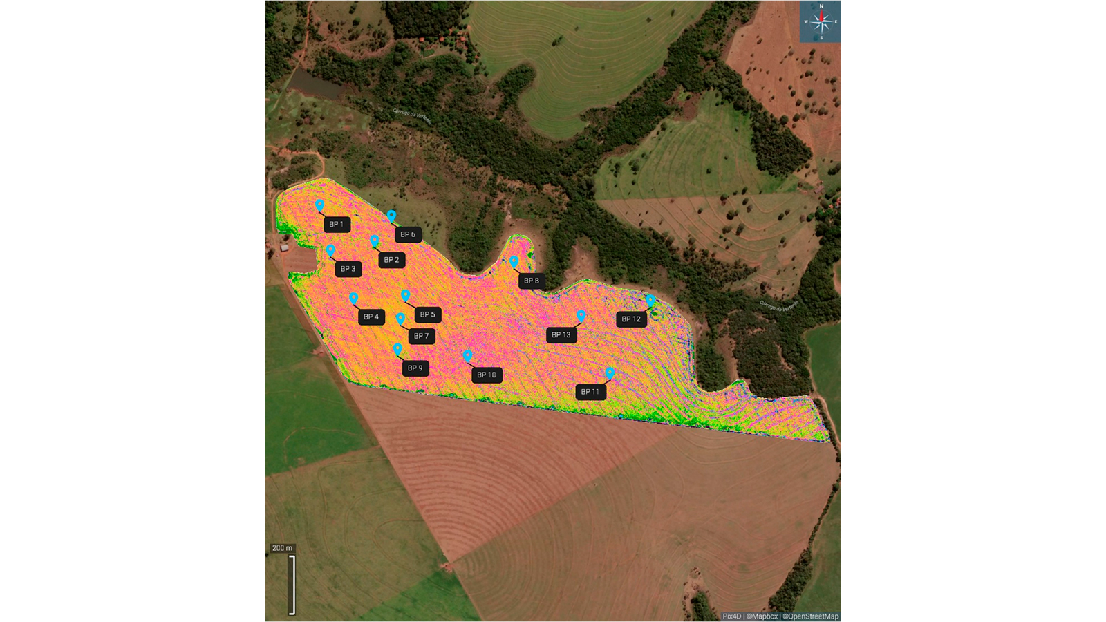
The colors represent the infestation level based on the amount of toxin inoculated into the plant by the stink bug. Light blue (level 4) indicates that pest pressure is out of control, while pink signals high infestation but still manageable with chemicals. Orange marks the ideal entry point for control, corresponding to approximately 2 stink bugs per m², the acceptable limit for commercial soybeans in Brazil. Light green indicates toxin levels near 1 or 0.5 stink bugs per m², and dark green shows no impact on commercial crops. Vetorgeo’s technology identifies infestations up to level 4; once light blue appears, it signifies a critical stage where management remains the same. Producers should act when the color detected is still orange or pink, as it significantly affects management outcomes.
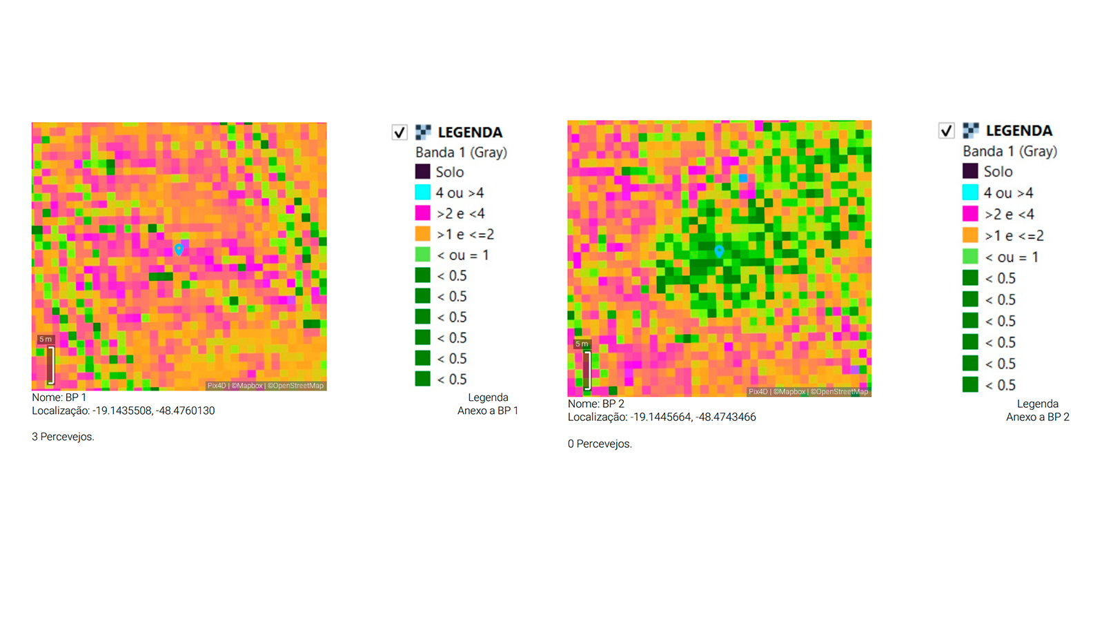
During Brazil's four-month soybean harvest period, the team monitored the fields every 30 days, resulting in at least four variable-rate insecticide applications to ensure a high-quality harvest at the end of the season. Using the infestation level shown on PIX4Dfields’ vegetation index map, the team created a prescription map for variable-rate insecticide application. This map was then sent directly to the spraying equipment’s terminal through PIX4Dfields’ Targeted Operations workflow.
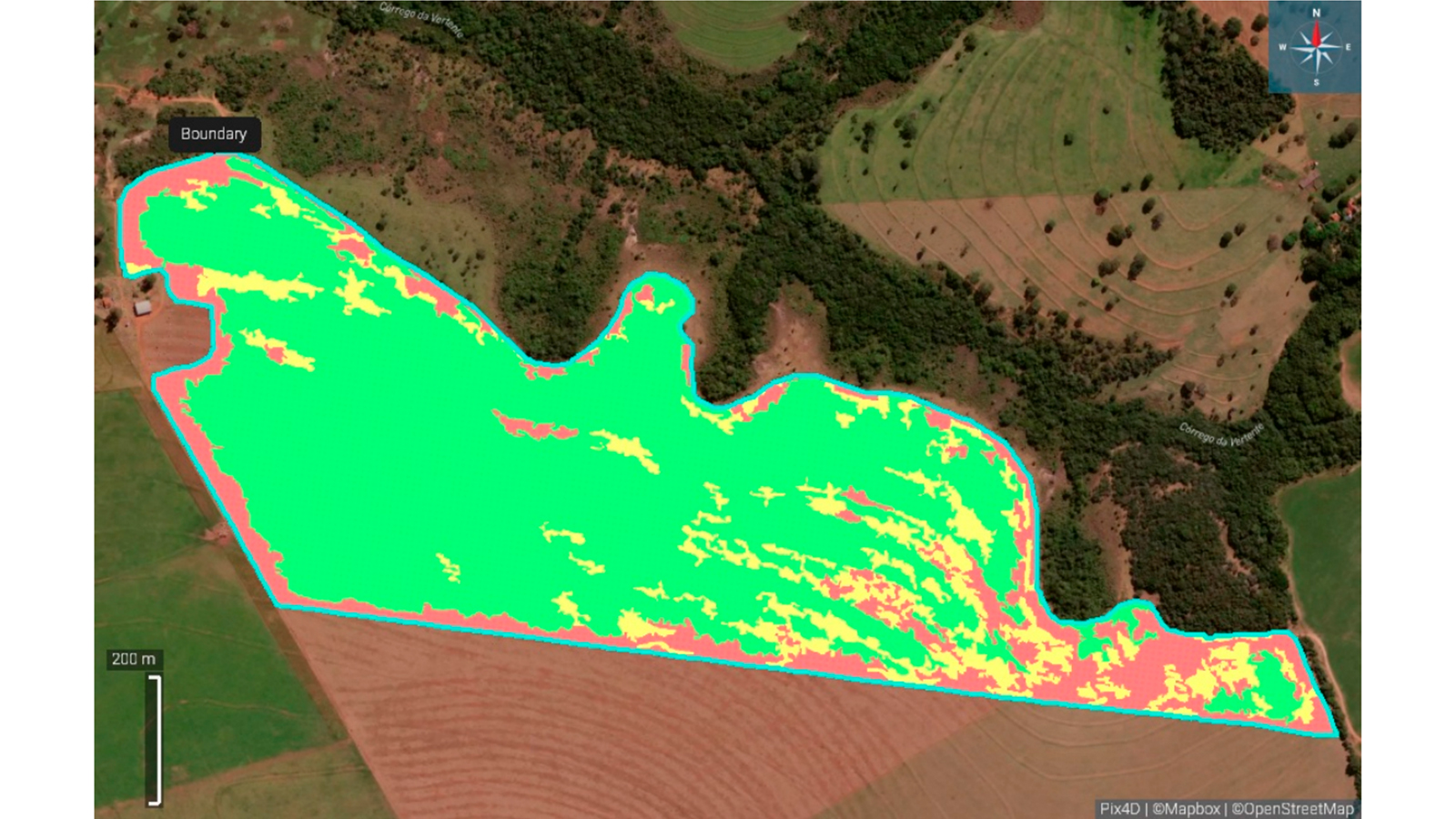
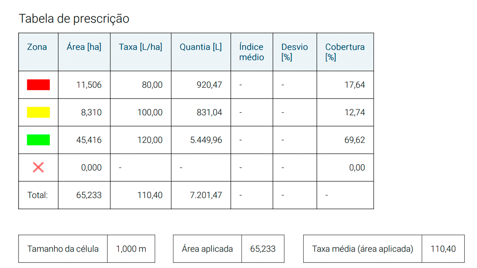
Vetorgeo also used PIX4Dfield’s customized PDF report where they kept all soybean field data and analysis during the harvest period (vegetation indices, prescription maps, infestation annotations, and more).
Impact: 95% acceptance of soybean seeds during quality control
Vetorgeo’s solution delivered outstanding statistical results, exceeding an R² value of 0.8 in linear regression tests and cross-checking with conventional methods. By using this tool to monitor and apply insecticide at optimal times, they achieved a 95% success rate in controlling stink bug infestation—at a threshold of 1 bug per m²—in soybean seed control areas. This high acceptance rate underscores the effectiveness when producers adhere to their recommendations and timely spray activations.

The time savings and efficiency improvements due to PIX4Dfields have been instrumental in making timely, accurate deliveries. Through these advancements, Vetorgeo has established the groundwork for large-scale toxin monitoring in soybeans and other crops, pushing agricultural quality standards forward.
PIX4Dfields has made all the difference in terms of time spent on our deliveries, due to the automation of the variable rate maps compatible with all the sprayers we work with during the harvest. - Neto Salvador, Vetorgeo
This project highlights how technology and data-driven agriculture can tackle intricate crop challenges, minimize waste, and ultimately enhance agricultural productivity on a significant scale.


