Weed damage detection in rice fields
Wind damage poses a significant threat to rice crops, impacting productivity and profitability. The challenge lies in quickly and accurately identifying affected areas to enable timely interventions. KPN Group, a Montevideo, Uruguay-based company specializing in technological solutions for precision agriculture, topography, mapping, and precision forestry, recently leveraged drone technology and PIX4Dfields. With over 10 years of experience in the field, KPN Group efficiently detected and assessed wind damage in rice fields. This work was carried out by Agroequipos, a client of KPN's consulting and training program, located in Lascano-Rocha. Agroequipos provided accurate information to farmers for crop management and insurance claims.
Assessing wind damage in rice crops
This project focused on the detection and assessment of wind damage in rice crops using a drone equipped with an RGB camera and PIX4Dfields. The farmer’s need was to quickly identify affected areas for informed crop management decisions, directly influencing productivity and profitability. Traditionally, this task is labor-intensive, time-consuming, and prone to inaccuracies, leading to delayed interventions and potential yield losses. By using PIX4Dfields, the Agroequipos team was able to deliver to the farmer an accurate and detailed damage report of the 368 hectares rice crop plots in just 3 hours.
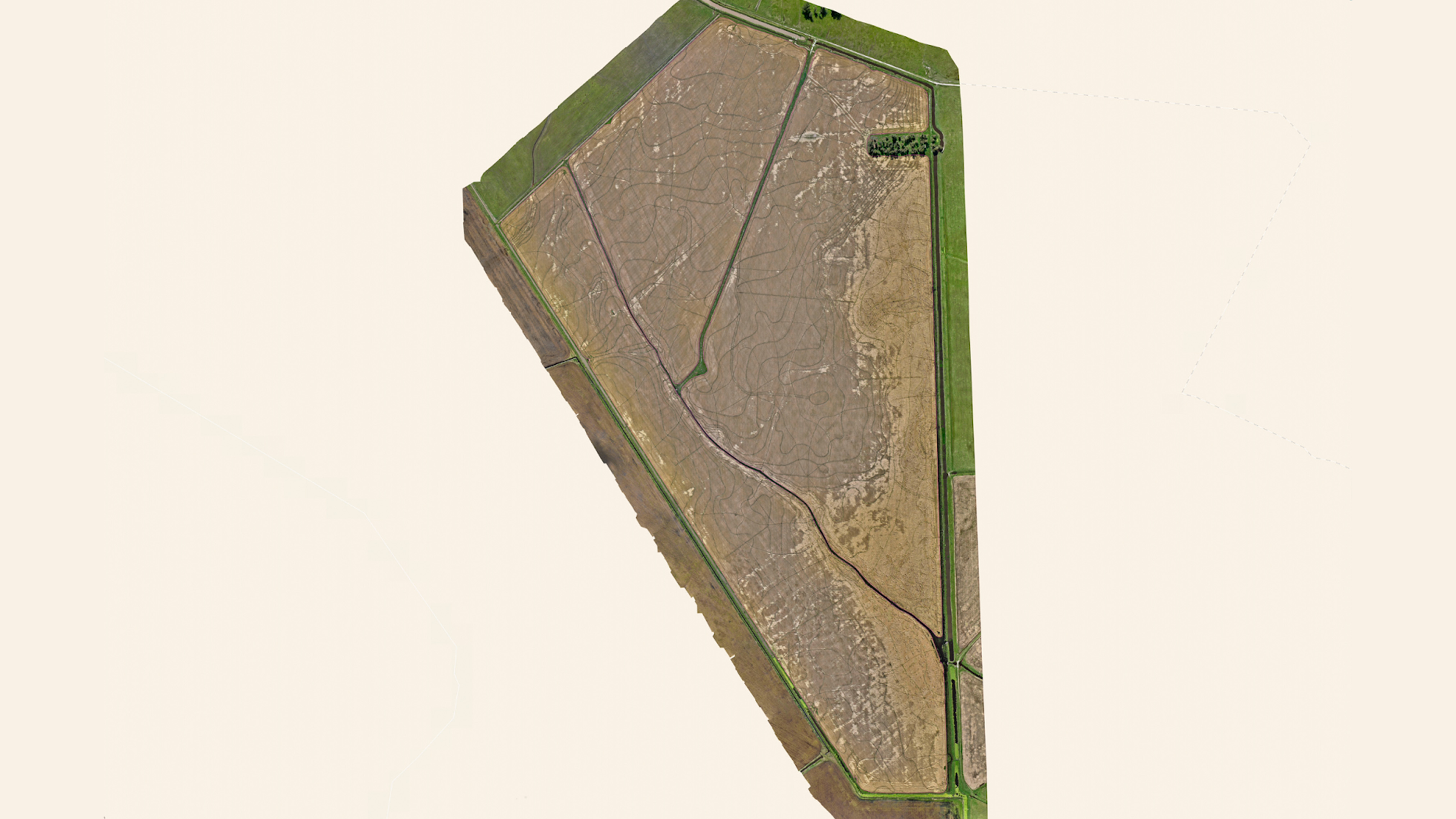
The drone imagery was swiftly processed offline on a laptop using PIX4Dfields directly in the field. The team found its fast processing speed and intuitive interface highly beneficial for quickly generating vegetation index maps, orthomosaics, and plot contours. This rapid, offline processing was crucial for creating timely damage detection reports, as Juan emphasized, "Processing speed is crucial for agricultural decision-making." The digital surface model (DSM) generated in PIX4Dfields also identified damaged areas corresponding to the lowest terrain, informing future land leveling to prevent yield losses.
Project details
| Location | Uruguay |
| User | Agroequipos |
| Project duration | 3 hours |
| Area surveyed | 268 hectares |
| Software used | PIX4Dfields |
| Hardware used | DJI Mavic 3 Enterprise Multispectral |
| Images captured | Total images: 1522 |
| Processing time | Approximately 20 minutes |
| GSD | 3.6 CM/Pixel |
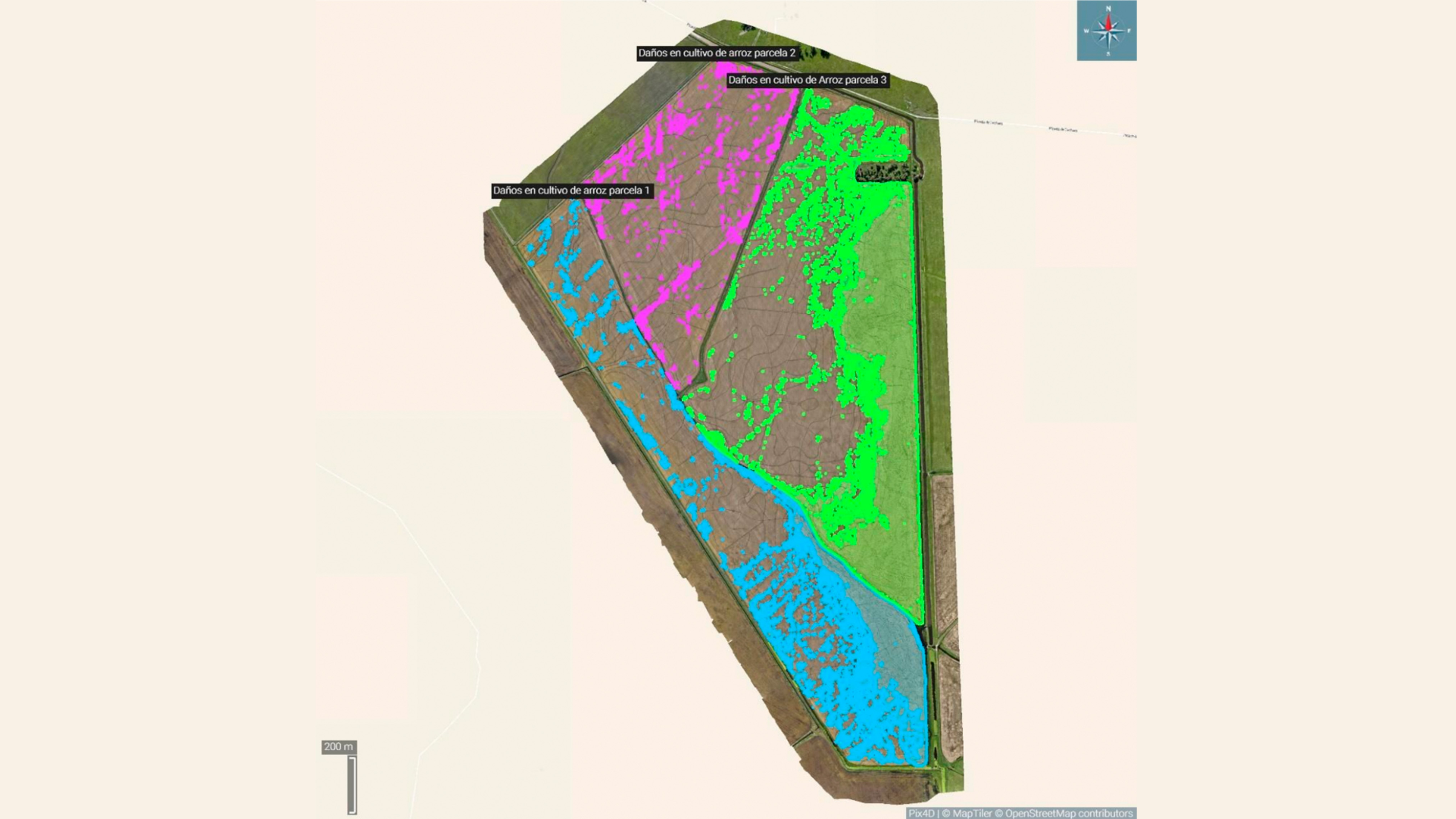
A specific challenge encountered was the accurate assessment of crop damage percentage. PIX4Dfields' Magic Tool significantly sped up the automatic detection and definition of damaged areas within the rice plots, proving to be a crucial asset for this project. Agroequipos also leveraged PIX4Dfields' Annotations tool to precisely classify damaged areas within each of the three rice plots.
Georeferenced damage estimate just 3 hours
The main achievement was the quantification and precise location of damage, which is impossible to achieve with traditional methods on large areas. This represents a significant leap in speed and precision compared to current practices. Most insurance companies still rely on visual inspections by experts, which are essentially visual estimates and can often be unfair to one of the parties involved. This new system removes the uncertainty of judgment-based estimates, providing a real, georeferenced estimate with excellent resolution.
The entire project, from beginning to end, took approximately three hours. This project had a significant impact by providing accurate and timely information on wind-affected areas, enabling farmers to make quick, targeted decisions and get a report for the insurance company. The detailed crop damage report was generated in PIX4Dfields and could be directly exported in PDF format.
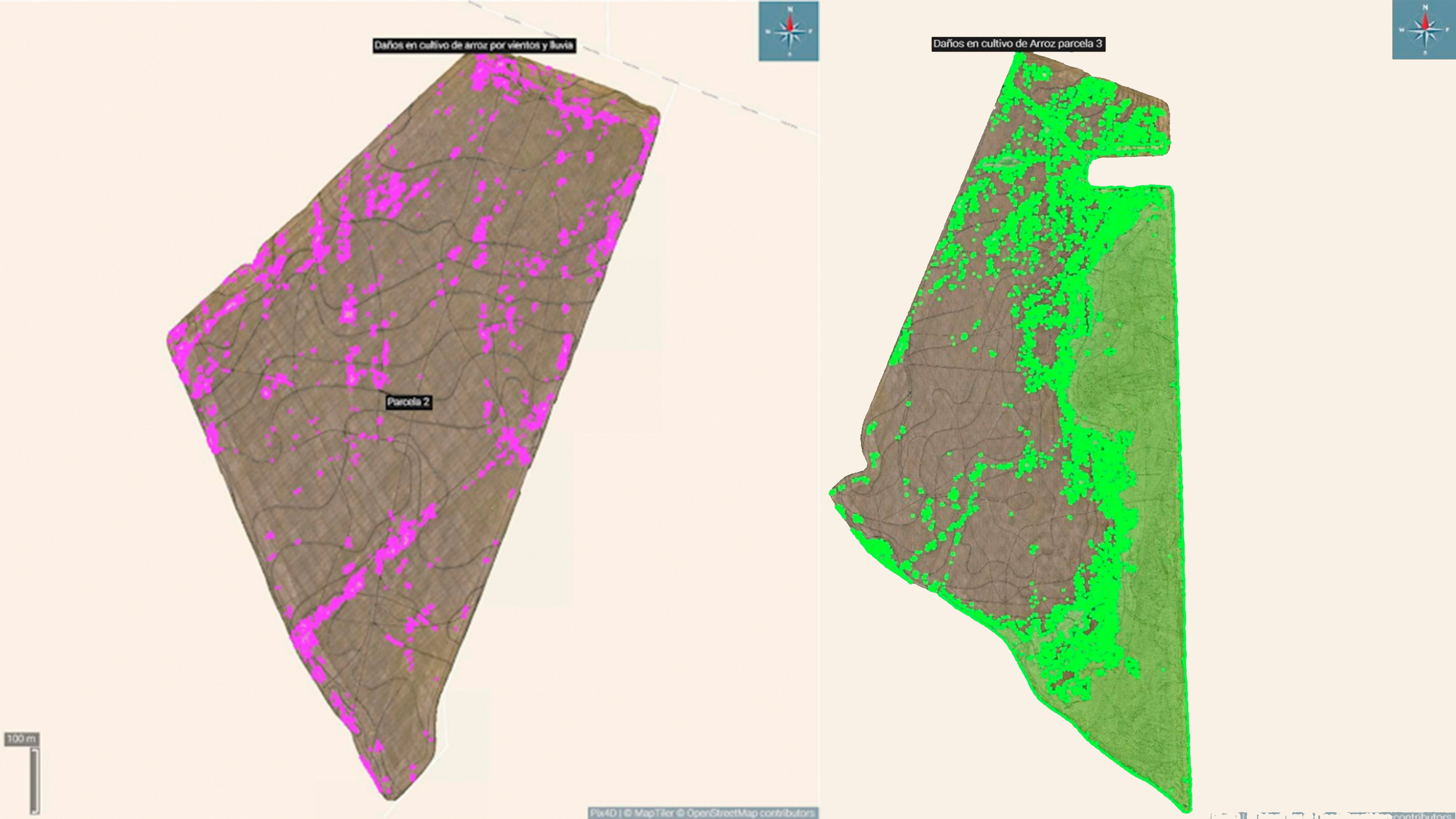
The results by rice plot were:
Plot No.1:
- Total Area: 60.049 ha
- Total Damaged Area: 13.128 ha
- Effective Planted Area: 46.921 ha
Plot No.2:
- Total Area: 41.451 ha
- Total Damaged Area: 1.412 ha
- Effective Planted Area: 40.039 ha
Plot No.3:
- Total Area: 85.132 ha
- Total Damaged Area: 33.864 ha
- Effective Planted Area: 51.268 ha
Overall: Total Damage: 25.9%, Total Effective Area: 74.1%
"The speed in processing, along with intuitive tools for creating plot outlines, was essential to the project's success. The DSM was also able to identify that the damaged areas of the crop correspond to the lowest areas of the land, aiding in future decision-making in geo-leveling planning to prevent future losses."- Juan Próspero, Commercial Manager for Agriculture & Forestry at KPN Group