
PIX4D PARTNERS
Locate your nearest Pix4D partner

Pix4D Partners form a trusted global extension of Pix4D by representing our brand and selling our products in the markets that they know best.
Technology Partners

Premier Resellers
United States www.aerial-metrics.com
Italy www.analistgroup.com
New Zealand www.aptella.com/nz
Turkey www.ataymuhendislik.com
United States www.auteldrones.com
Australia www.crkennedy.com.au
Japan www.cybernetech.co.jp
Peru www.datacont.com

United States www.dronenerds.com

United States www.duncan-parnell.com

South Korea https://www.e8ight.co.kr
Switzerland www.fieldwork.ch/de
France www.flyingeye.fr
United States www.forensicmappingsolutions.com
United States www.frontierprecision.com
Colombia www.galileoinstruments.com.co
Brazil www.geoagri.com.br
Taiwan www.geoforce.com.tw
Costa Rica www.geoinn.com
Honduras www.geomapps.com
Hong Kong www.geosys.org

Colombia www.geosysteming.com/
Spain www.grupoacre.es

Netherlands www.hogervorst.nl
Mexico www.igeomexico.com
Japan www.imageone.co.jp

Thailand www.jitjai.co.th

Japan www.kkc.co.jp
Poland navigate.pl
United States www.noartechnologies.com
France https://www.parrot.com/fr

China www.pix4d.com.cn
Brazil www.santiagoecintra.com.br
Norway www.scandinaviandrone.no
United States www.smart-systems.tech
Mexico www.sysmap.net
France www.studiosport.fr
China www.topxgunag.cl

Japan www.tphd.co.jp
Japan www.sysmap.net

Chile www.uavsics.cl
Switzerland www.wingtra.com
Worldwide Reseller Network
Feel free to contact any of the official Partners listed below for further information about buying Pix4D products, first-level training and a face-to-face meeting.
North America
CanadaAdvanced Drone Solutions
Carto Canada
DraganFly
DroneXperts
Koptr Image
Landview (Canada)
RMUS Canada (Canada)
United States
4Rivers Equipment
Adorama
Advexure
Aerial Metrics
AgriSpray Drones
Agtek
Airstrike Ag
Autel Robotics
Benchmark Tool and Supply
Caron East
Drone Nerds
DSLR Pros
E38 Survey Solutions
Earl Dudley
Enterprise UAS
Fly Motion
Forensic Mapping Solutions
Frontier Precision
General Pacific
Granite Defense Technologies
Gresco
Hixon Mfg. & Supply Co.
HTS Ag
Keystone Precision Solutions
Kuker-Ranken
Maine Technical Source
Maverick Drone Systems
Multicopter Warehouse
NOAR Technologies
Public Safety UAS
Seiler Instrument & Mfg. Co.
SITECH South
SkyOp
Terrestrial Imaging
The LiDAR PROs
Topcon Solutions Store
Tough Stump Technologies, LLC
Unmanned Vehicle Technologies
Vertex Unmanned Solutions
Vertical Aspect
Volitant Drone Technology Solutions
W.S. Darley
Latin America
ArgentinaRC Online
Runco
XAG Atlas
Brazil
Futuriste
Geo Agri
Santiago & Cintra
Chile
Microgeo
Colombia
Galileo Instruments
Geosystem Ingeniería
GeoSpatial
Costa Rica
GEOINN
Ecuador
Cotecmi
Geotop S.A.
El Salvador
Rumbo GNSS SA de CV.
Guatemala
GYFSA
Mexico
iGeo México
Max3Design
SISTEMAS Y SERVICIOS PARA TOPOGAFIA SA DE CV
Sysmap
Tecmundo mexico (XAG Mexico)
Terrasat
TTQ De Monterrey
Panama
Geosystem Topografia
Paraguay
Grupo Corporativo S.A (Gestecner)
Peru
Cotecmi
Datacont
GEOTOP - Geodesia y Topografia SAC
Uruguay
Dragur
KPN
EMEA
Sky Elements - Drone Solution AT
Skyability GmbH
Belgium & Luxembourg
Aerialsolutions
Croatia
Agrigentum - Digital Agro
Geosustavi
Czechia
GEOTRONICS Praha s.r.o.
STROM Praha a.s.
3Gon Positioning s.r.o
Denmark
Geoteam
Egypt
Geomatex
Estonia
GeoNovus Eesti OÜ
Finland
Nordic Drones
Skydata Oy
France
Clic & Bat
Escadrone
Flying Eye
Parrot
Studio Sport
Germany
Smart Systems Technology
Vermessung3D
Werner & Schlei Engineers GmbH
Greece
Geosense
Hungary
ABZdrone
Ireland
Survey Instrument Services
Italy
Analist Group
3D Target
GeoNovus Latvija SIA
SIA Agrodrons
Lithuania
GeoNovus
Morocco
Droneway
Netherlands
Aerialtronics DV
Geometius
Hogervorst
Norway
Norconsult
Scandinavian Drone AS
Oman
IBN FIRNAS DRONE CENTER
Poland
NaviGate Sp. z o.o.
TPI SP. Z O. O.
Portugal
HP Drones
Romania
Edit Shop & Business SRL (La Orizont)Survey topo Solutions (SkyGrid)
Senegal
SAREDICA
Slovakia
3Gon Slovakia s.r.o.
Slovenia
OneDrone
South Africa
SSASS Holdings
Spain
ATyges
Drone Prix
Grupo Acre
Sweden
Scandinavian Drone AB
Swedron Sverige AB
Switzerland
Fieldwork AG
Wingtra
Turkey
Atay
Ukraine
DroneUA
United Arab Emirates
The Drone Centre FEDS
United Kingdom
Coptrz
Drone Pilot Academy Ltd
G2 Survey
Innovelec Solutions Limited
Korec Group
Asia-Pacific
AustraliaC.R. Kennedy & Company
Map Gear Pty Ltd
China
Peakview
Hong Kong & Macau
Dronesurvey Asia
GeoSys Hong Kong
India
Indo Wings Private Limited
K K Sales
Nationwide Drone & Mapping Services
UAVGARAGE PRIVATE LIMITED
VibeGeo Technologies Private Limited
Vyom Drones
Indonesia
Halo Robotics
Japan
Active Solution
Cybernetech
DataLabs,Inc.
Image One
KAMETA Co
Kokusai Kogyo (KKC)
Skylink Japan
TP Holdings Co.,Ltd.
UGOSOKKI
Korea
E8IGHT
Malaysia
Surmap
New Zealand
Ferntech
Aptella NZ
Philippines
Geocat Services Inc.
Precision Path Technologies Inc.
Singapore
Easepect
Solomon Islands, Fiji and Vanuatu
Kahuto Investment LTD
Sri Lanka
Sumathi Holdings
Thailand
JITJAI CO., LTD.
Taiwan
Geoforce
Vietnam
DAT HOP CO., LTD
Inspiring projects from our partners

3D modeling one of the world's biggest challenges
Learn how SenseFly, Pix4D, Drone Adventures and Mapbox worked together to create a unique 3D model of the Matterhorn.
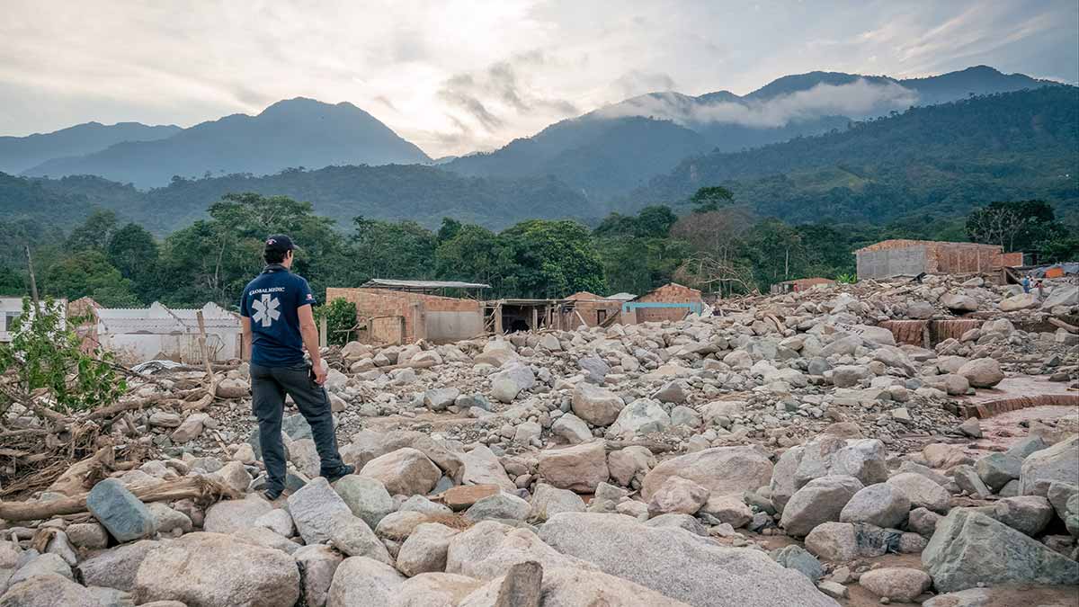
Drone mapping saved lifes after fatal landslide in Colombia
Read how Aeryon Labs joined forces with local emergency response organizations in Mocoa and helped 4,000 people return home.
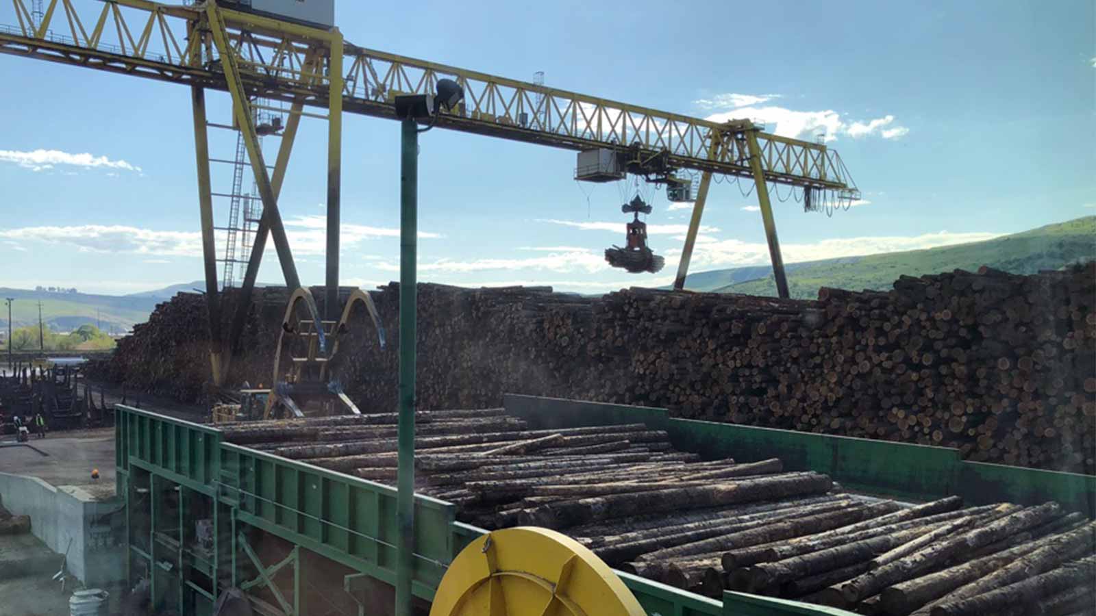
The right tools are the secret to measuring material piles
WingtraOne and photogrammetry helps Idaho Forest Group to get reliable stockpile measurements without stopping operations.