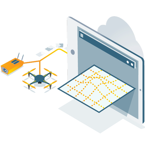
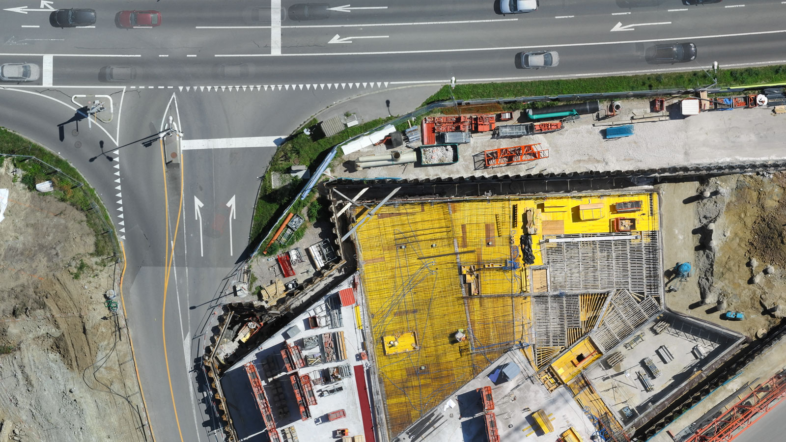
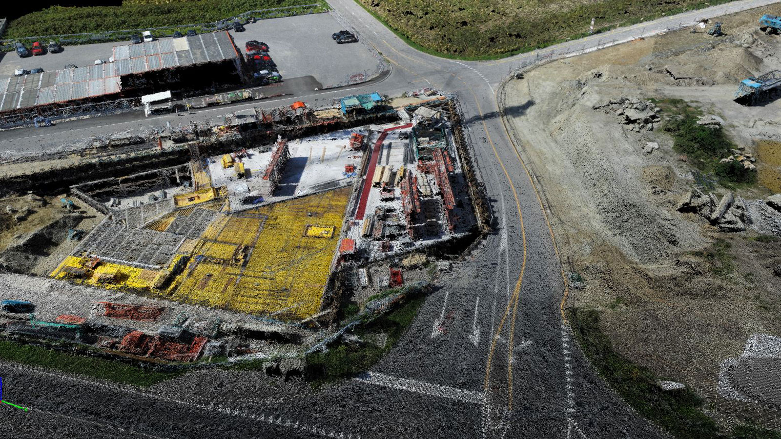
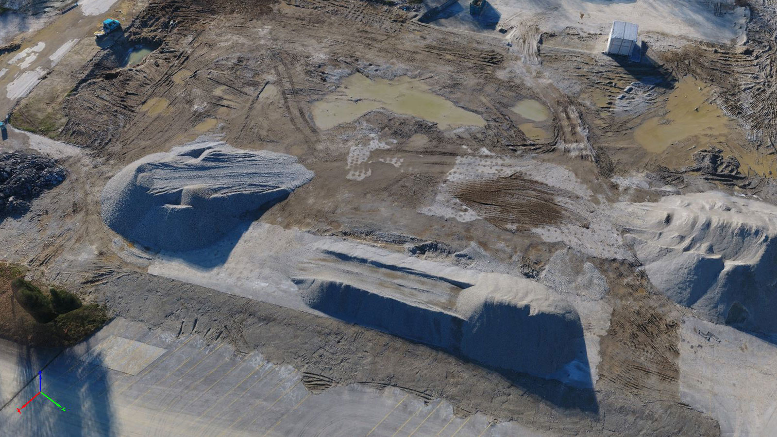
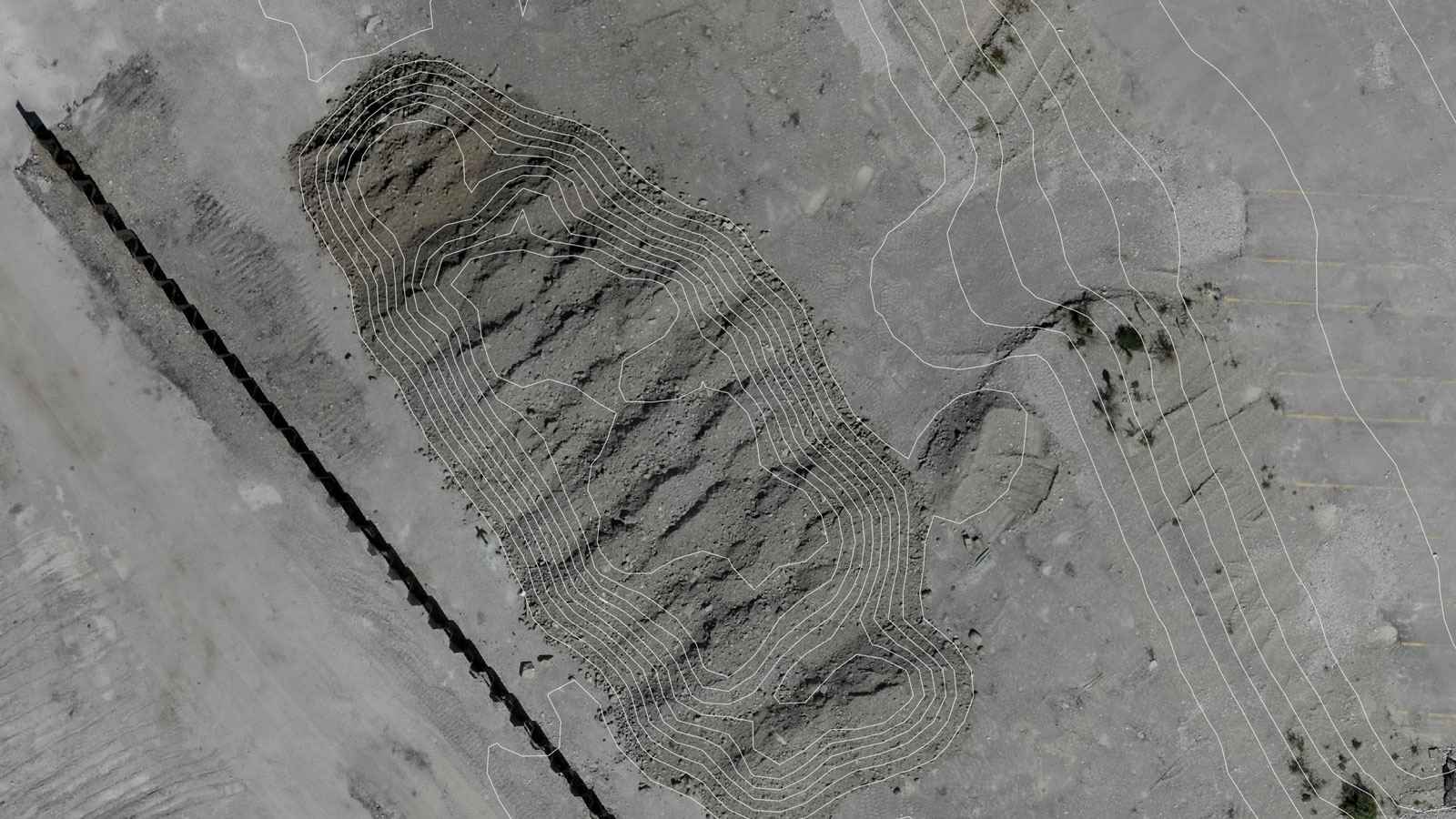
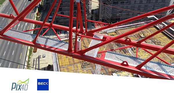
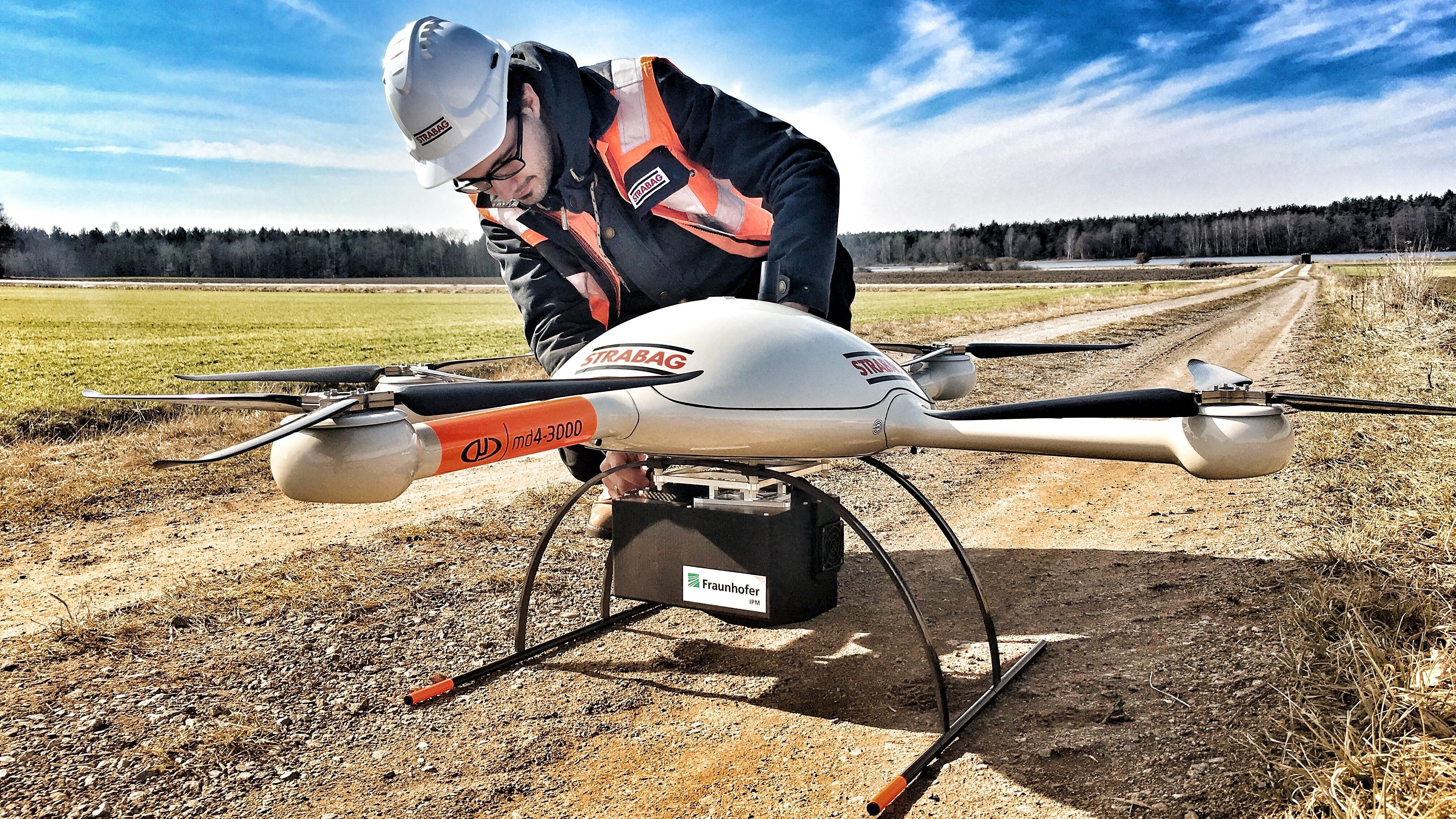
HERO Pix4Dbim
Construction site mapping software Pix4Dbim

Pix4Dbim

3D mapping software for earthworks and construction management

Contact us
BACKGROUND Pix4Dmapper workflow
  • Capture images with a drone or Crane Camera then import into Pix4Dbim photogrammetry software
    Capture
  • Digitize images in Pix4Dbim photogrammetry software
    Process
  • Create maps and models with Pix4Dbim
    Output
  • Document and monitor site progress in Pix4Dbim
    Analyze
  • Share drone data and insights with Pix4Dbim
    Share
  • Integrate Pix4Dbim with construction site management software
    Integrate
Use a drone or the crane camera to capture images
Capture
Collect site images using drones, handheld cameras or our Crane Camera solution.
- Use our free Pix4Dcapture app to easily plan and control drone flights. - Use Pix4D's Crane Camera to capture site images daily and automatically.
Process images in Pix4Dbim photogrammetry software
Process
Choose to process site images locally in Pix4Dbim or in Pix4D cloud.
Create accurate maps with Pix4Dbim Photogrammetry software
Output
Generate accurate and georeferenced orthomosaics, 3D mesh models, 3D point-clouds, and elevation models.
Analyze images in Pix4Dbim
Analyze
Visualize, measure, compare the as-built situation with the as-design and document the progress of your site, using a visual timeline and built-in measurement tools.
Share site information with Pix4Dbim
Share
Share the results with all project stakeholders via the cloud-based platform to ensure a seamless information flow and greater collaboration.
Integrate Pix4Dbim with CAD applications
Integrate
Download all outputs and export to third-party CAD and BIM software.
BACKGROUND generic

Why Pix4Dbim for construction project management?

Repeatable accurate results with construction mapping software
Accurate results
Rely on our powerful desktop and cloud processing options to generate accurate site surveys.
Instant data analysis with construction management software
Instant analysis
Get an instant view of any jobsite with online results that you can measure, analyze, and share.
construction management software using drones
BIM Integration
Easily export 2D and 3D outputs to third-party BIM or CAD software for further analysis.
Map, measure, and document the progress of your construction site
Process your data on desktop and cloud
Process on Desktop & Cloud
Choose to process your data on desktop or on the cloud for complete control over your workflow.
Map, measure, and document the progress of your construction site
  • BIM management software for construction mapping
    Process on Desktop & Cloud
  • Built-in Measuring tools in Pix4Dbim construction management software
    Measure area, distance & elevation
  • Volume calculation with Pix4Dbim construction management software
    Calculate volumes
  • Cross-section tool in Pix4Dbim construction management software
    Generate cross-sections
  • CAD drawing and map overlay tool in Pix4Dbim construction management software
    Overlay design plan & map
  • Pix4Dbim
    Compare over time
  • Annotate and share your construction projects with Pix4Dbim
    Annotate & share


See all features

Pix4Dbim delivers the data you need

Orthomosaic of construction site
Orthomosaic
3D point cloud from Pix4Dbim construction mapping software
3D point cloud
Point cloud classification
Classified point cloud
3D textured mesh output
3D textured mesh
Contour lines on a map
Contour lines
Digital surface model output
Digital surface model (DSM)
See all outputs

Pix4Dbim delivers the data you need

Easily export 2D and 3D outputs to third-party BIM or CAD software for further analysis

2D map

Georeferenced and scaled 2D orthophotos in high resolution, ideal for site visualization and measurements

Export formats: .tiff

Software integrations: All software applications that work with 2D drawings for project documentation

Pix4Dbim outputs 2D orthophoto

3D point cloud

Densified 3D point clouds to get the most accurate 3D representation of your site

Export formats: .las, .laz, .xyz, .ply

Software integrations: All applications which utilize point clouds for design and construction verification

Pix4Dbim construction management software outputs 3D point-cloud

3D mesh

Highly visual 3D textured mesh perfect for communication and client updates

Export formats: .obj, .ply, .dxf, .fbx, .pdf, .osgb, .slpk

Software integrations: All surveying and earthworks applications, for both the design and construction phase

Pix4Dbim construction management software outputs 3D mesh models

Contour map

Contour maps are useful in design and earthworks projects that require simplified land surface representation

Export formats: .shp, .dxf, .pdf

Software integrations: All surveying and earthworks applications, for both the design and construction phase

Pix4Dbim construction management software outputs counter map
BACKGROUND homepage 3D mesh 3 fade

Upcoming webinars

Pix4D Crane Camera solution - a fully autonomous alternative to drones in construction

webinar for construction progress monitoring with crane camera in EU
Europe: June 27th, 11:00 am CEST

Register now
webinar for construction monitoring in USA
North America: June 27th, 11:00 am CSD

Register now

Construction use cases

Strabag uses Pix4D drone mapping software for their construction projects

How drones save time in construction projects

Every construction site is different and has its own challenges. Drone mapping helps make planning, monitoring and documenting more efficient.


Read more >
Isachsen surveyors using videos for site surveys using Pix4Dbim

How videogrammetry helps construction site surveys

Video surveys: a smart and cost-effective workflow to increase productivity and get accurate data faster.


Read more >
Boost 4d project management using drone mapping

Boosting 4D project management with drone mapping

"There is a gap between the schedule and the reality in the field, the two are rarely connected. Now with drone mapping we make that connection happen."


Read more >
Read more use cases
Get Pix4Dbim now
Easily map, measure and track your construction projects
View our Pix4Dbim getting started guide