How does PIX4Dcatch achieve professional accuracy?
PIX4Dcatch is a solution that empowers anyone to digitize physical spaces simply by connecting a smartphone to an RTK receiver. It enables advanced spatial reconstruction, without outputs such as 3D point clouds, textured meshes, and Gaussian Splatting with centimeter-level absolute accuracy.
In this article, we take a deep dive into the technical background.
1. Hybrid of photogrammetry and smartphone LiDAR
The most significant difference between PIX4Dcatch and other mobile surveying apps lies in its hybrid approach. Most applications rely solely on a smartphone’s built-in LiDAR. In contrast, PIX4Dcatch enables "hybrid reconstruction" by using the strengths of both smartphone LiDAR and photogrammetry.
The difference in point cloud quality between smartphone LiDAR and photogrammetry has already been verified. While smartphone LiDAR excels at reconstructing 3D objects regardless of their texture, it is limited by a range of approximately 5 meters, often resulting in blurred edges and "thick" (noisy) point clouds.
Photogrammetry has fewer distance constraints as long as the subject is captured clearly. It produces sharp edges and thin, high-precision point clouds. However, it struggles with featureless (untextured) surfaces.
PIX4Dcatch uses high-precision photogrammetry as its foundation while using LiDAR to compensate for its weaknesses.
The keys to high-precision 3D reconstruction in photogrammetry are "optimized image overlap" and "precise tracking of the device trajectory." PIX4Dcatch detects user movement and automatically captures images at optimal intervals, ensuring sufficient overlap regardless of the user's skill level. Supporting this precise tracking is PIX4D’s unique "Geofusion" technology.
2. PIX4Dcatch’s Geofusion technology
To achieve accurate 3D reconstruction, it is essential to precisely track the trajectory of the device as it moves. PIX4Dcatch integrates with external RTK receivers, enabling precise tracking at the centimeter level.
However, RTK positioning accuracy cannot be guaranteed in every environment. In areas where the sky view is obstructed or in urban settings prone to multipath (signal reflection), intervals of degraded positioning accuracy occur. Furthermore, RTK positioning alone is often insufficient for responding to subtle user movements or achieving ultra-fine 3D reconstruction. This is where PIX4D’s "Geofusion" algorithm comes in.
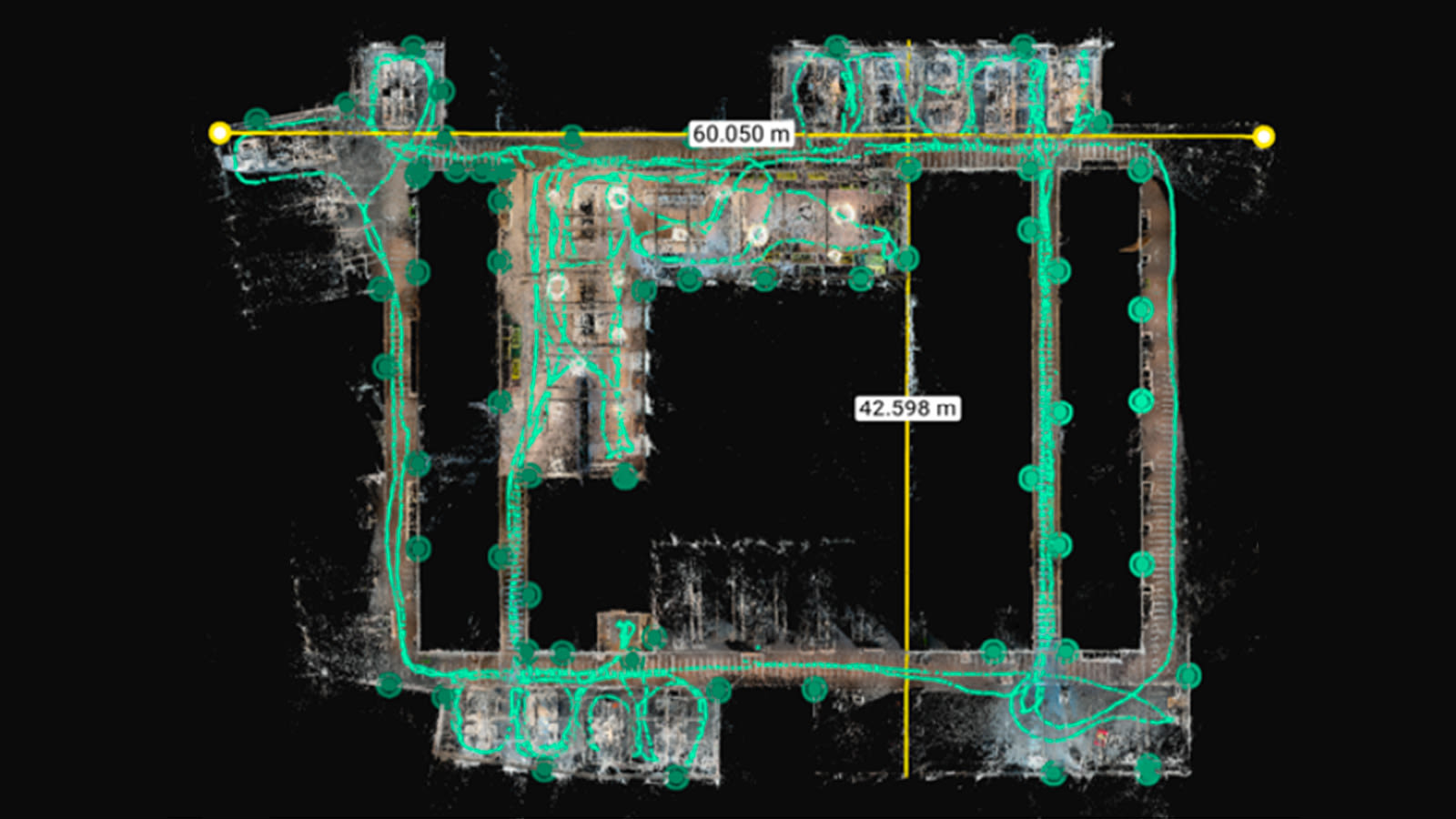
Geofusion is a technology that tracks the device's trajectory with precision by fusing RTK receiver data with various sensors built into the smartphone. Specifically, it combines RTK positioning data with inertial data from the phone's IMU and accelerometer, as well as Visual Inertial Odometry (VIO)—a technology similar to Visual-SLAM that estimates self-position by analyzing continuous images. By integrating these sensor inputs on the device, the system precisely calculates the position and orientation (angle) of the device at the exact moment each image is taken.
The real-world efficacy of Geofusion is most evident in environments where traditional GPS/RTK fails. As demonstrated in our recent research paper on subterranean mapping, PIX4Dcatch successfully mapped a 30-meter-long tunnel, achieving a checkpoint RMS error of less than 10 cm. This is possible because Geofusion bridges the gap when the RTK signal is lost, using the smartphone’s internal sensors and Visual Inertial Odometry (VIO) to maintain a precise trajectory where other solutions would lose their absolute positioning.
Of particular note is its adaptability to environmental changes. While RTK accuracy fluctuates based on surroundings and satellite constellation, Geofusion automatically optimizes the weighting (balance) of each sensor based on real-time conditions to consistently derive the most stable and accurate solution.
3. Photogrammetry expertise
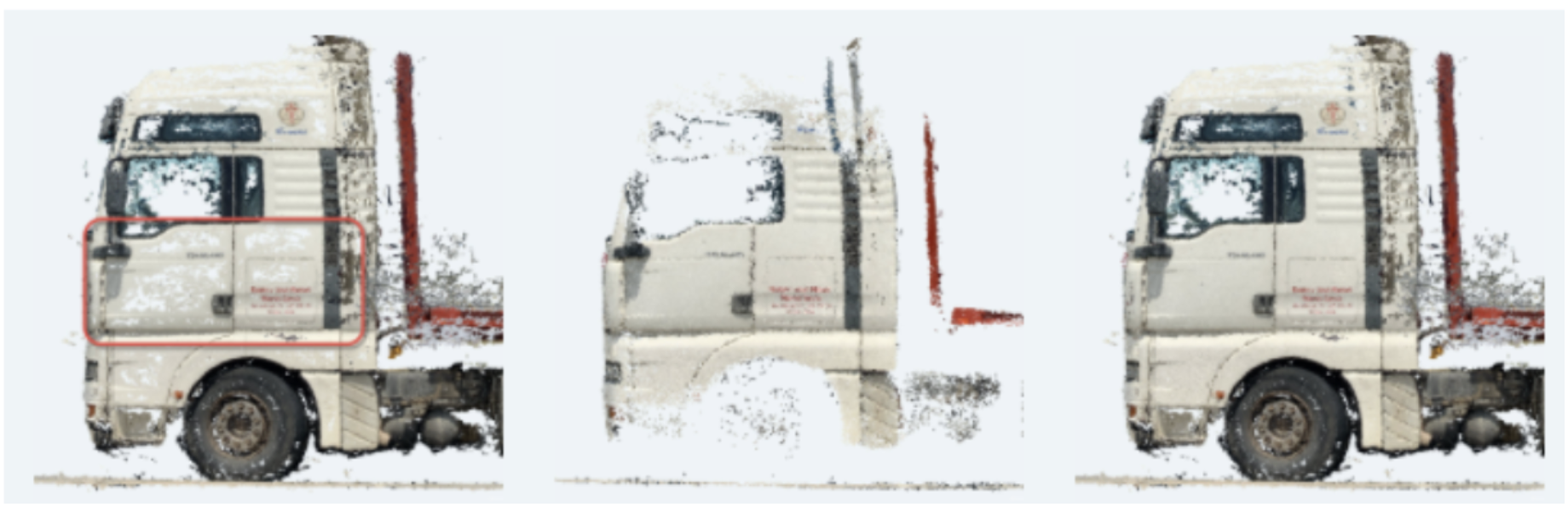
The defining feature of photogrammetry is the process of matching and analyzing distinctive pixels across continuous images to calculate the optimal position and orientation for each capture. While PIX4Dcatch gathers this data during the scan and automatically optimizes it on your phone the moment you hit 'save' on the smartphone, the accuracy is dramatically enhanced through post-processing. This is a distinct advantage over apps that rely solely on LiDAR and are limited by the accuracy of real-time tracking during capture.
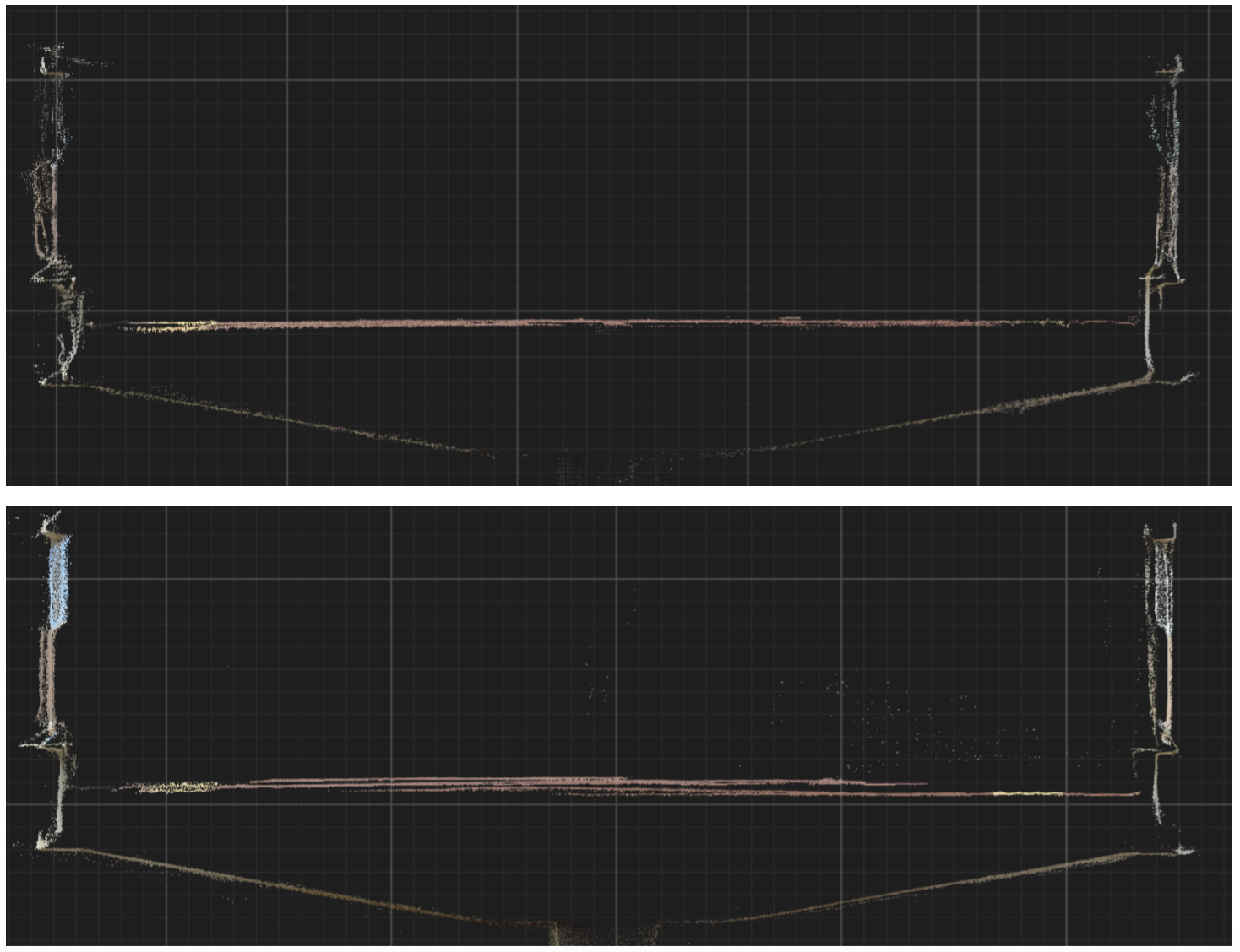
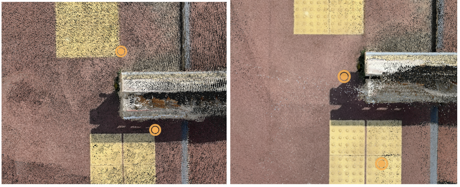
If image matching and orientation optimization are not performed with a certain level of rigor, it often results in 'ghosting' (double-layered point clouds) or tilted models. Point cloud accuracy drops, and significant noise is generated. This leads to "thick" data where edges of structures are not sharply defined.
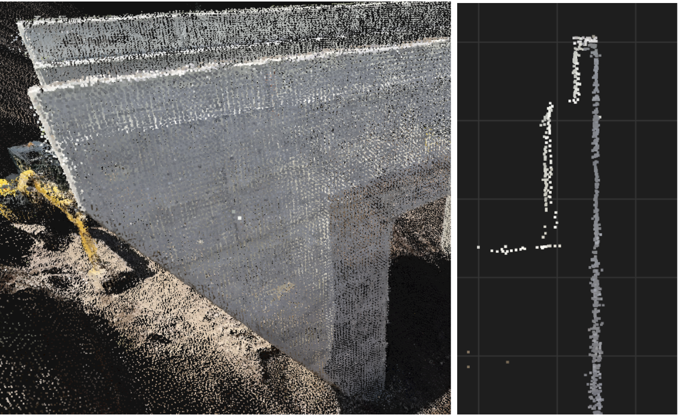
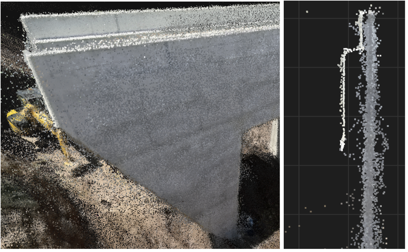
In contrast, PIX4D’s processing engine strictly optimizes the position and orientation of every image across the entire project. This, combined with advanced noise filtering, results in exceptionally clean point clouds that meet the professional requirements of surveying and measurement.
4. PIX4D and Gaussian Splatting
PIX4D’s implementation of Gaussian Splatting stands apart from general solutions with three key features:
- Easy acquisition via universal devices: high-quality data can be captured using a standard smartphone, eliminating the need for expensive, specialized hardware.
- Spatial reconstruction with "absolute accuracy": beyond mere visual representation (relative accuracy), integration with RTK receivers allows for 3D expressions with centimeter-level absolute accuracy.
- Dramatically enhanced expressiveness: it enables the reconstruction of "thin structures" and "glossy objects"—elements traditionally difficult for point clouds or meshes—significantly improving the overall reality of the spatial data.
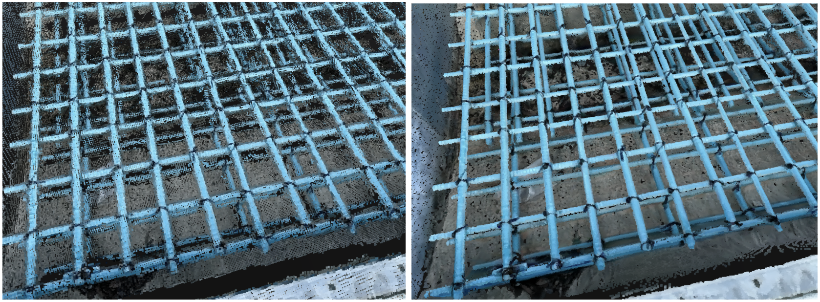
It is important to note that PIX4D’s Gaussian Splatting is not merely about visual enhancement or improved 3D expressiveness; it is about advancing surveying and measurement precision. By improving the reconstruction of "thin structures" and "glossy objects," the technology enables noise-free, highly detailed representations, making it possible to accurately measure even the finest details.
The captured data can be processed seamlessly through the PIX4D ecosystem, offering the flexibility to upload directly to PIX4Dcloud for quick results and sharing, or to PIX4Dmatic for deeper desktop-based analysis. This integrated workflow ensures that the transition from a simple mobile scan to a professional, survey-grade deliverable is both fast and reliable.
PIX4Dcatch features hybrid measurement, which integrates the smartphone’s built-in LiDAR with photogrammetry, alongside ‘Geofusion’—a PIX4D technology that continuously tracks the device’s trajectory with centimetre-level accuracy. Support for Gaussian splatting has improved the fidelity of the real-world reproduction. PIX4D remains a global professional choice by balancing ease of use with survey-grade accuracy