Drone bridge inspection with PIX4D
INSERT SCHEMA MARK UP
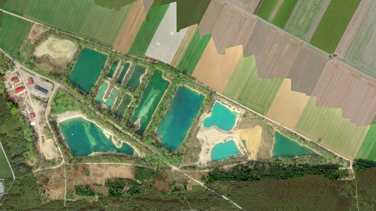
Linear Projects Inspection & Monitoring (LPIM) is based in Bogotá D.C., Colombia. They operate nationwide. LPIM inspects, monitors, and manages critical infrastructure projects. They use drone mapping and geospatial analysis. We spoke to them about their most recent bridge inspection project, using PIX4Dcloud.
Five key problems in traditional bridge inspections
This project addressed five key problems associated with traditional bridge inspections in complex urban environments like Bogotá:
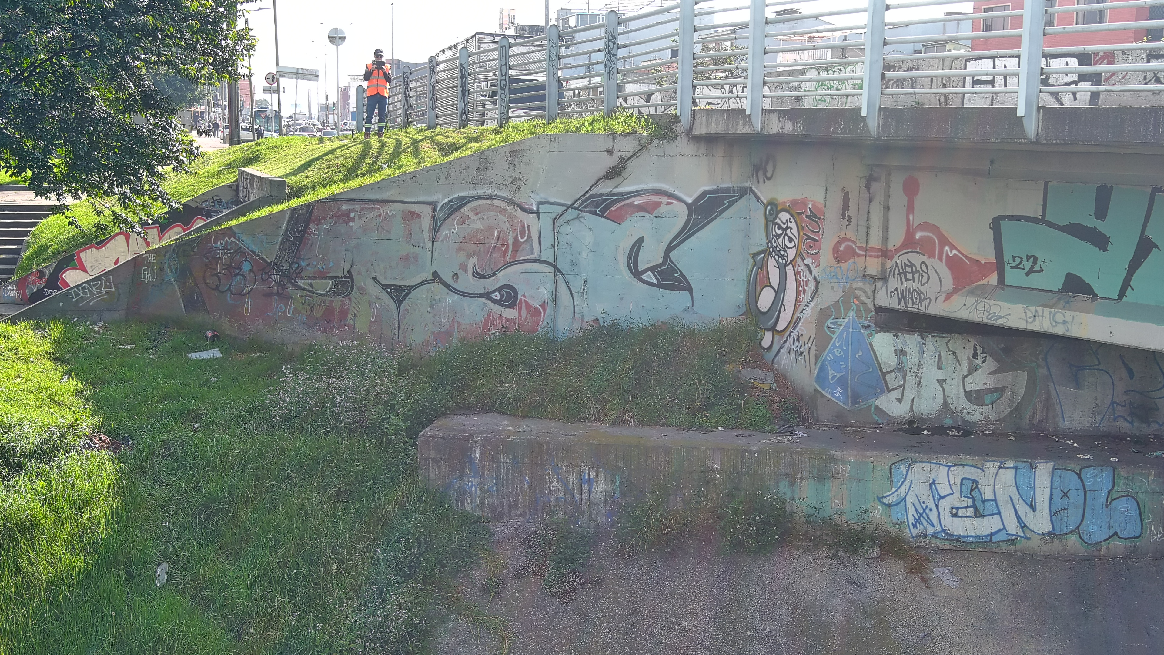
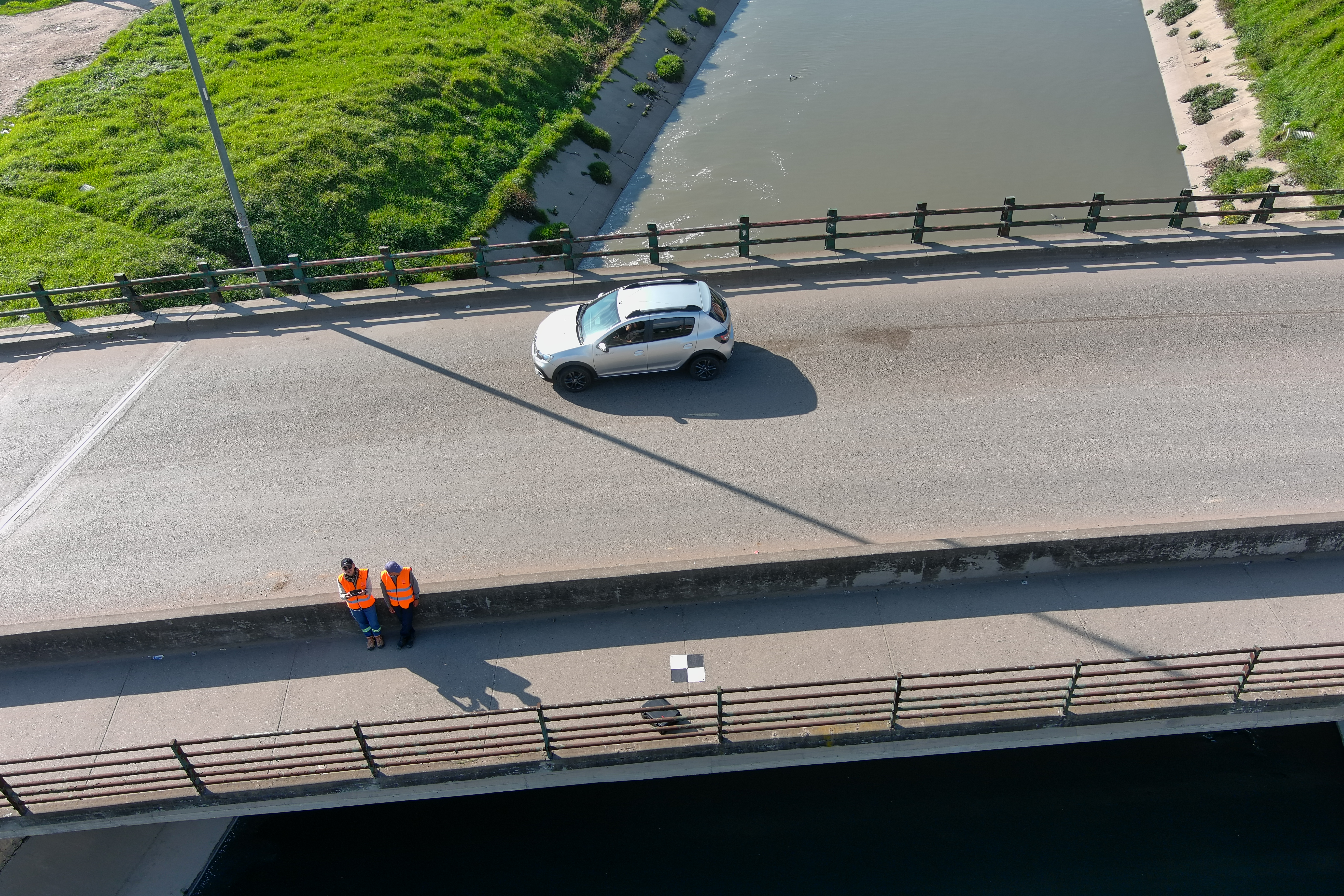
- Access limits and safety risks occur when inspecting high or hard-to-reach structural parts, like beams, bearings, and the deck underside. This raises risks for workers and disrupts city travel. The use of drones allowed these areas to be inspected safely and remotely without interfering with traffic.
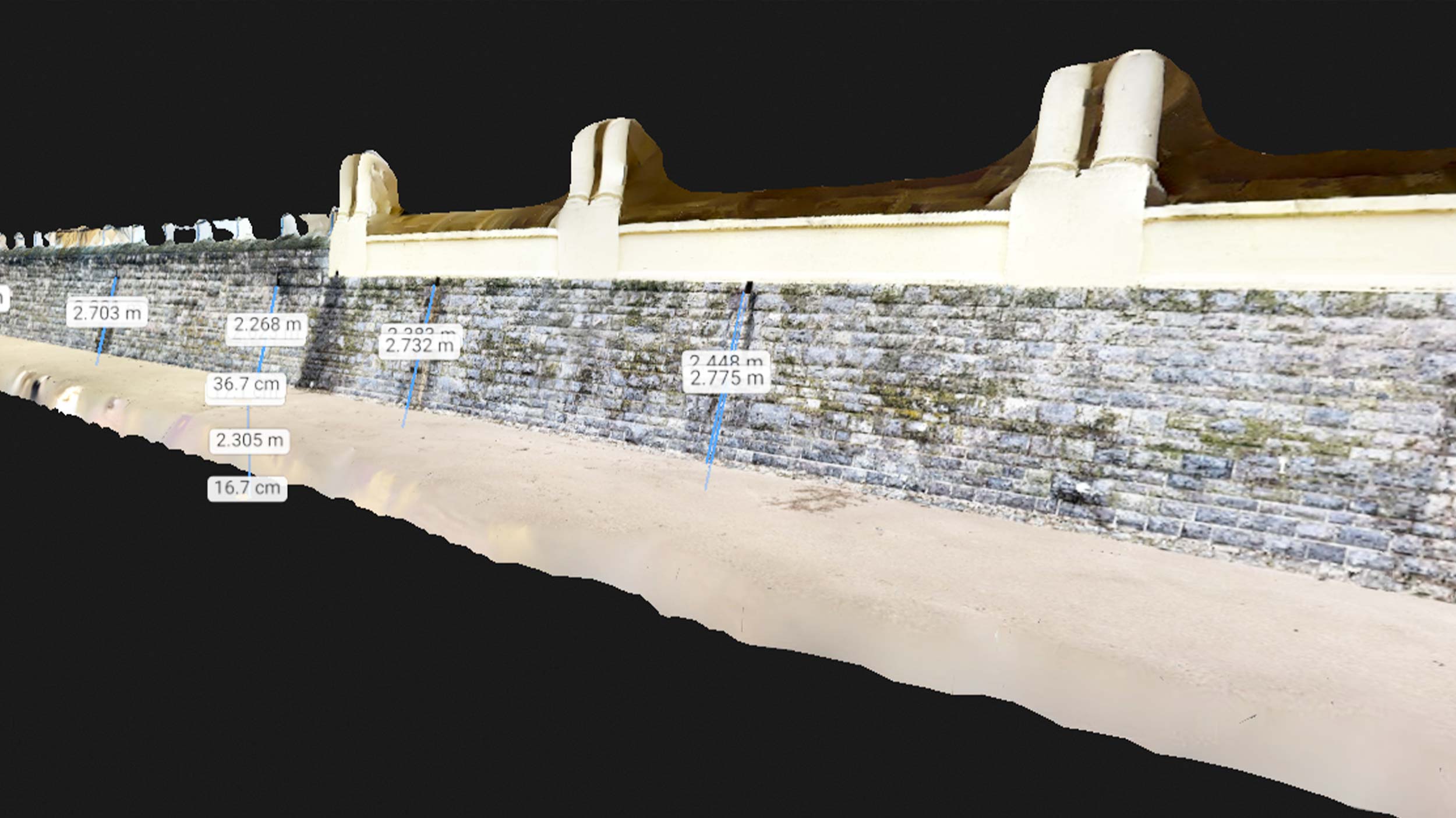
- Lack of complete visual coverage. Thanks to planned flight paths and the systematic capture of RGB and LiDAR imagery, 100% coverage of all visible elements was guaranteed, reducing the possibility of overlooking early-stage damage or critical zones of the structure.
- Slow inspection turnaround times. PIX4Dmatic and PIX4Dcloud processed the data rapidly, making it possible to generate models, orthophomosaics, and georeferenced visual material in a very short time, allowing for the quick delivery of preliminary reports.
- Poor traceability and spatial precision. Isolated photographs often suffer from poor traceability and spatial precision. PIX4D’s photogrammetric restitution solves this by linking each finding to an exact location on the structure, simplifying damage inventory, monitoring, and future comparisons.
- Lack of an objective, structured, and reusable digital record. Drone mapping with the PIX4D workflow resolved this by providing an accurate digital reconstruction. This permanent record eliminates subjective paperwork, providing an exact, repeatable reference to track deterioration and manage maintenance long-term.
Project hurdles
LPIM joined the project for their expertise in drone mapping and photogrammetry for critical assets like bridges. The inspection had to navigate the strict operational, environmental, and security challenges typical of urban infrastructure in a complex city like Bogotá.
One of the primary hurdles was the city’s unpredictable weather. Heavy rain caused water levels in rivers and canals beneath the bridges to rise. This directly impacted the ability to perform underside captures on the same day as nadir flights, forcing the team to reschedule operations and split data capture into different stages to ensure both safety and data quality. This required flexible flight planning, high-level pilot expertise, and rapid decision-making in the field.
By quickly processing available data, the team ensured that structural engineers had access to precise data for analysis, even when the capture process had to be carried out in stages.
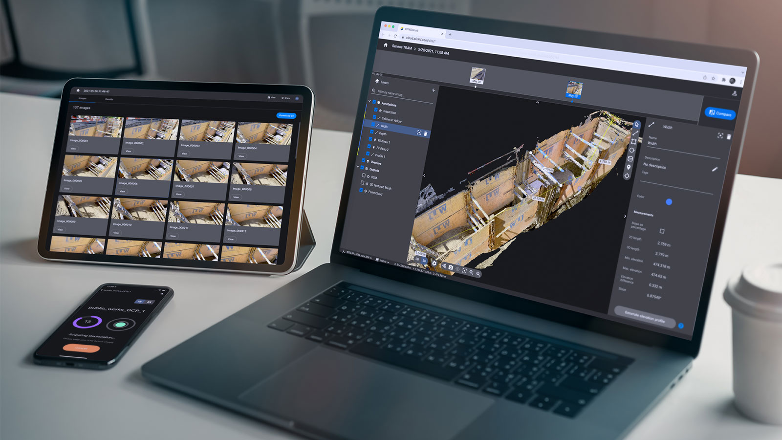
“PIX4D was key to strengthening collaboration with our clients (stakeholders) during the project. The ability to share results in the cloud allowed us to present findings clearly, visually, and with georeferencing, even from very early stages. This facilitated more productive technical discussions, reduced feedback times, and quickly aligned all involved parties. Furthermore, the PIX4D support team was always available and willing to provide close, personalized assistance, which is essential when working on real-world infrastructure projects with high levels of technical demand." - Yoly Andrea Cubides, Project Manager, Lpim
Project details
| Location | Bogotá, Colombia |
| User | Lpim |
| Project duration | 45 calendar days, 16 bridges (capture to final delivery) |
| Project area | 0.402 km |
| Total number of images | 167 |
| Images per flight/dataset | 2,664 |
| Software used | PIX4Dmatic, PIX4Dcloud |
| Hardware used | Autel EVO II Pro RTK V2 drone + RTK |
| CPU | 13th Gen Intel(R) Core(TM) i9-13900K |
| RAM | 64GB |
| GPU | NVIDIA GeForce RTX 4070 Ti & Intel(R) UHD Graphics 770 |
| Operating System | Windows 11, 64-bit |
| Processing time | 5–8 hours per bridge; the global project to process all 16 bridges took approximately 128 hours of processing time. |
| GSD. | < 2 cm / px |
75% faster bridge inspections with PIX4D
This methodology cut field inspection times by 75%, minimized working-at-height risks, and expanded visual coverage of critical elements. It also introduced georeferenced digital evidence, significantly improving objectivity and traceability over traditional methods. The project demonstrated how these solutions do not aim to replace industry experts such as surveyors or engineers, but rather to empower their work by providing them with more complete, precise, and timely information.
By rapidly processing data from staggered drone flights, PIX4Dmatic and PIX4Dcloud turned scattered photos into a precise, georeferenced 3D master record. This software eliminated reporting ambiguities by pinning every defect to its exact location on the structure, allowing structural engineers to conduct faster, more accurate remote diagnoses. Ultimately, PIX4D replaced traditional paperwork with a reusable digital database, providing the exact historical traceability needed for long-term bridge monitoring and maintenance planning.
Why choose PIX4D for critical infrastructure inspection?
Other photogrammetry and geospatial solutions were considered, but ultimately PIX4D was chosen because it was best suited for the operational demands of critical infrastructure inspections. It offers a wide variety of processing options and achieves high-quality results using different types of input material.
“PIX4D was fundamental for the efficient and precise processing of the bridge imagery. It allowed us to organize, analyze, and validate large volumes of photogrammetric data reliably and in very short timeframes. Subsequently, PIX4Dcloud greatly facilitated sharing the results with stakeholders (such as structural engineers) in an agile, visual, and accessible manner, improving technical communication and data-driven decision-making collaboratively and online." - Juan Sebastián Moreno, Geomatics Manager, Lpim
PIX4D stood out as a user-friendly tool, allowing the team to shorten the learning curve and accelerate the generation of technical results. Another decisive factor was the ability to share results via PIX4Dcloud, allowing for the remote and collaborative review of models, images, and findings, optimizing communication and streamlining decision-making.
In summary, PIX4D offered LPIM a balanced solution of technical robustness, ease of use, and cloud collaboration, making it the most suitable choice to meet the project's goals of precision, speed, and traceability.